The idea for this article came while writing a previous one - Satellite Basemaps: Looking to the Past, which highlights the limited usage of available satellite data. While the first use case used US cities as the target geo, it was not simple to show why data should be frequently updated. Humanitarian use cases bring more focus since wrong decisions can result in the loss of human life.
As an input for this article, I've used data from the Humanitarian OpenStreetMap Team (HOT) and referred to the project from the Tasking Manager.
HOT Projects Imagery Insights
HOT uses a simple and straightforward approach: each region that requires mapping is divided into a grid. Members of HOT could select this grid's cell and start adding features to the map based on the satellite basemap. One of the satellite basemap providers is Bing maps by Microsoft.
In this article, I am referring only to those projects where Bing Aerial is (one of) the preferred source of imagery. I have focused on Urgent and High priority projects, so the following information represents data from 15 projects: 140,000 sq km with ~14,500 cells.
Data Overview
For each of the projects' cells, I've collected information from Bing Aerial about the date when the image was taken.
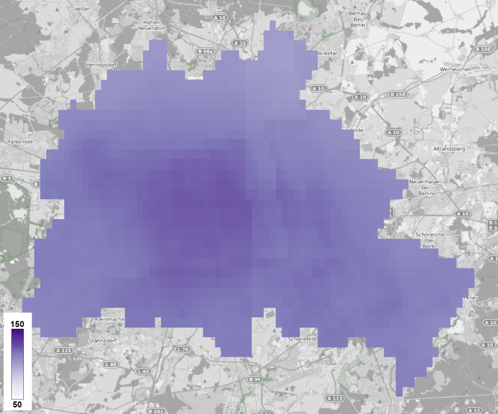
The overall situation is rather worrying - the aerial imagery mappers are using to help people could be extremely outdated: half of the areas are more than four years old, with some imagery up to 11 years old.

The following map visualizes this data's spatial distribution:
This visualization shows a couple of AOIs to highlight how critical the outdated information could be.
COVID-19 in Botswana
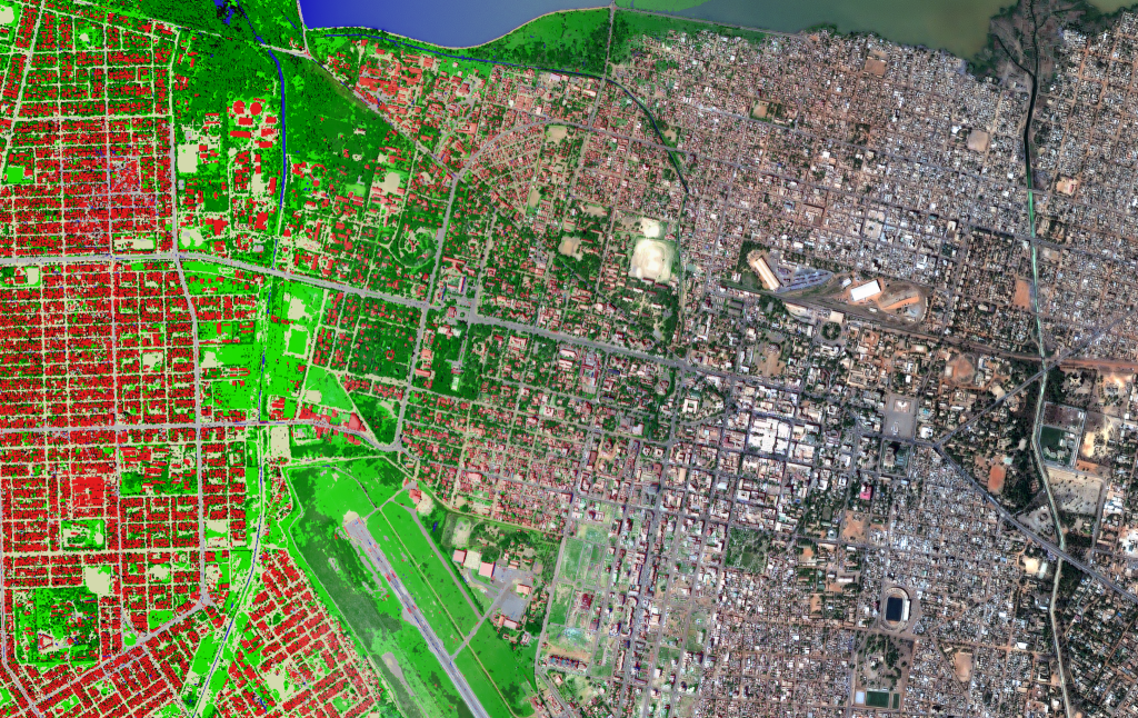
One recent project focused on the request to map areas in Botswana susceptible to or identified as impacted by the COVID-19 outbreak. The basis for mapping this area is a satellite image captured in 2016. The area continues to grow, and the following image represents the new Pléiades imagery on top of Bing Aerial basemap.

COVID-19 in Peru
Another project focuses on Peru to complement COVID-19 activation. You could see new buildings appear in recent images.

However, the largest changes are spotted in the Africa region, and these changes require specific attention.
Polio in Nigeria
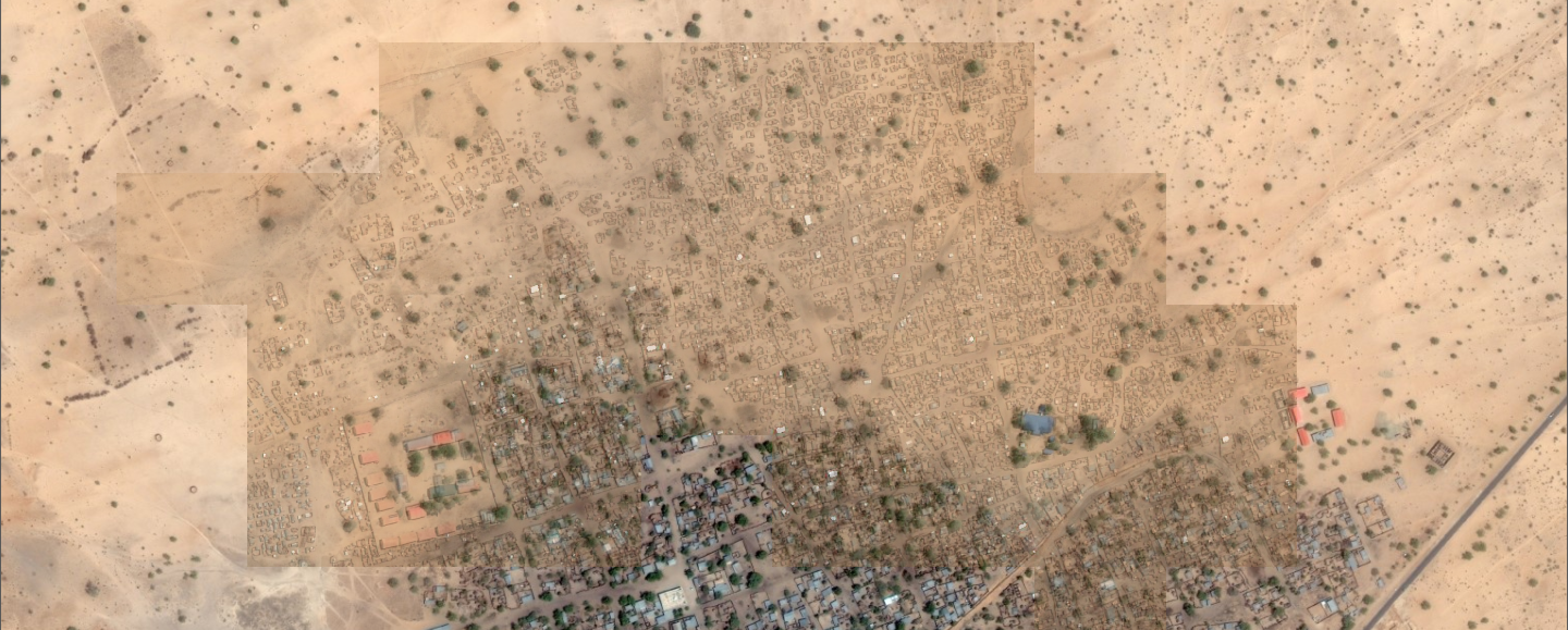
Despite this project being from 2017, I'd like to highlight how much change can happen after the basemap imagery was taken. Most of the areas were captured between the years of 2010 and 2014. The following image demonstrates how the area of Gajiram, Nigeria, was mapped and grown after that. You could see the Bing Aerial basemap used for mapping with OpenStreetMap features on top of it. Then three Pleiades imageries are added, captured in 2014, 2018, and 2020.

This particular example shows the importance of monitoring urban growth areas with satellite images in a single application.
Discussion
The current state of affairs is striking:
- Data providers capture terabytes of satellite images that are rarely used.
- Millions of people remain isolated from the world because their homes are not detected.
- Hundreds of people e.g. in the OSM community are ready to support but have no proper access to recent satellite image basemaps.
Everyone could donate food, water, and clothes, but could you easily donate information about new people's homes? Democratizing access to data and tools is the only scalable way to make a significant impact.
Next steps
We should understand the volume of missed opportunities. We would eventually stop selling raw data but focus on information from this data with easy access and constant updates.

Additionally, if you have any ideas connected to the geospatial, please contact me on LinkedIn or Twitter. Would be happy to discuss and contribute!


