What’s new
Release notes
Keep up with the latest releases and improvements.
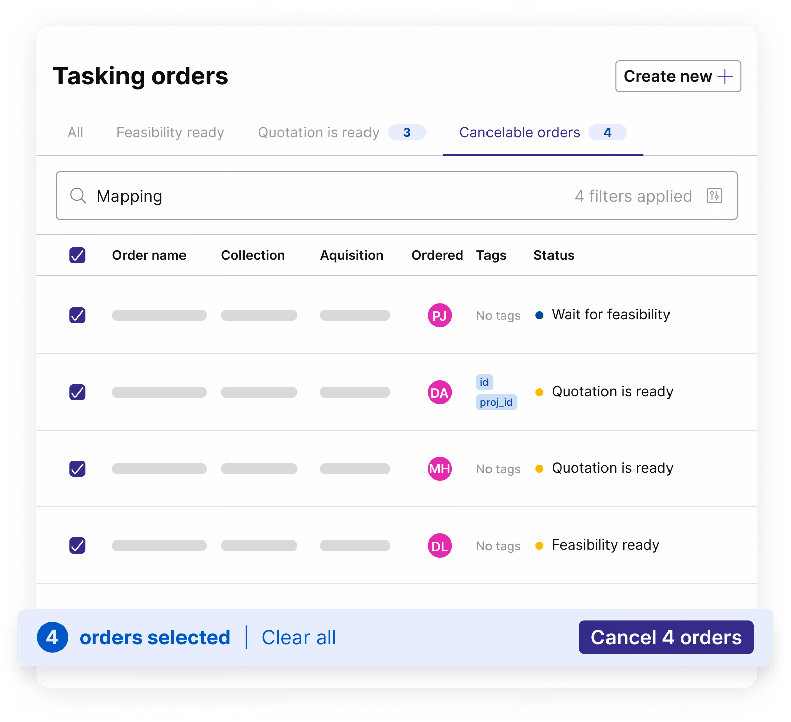
Cancel tasking orders directly from the console
Manage your projects with more flexibility using the new Cancelable orders tab. You can now select one or multiple tasking orders and cancel them instantly with a single click. This update removes manual hurdles and gives you the autonomy to pivot mid-project, ensuring your budget and focus stay aligned with shifting priorities.
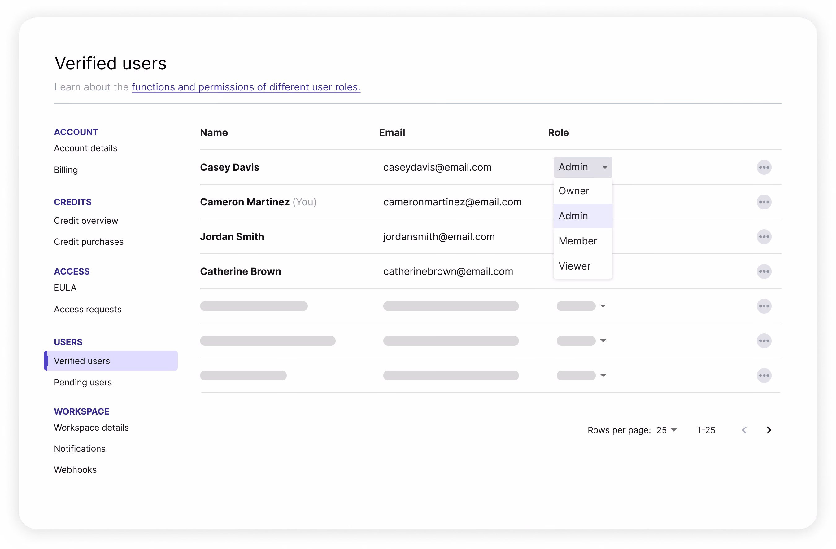
User roles for enhanced access control
We’ve upgraded our user management model from the previous Admin/Member structure to four distinct roles, giving you more granular control over account access.
You can now assign permissions based on actual responsibilities, protecting sensitive account settings while enabling teams to work efficiently.
Available roles:
- Owner: The primary account holder with full authority. Includes all Admin permissions plus the exclusive ability to permanently delete the account. (Limited to one per account.)
- Admin: Full administrative access to manage users, update billing details, and perform financial transactions.
- Member: Designed for day-to-day operational work. Members can create and manage orders and run processing jobs, but cannot access user management or financial settings.
- Viewer: Read-only access for stakeholders. Viewers can view orders and stored data but cannot create orders, run jobs, or spend credits.
For teams looking to scale their operations, you can now onboard observers (Viewers) and technical staff (Members) without exposing any sensitive information.
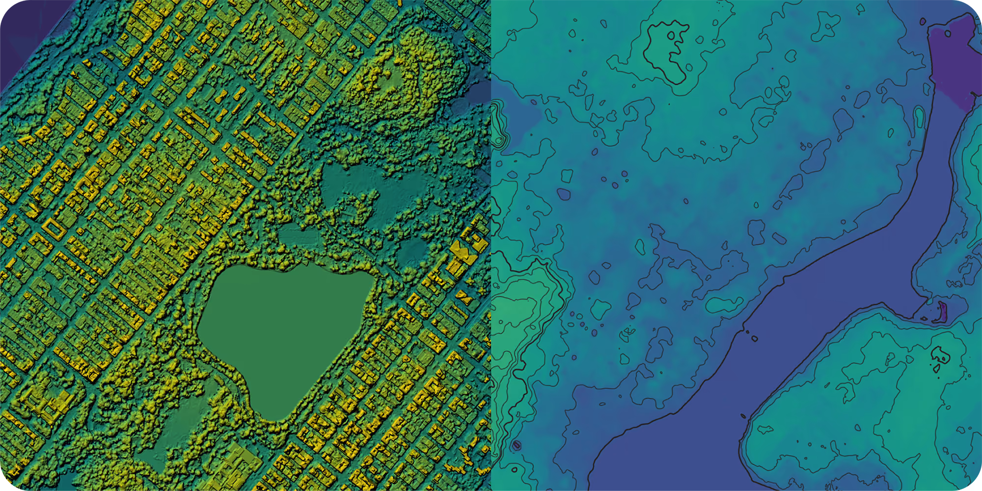
New data alert: Vantor's Vivid Terrain 50 cm elevation
You can now order Vantor’s 50 cm high resolution elevation data through the UP42 platform. Vivid Terrain provides global digital surface models (DSMs) and digital terrain models (DTMs) derived from Vantor’s satellite imagery dating back to 2007. You can also order the data as a bundle.
These datasets are great for:
- Urban planning: Accurate modeling of built environments
- Line of sight: Precise visibility analysis
- Environmental monitoring: Mapping forest canopy height and shade patterns
Tasking made easier with new project tracking and actioning capabilities
We've been working hard to enhance our tasking capabilities and make your workflow more efficient. We've just launched two powerful new features to help you manage your projects and plan your next steps.
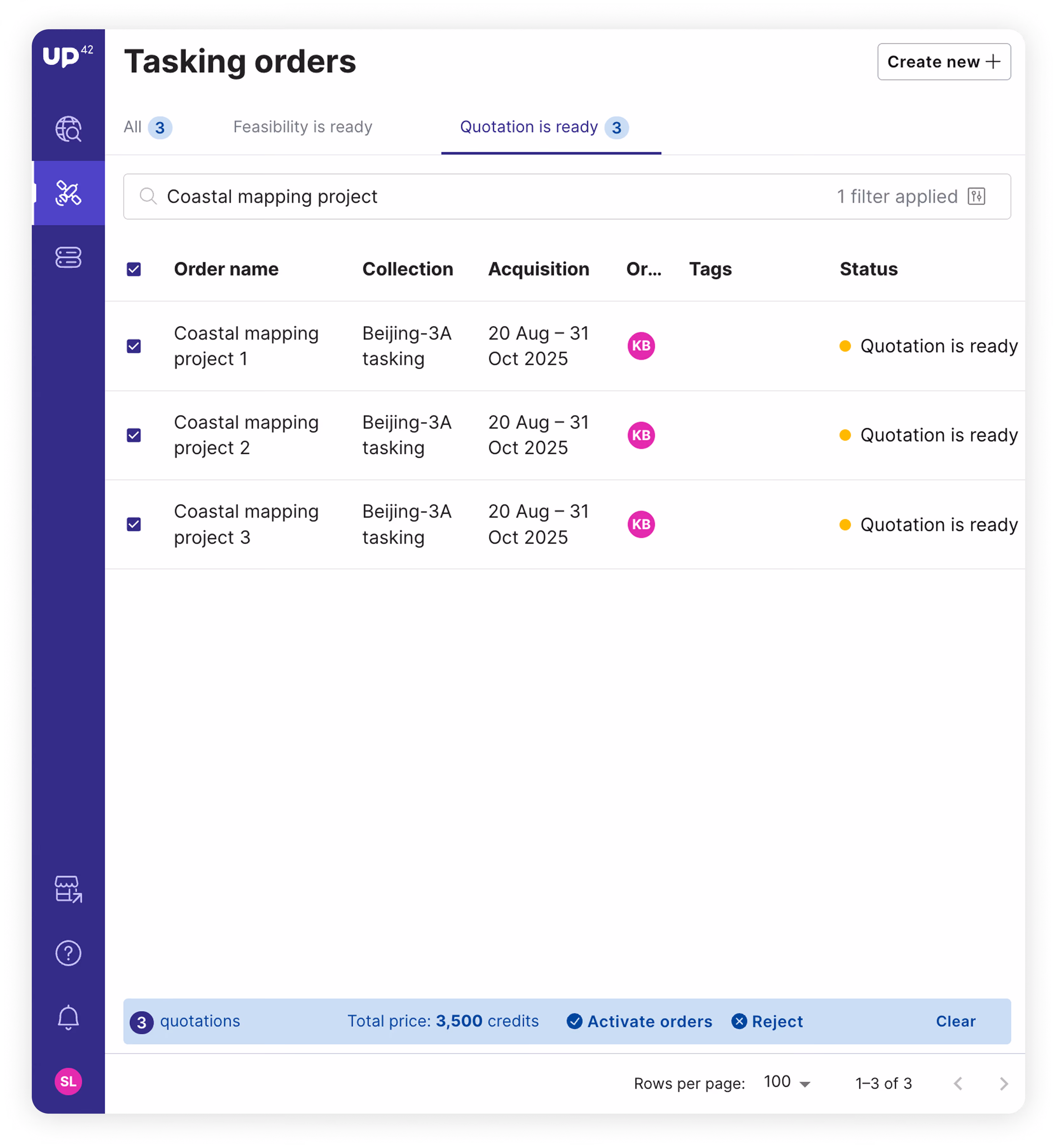
You can now filter your tasking orders by project name and/or tags to get a comprehensive, project-level view. See the combined progress of an entire project, including total ordered and delivered square kilometers, and download all coverage data at once.
You can also view and manage price quotations in bulk. Streamline your workflow by accepting or rejecting multiple quotes at the same time. These updates are designed to save you time and give you a clearer picture of your project's status.
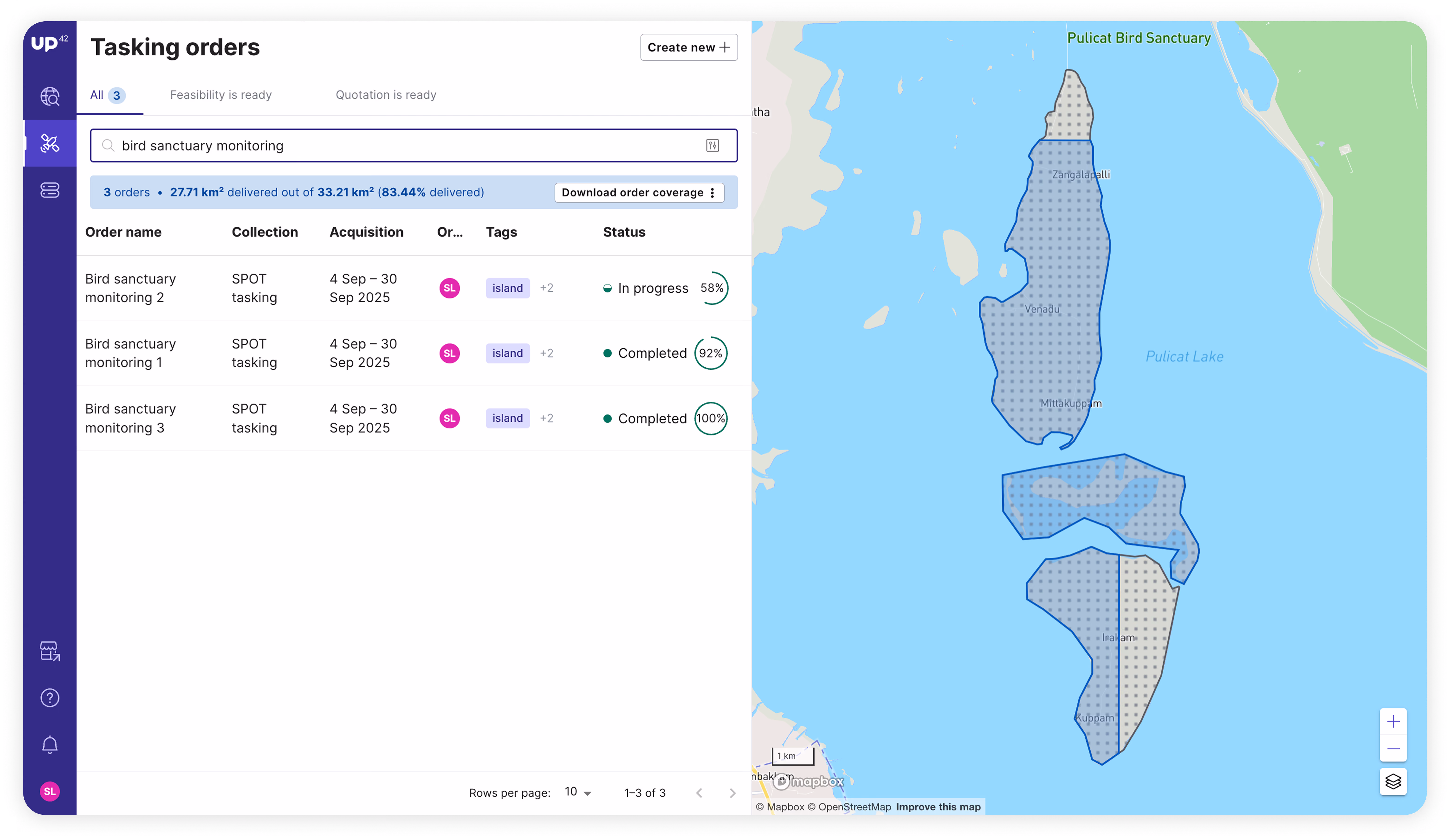
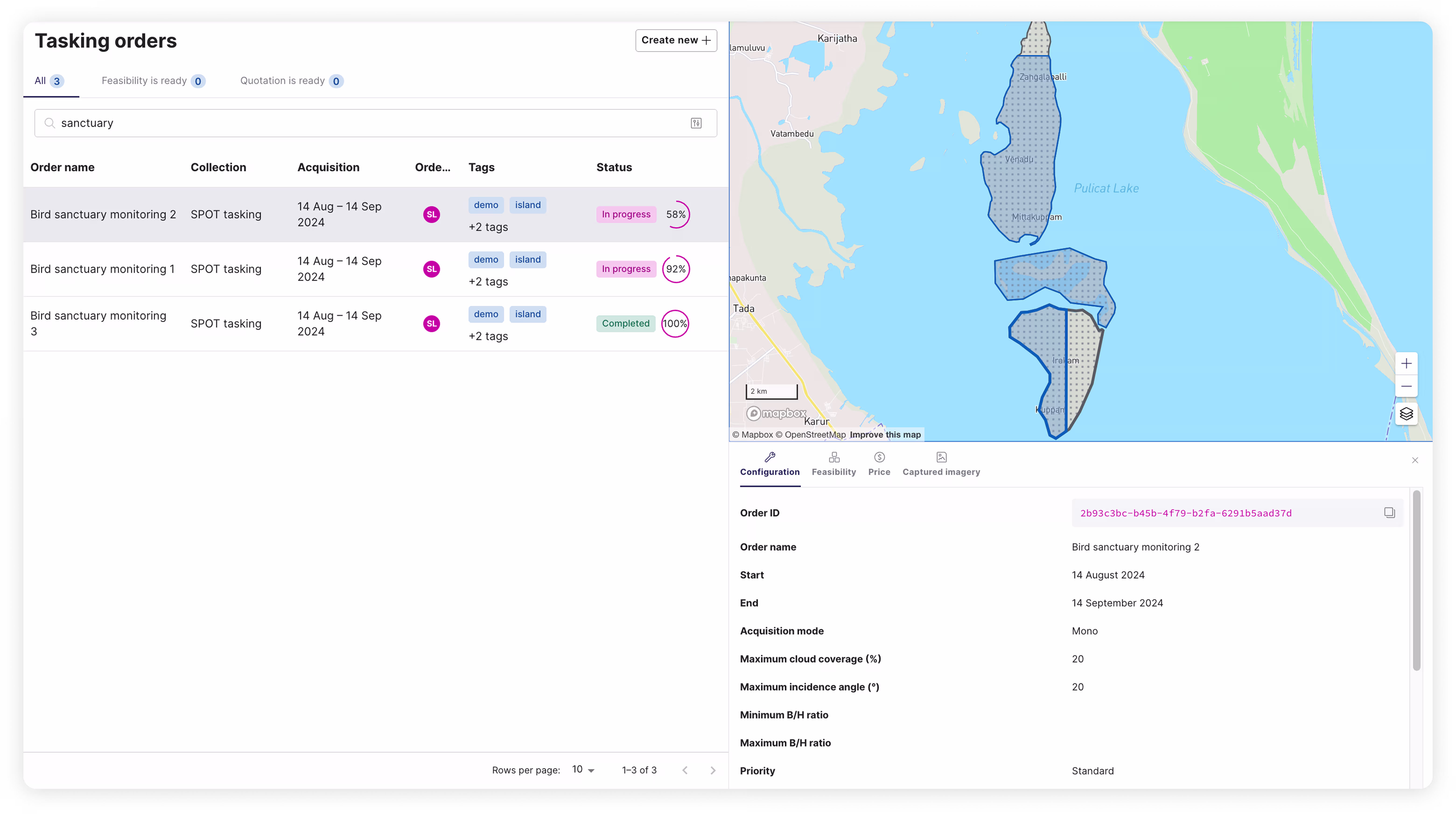
New tasking dashboard: See all your order geometries at once!
We've just released a new tasking dashboard, designed to give you a more powerful view of your projects. Here’s what it can do for you.
Display multiple AOIs and assets from your tasking orders and projects simultaneously on an interactive map. Instead of switching between individual AOIs, you'll get a consolidated map view of your entire project. Easily filter by name, status, or tags, or use the existing tabs that categorize orders by feasibility and quotation status to quickly find specific tasking orders.
Explore the UP42 platform
Create an account to order, access, and analyze geospatial data.
