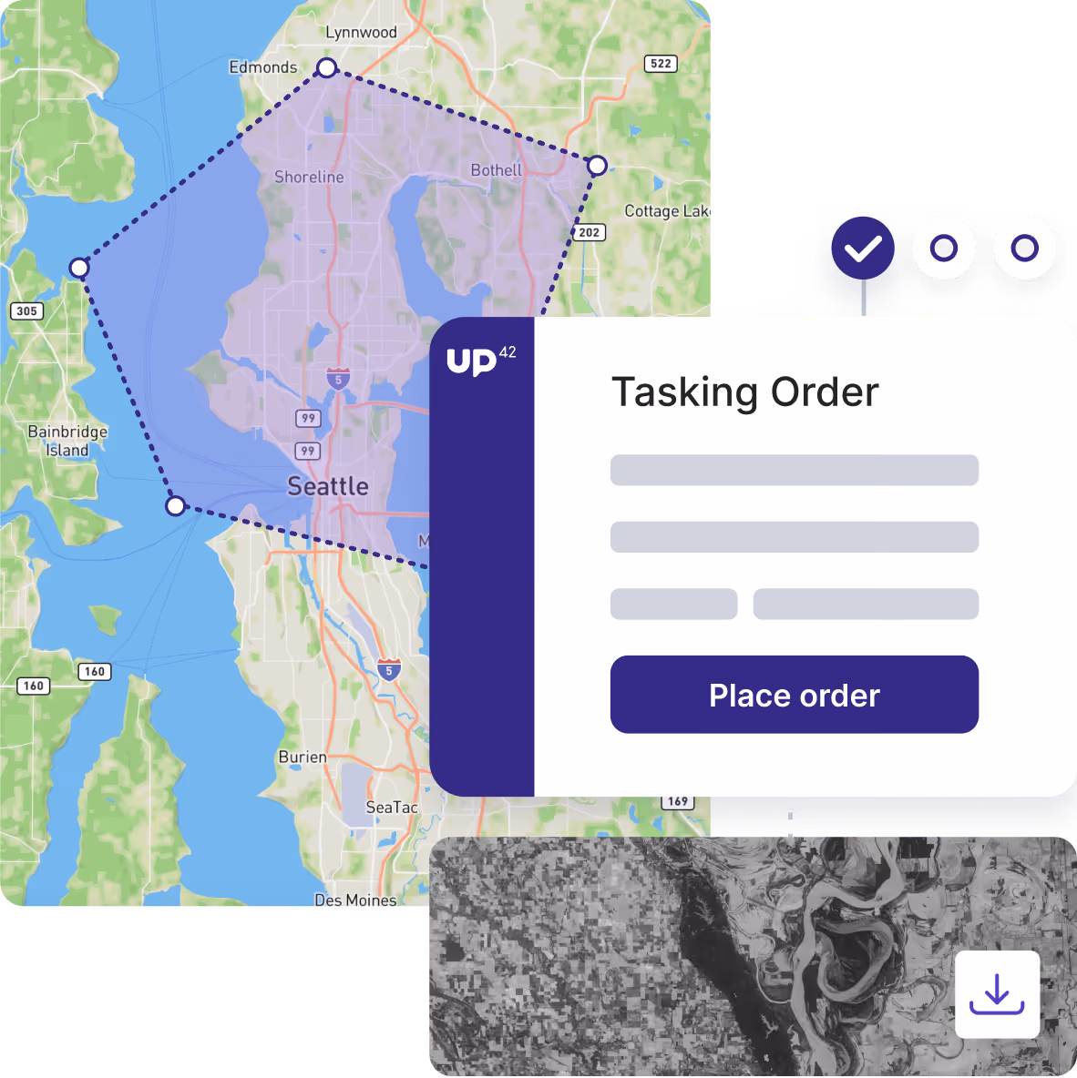
Collect the imagery you need, when you need it
Task satellites and aerial sensors to capture new imagery for your AOI, with instant pricing, automated updates, and zero back-and-forth.
Bring your tasking operations together in a single platform

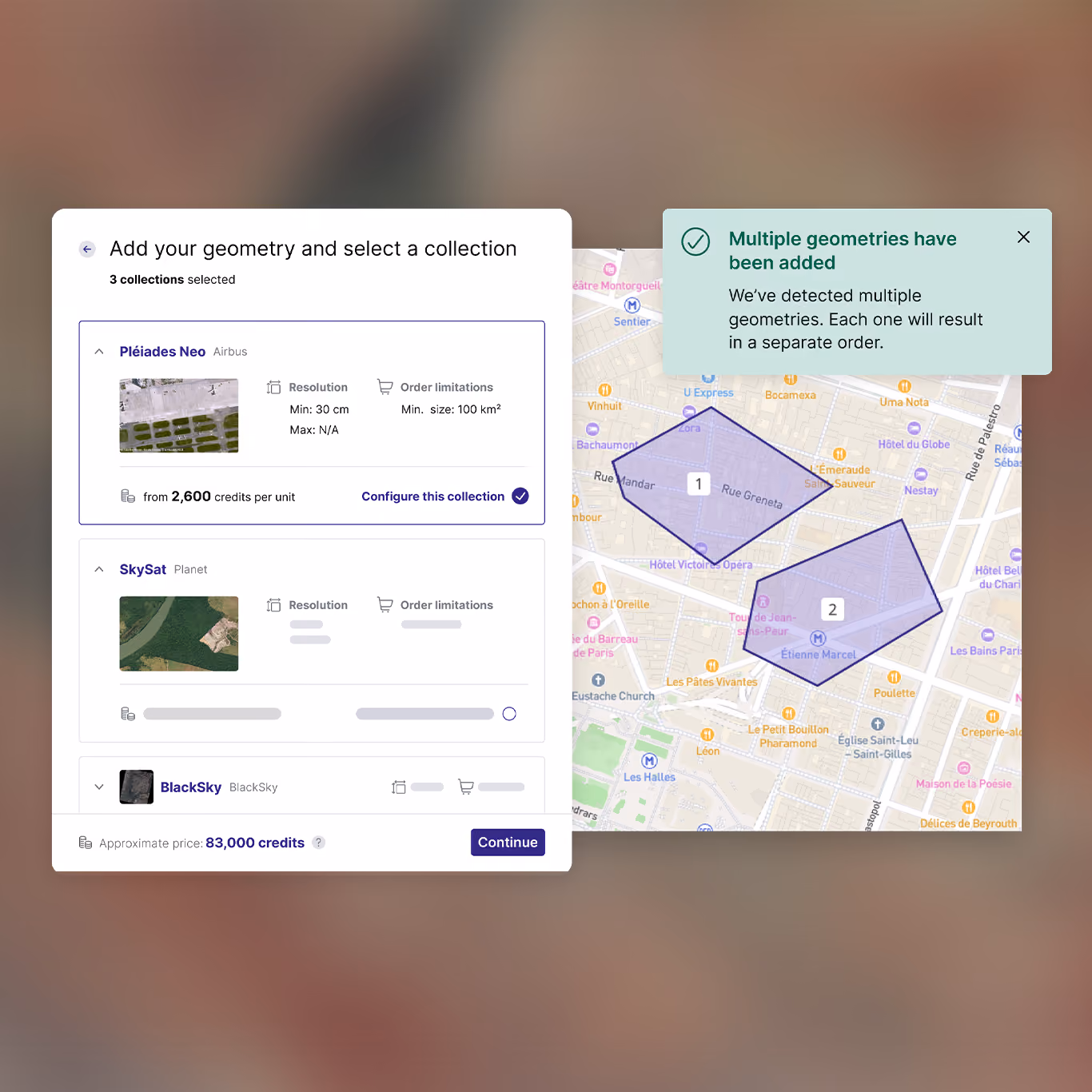
Configure your order
See instant price estimates

Confirm and activate

Track, access, use
One platform for every acquisition type
Order satellite, aerial, elevation, and more data types from the world's top providers, with one contract and one interface.
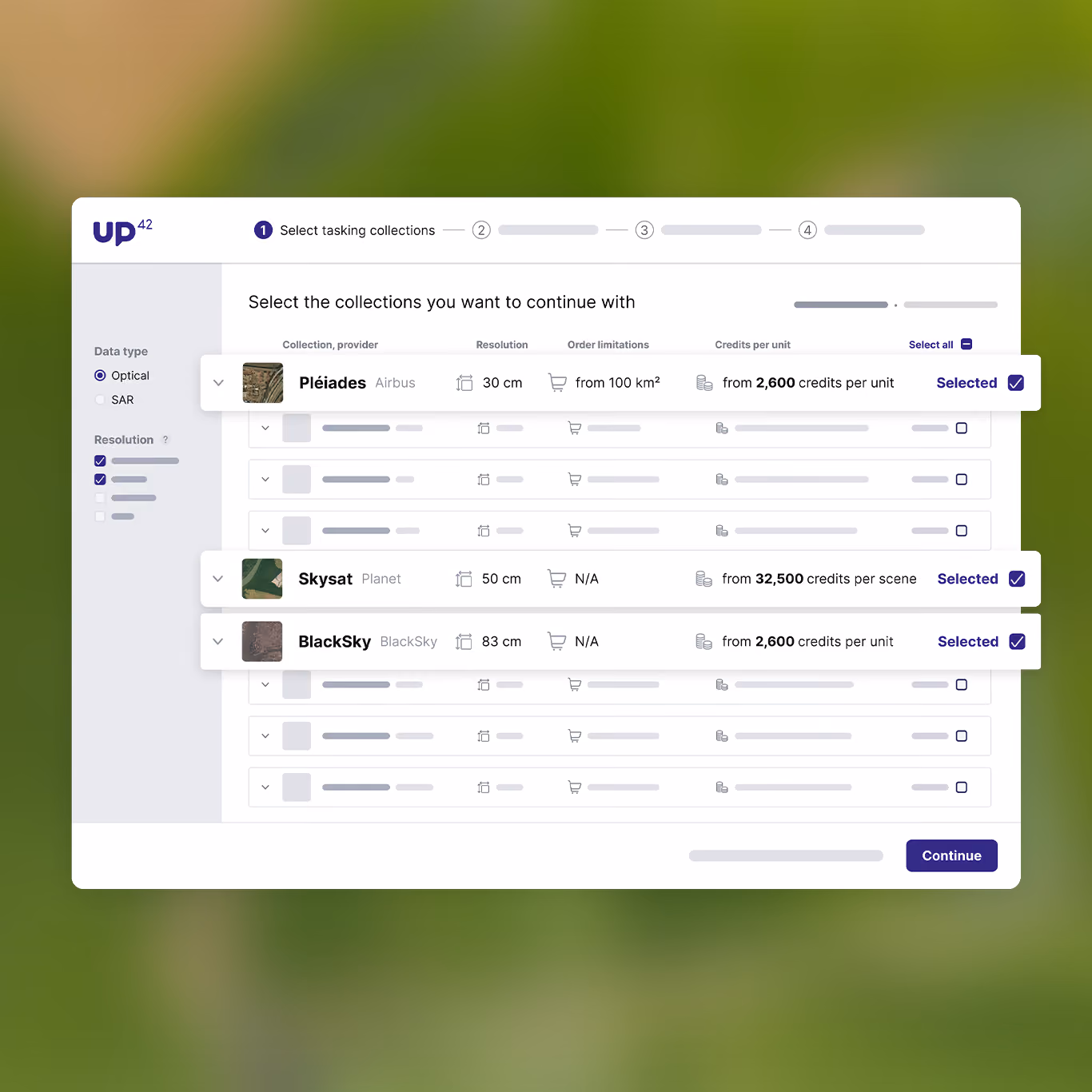
Compare options before you order
See pricing before you submit an order and compare acquisition options based on budget and timeline.
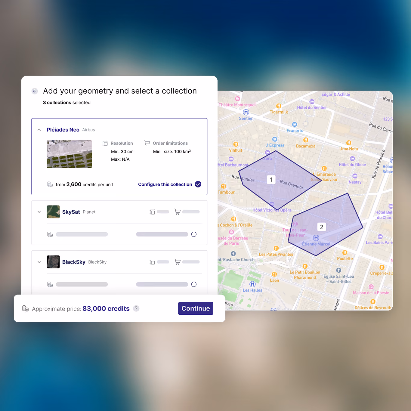
Scale up your data acquisition
Manage multiple areas of interest, sensors, and repeat orders with ease. Place more tasking orders without increasing your workload.
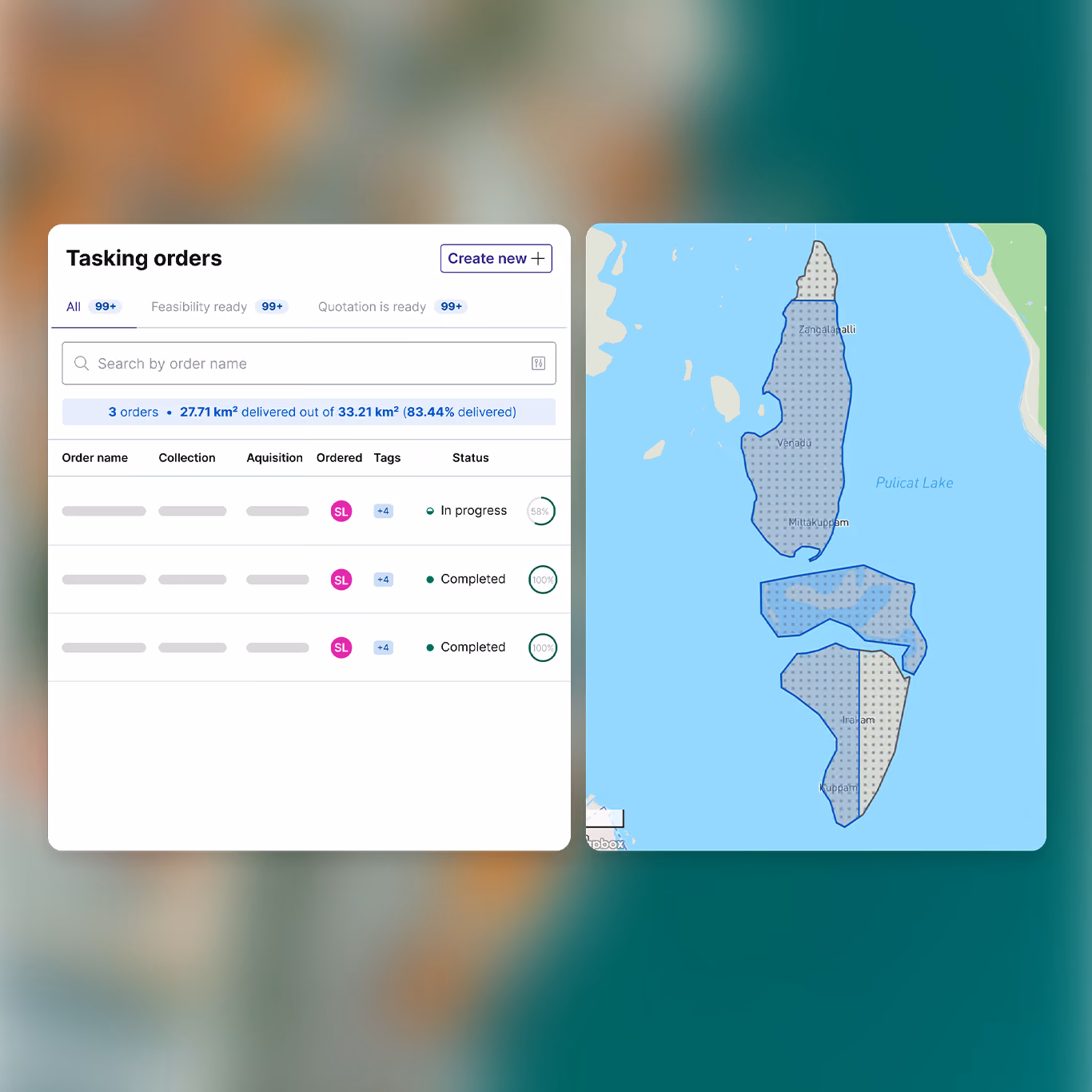
Stay informed from order to delivery
Track acquisition status, monitor coverage, and immediately integrate delivered data into your workflows.
FAQs
Tasking is what you do when you need brand-new data collected on a specific date or range of dates, or you need data of an area that hasn’t been captured. In this case, you “task” a satellite to capture fresh data for you. You can do both things directly from the UP42 platform. You can also check out our dedicated tasking blog post for more details.
Head to the UP42 console’s tasking tab. From here, click the Create new button. Then select your desired provider, or multiple providers, and create or upload your area of interest. At this point, you can enter your desired parameters, and you’ll see a price estimate before placing the order.
Every collection has its own minimum order size. We encourage you to talk to our customer success team to find the best combination of size, resolution, and price. You can also check minimum sizes in our documentation.
There’s no one-size-fits-all answer for this question.
For optical imagery especially, collection capacity and availability depends heavily on the season: high season for tasking is from June through August in the Northern hemisphere, so during those months, orders may take longer due to competition for sensor capacity.
For many collections, orders can be immediately activated, but some will require feasibility studies. In this cases, our team will check your order’s requirements and let you know if it’s possible or if your order requires modifications. Feasibility studies can range from 1 to 10 business days.
In terms of near real-time imagery, some of our providers offer revisit times of up to 7 captures per day.
For more information on time frames, please see our documentation.
UP42 also offers support for rush tasking orders if you have an urgent request. These requests can be made directly within the platform. But if you have questions, please get in touch with our team.
You can monitor your order status in the console, or via our API or Python SDK. And you’ll receive automatic updates when your order status changes.
You can also automate delivery with our API or Python SDK so that your finished assets download automatically into your workflows.
Still have questions?
Get in touch with us!
Conditions change. We've got you.
