A complete guide to marine traffic tracking technologies and AIS data
We’ve talked about marine traffic tracking technologies and AIS data when it comes to gathering vessel insights to create maritime solutions. This forms an important part of situational awareness, bringing rich information to things like port monitoring and vessel route optimization.
But, we thought we’d break down this kind of data and create a complete guide so you know exactly what’s involved.
Perhaps your organization is looking to supplement ship detection satellite analysis with AIS ship identification and that led you to wonder: what is marine tracking and AIS data exactly? How does it work, and how do satellites in space play a part?
Let’s take a closer look and find out.
So, what is marine traffic?
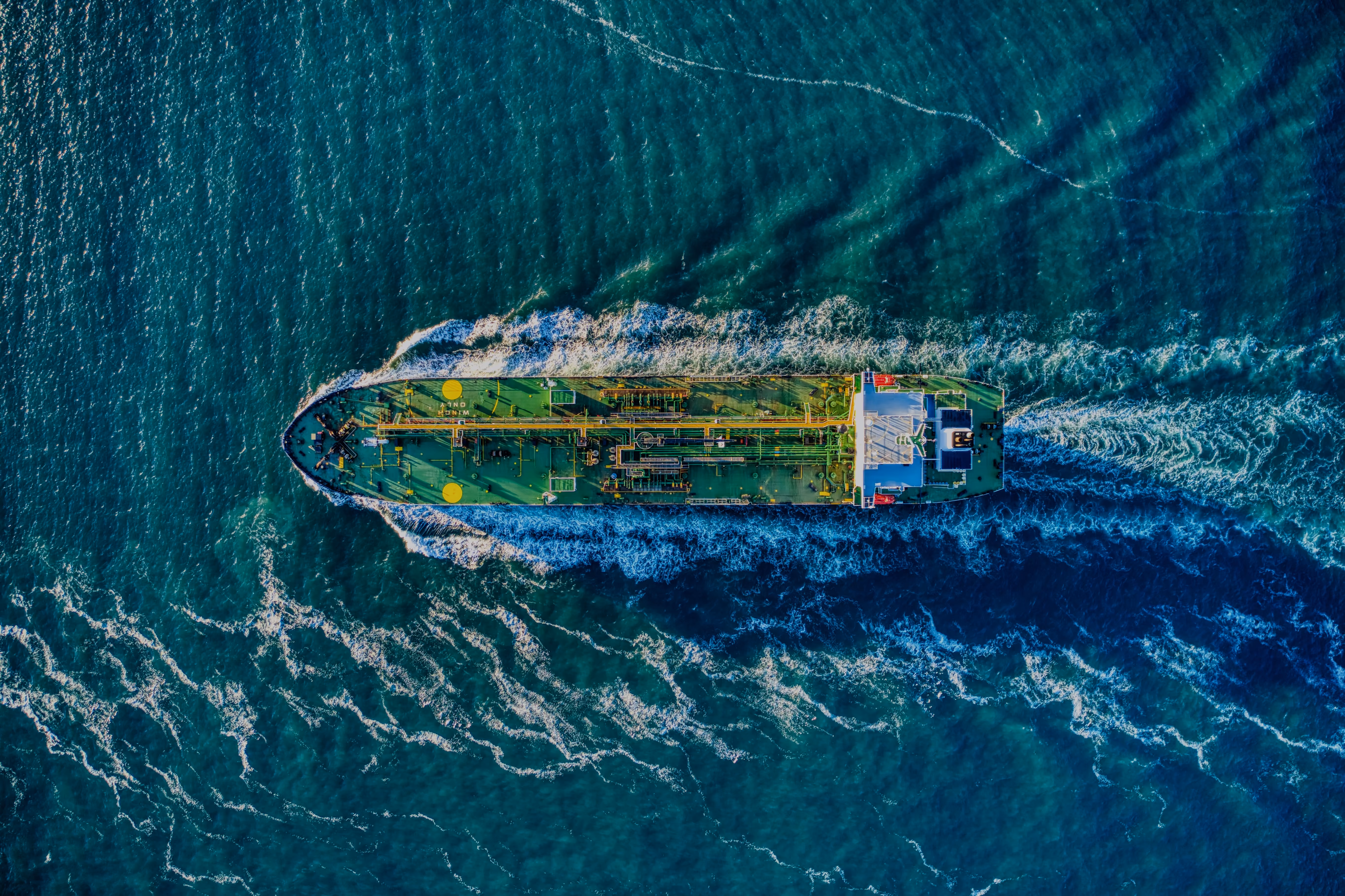
Marine traffic is essentially all ships at sea. Tankers, naval ships, container ships, fishing boats, passenger ships—collectively. Ships are classified into various types based on their purpose, size, and type of cargo.
A vessel traffic service (VTS) keeps track of marine traffic in a similar way that air traffic control does for aircraft. These marine traffic monitoring systems are established by harbor or port authorities and designed to improve the safety and efficiency of vessel traffic and protect the environment.
What is maritime tracking?
Think of it as your eyes on the seas. Maritime tracking is an ideal way to scour the waves and know exactly what, where, when, and how (fast, slow, or otherwise) ships are traveling.
It enables real-time information on the movement of ships and their current locations in harbors and ports to be deduced.
A 2018 review of Maritime Transport (UNCTAD) calculated that there are 50,732 active ships around the world—including those at seas and in port.
There are many ways to keep track of all this traffic and do maritime tracking. AIS tracking websites such as the aptly named MarineTraffic operate over 2000 automatic identification system (AIS) stations in over 165 countries across the globe.
Maritime tracking services provide real-time, worldwide ocean coverage, as well as predictive services. This includes a detailed breakdown of the vessel, including name, country of origin, speed, heading, status, exact position, and more.
It’s important to note that not all ships have the necessary technical equipment for maritime tracking.
However, in 2004 it was decided that all vessels over 300 gross tonnages (GT) on international voyages must have AIS equipment on board, as part of requirements set out by the International Maritime Organization Convention for the Safety Of Life At Sea (SOLAS) Regulation V/19.2.4.
What is AIS data?
AIS, or the automatic identification system, is an automated tracking system that displays other vessels in the vicinity. It tracks bigger vessels on voyages across the world—offering real-time information about them.
AIS uses transponders on ships for the tracking and tracing of vessels, allowing the automatic electronic exchange of nautical data between ships and shore installations.
Vessels fitted with AIS transmit and receive information on a periodic basis from other ships with AIS. This information is divided into three categories and includes:
Static information (transmitted every 6 minutes):
- Identity
- IMO number
- Length and beam
- Type of vessel
- Location of position-fixing antenna
Dynamic information (transmitted depending on speed and course alteration):
- Position
- Speed over ground
- Course over ground
- Navigational status
- Rate of turn
Voyage information (transmitted every 6 minutes):
- Type of cargo
- Destination
- Estimated Time of Arrival (ETA)
- Route plan
- Safety-related information
Why is AIS important?
The AIS tracking system was originally developed by the IMO as a collision avoidance tool for large vessels at sea, not within the range of shore-based systems. AIS enables ships to ‘see’ each other more clearly, as well as improving seafarers’ situational awareness.
AIS shore stations and all other ships in its vicinity fitted with AIS receive AIS data transmissions. As a result, it’s possible to automatically recognize, identify, and track vessels no matter its location: high seas, inland waterways, or coastal waters.
This data can be displayed on a screen or an information system—presenting the bearing and distance of nearby vessels in a radar-like display format. This enables seafarers to be aware of other vessels long before visual contact is possible and make time-sensitive decisions.
AIS vessel tracking has been the most significant development in navigation safety since the introduction of radar.
That being said, AIS does not replace navigation-related services such as radar and vessel traffic services but supports them.
The strength in AIS lies in its ability to detect and track vessels also fitted with it. Both AIS and radar go hand in hand, complementing one another due to their different characteristics.
With AIS data, collision avoidance is more accurate than ever before and safety at sea is paramount.
To keep AIS data useful and standardized, IMO regulations require that AIS shall:
- Provide information on the ship’s identity, type, position, course, speed, navigational status and other
- Receive such information automatically from similarity AIS fitted ships
- Exchange data with shore-based facilities
Applications of AIS data
While the original purpose of AIS was solely collision avoidance, many other maritime applications have grown from this and AIS is currently used for:
Collision avoidance
- When a ship is navigating at sea, information about the movements and identities of ships in the vicinity is crucial for navigators to make decisions to avoid collision with other ships or objects such as rocks.
Marine protection
- The world’s oceans have been deteriorating in condition and declining in populations of living flora, fauna, and aquatic species. Vessel tracks and positions can be determined using AIS data in order to monitor protected areas, issue alerts of breaches to geo-fences areas, and identify culprits.
Maritime security
- AIS enables authorities to identify specific vessels and their activity within or near a nation’s Exclusive Economic Zone (a sea zone over which a sovereign state has special rights).
Navigation aids
- The AIS aids to navigation (AtoN) product standard was developed to enable the positions and names of objects other than vessels to be transmitted. This includes navigational aids and dynamic data reflecting the environment—such as a lighthouse or climate conditions.
Search and rescue
- AIS data can provide additional information that is imperative to coordinating on-scene marine search and rescue (SAR) operations. The position and navigation status of other ships in the vicinity provide SAR teams with greater situational awareness.
Accident investigation
- AIS data is key to piecing together a timeline during an accident investigation. It provides accurate historical data on time, identity, compass heading, GPS-based position, and speed—compared to the less accurate information provided by radar.
Fleet and cargo tracking
- AIS tracking websites can be used by fleet or ship managers to keep track of the global location of their ships. This enables the owners of goods in transit to follow the progress of cargo and anticipate arrival times in ports.
What are the technologies?
How does AIS work?
AIS is a broadcast transponder system which operates in the very high frequency (VHF) mobile maritime band.
An AIS system consists of one VHF transmitter, one VHHS DSC receiver, two VHF TDMA receivers, and a standard marine electronic communications link to shipboard display and sensor systems.
AIS data information
Information about position and timing is usually derived from an integrated or external GPS receiver. Other information that is broadcasted by the AIS is electronically extracted from shipboard equipment through standard marine data connections.
The AIS onboard must be switched on at all times, unless it must be turned off for security reasons or otherwise.
If AIS is not fitted or switched on, there is no exchange of information between ships via AIS. In general, the working model of AIS is autonomous and continuous. So, if a vessel is fitted with AIS, that ship will also be shown on the screens of other vessels in the vicinity.
AIS frequencies
Although only one channel is necessary, each station transmits and receives alternately over two radio channels to avoid interference and communication loss from ships:
- AIS 1: On 161.975 MHz-Channel 87B (Simplex, ship-ship)
- AIS 2: 162.025 MHz-Channel 88B (Duplex, ship-shore)
Data transfer
Signals are received by AIS transceivers fitted on other ships or land-based systems, such as VTA systems.
Data is transmitted using a tracking system that makes use of a self-organized time-division multiple access (SOTDMA) datalink designed by Swedish inventor Håkan Lans.
The term ‘self-organized’ refers to the manner in which time slots are assigned to users. With the SOTDMA method, only the first free slot available for transmission has to be found. The next five slots are always automatically reserved.
Per-minute, there are 2,250 slots available for the transmission of AIS data telegrams.
Types and classes of AIS
The AIS standard comprises sub-standards called ‘types’, which specify individual product types and describe technical specifications of each product type.
This upholds the overall integrity of the global AIS system. The major product types described in the AIS system standards for AIS data telegram transmission are:
- Class A - targeted at large commercial vessels and SART, a radio transmitter used to locate survival craft or distressed vessels by sending updated position reports.
- Class B - aimed at lighter commercial and leisure markets which also uses the carrier-sense time-division multiple-access (CDTDMA) system, as well as SOTDMA (as in Class A).
What is Satellite-AIS?
Satellite-AIS, or S-AIS is when satellites are used to detect AIS signatures.
Originally, AIS was used terrestrially with signals sent from ships to land—within a range of around 20 miles.
Then, as vessels began sailing further away from the shore, they began sending signals to satellites in space, which relayed this information back to land. This means that ships can voyage as far as they’d like, and we will always know which ship is where, and how they are doing.
Satellite detected AIS data completes the picture. With the help of transponders onboard each vessel, satellites collect AIS signals from vessels.
This way, vessels that are out of range of terrestrial networks of AIS base stations dotted along coastlines, can be tracked.
AIS Data and Earth Observation solutions
Where does Earth Observation come in?
Earth Observation (EO) satellites circling the globe collect essential information on the ocean, ice, land, and atmosphere. Advanced analytics algorithms are trained to identify and extract insights from EO data.
The great thing about EO data is that when it's looked at side by side with AIS data, it reveals more than meets the eye.
For example, satellite imagery from the Sentinel-1 satellite constellation provides the bigger picture over an area of interest. Ship detection algorithms then accurately identify vessels visible within the satellite imagery.
This enables you to isolate ships of a certain size and validate their respective locations.
On top of that, AIS data then provides information on those ships’ identity, course, destination, ETA, and more, as we’ve already covered.
Combining AIS with satellite data and analytics in this way opens up a whole host of solutions to meet challenges such as overwhelmed ports, proactive monitoring, and logistical efficiency.
What are the challenges of maritime tracking?
This helpful type of data has a number of limitations:
- The accuracy of AIS information received is only as good as the accuracy of the AIS that is transmitted.
- Incorrect information might be transmitted by the AIS from another ship.
- Not all ships are fitted with AIS.
- The position received on the AIS display may not be referenced to the WGS 84 datum—a standard coordinate system called the World Geodetic System.
Summary: What is marine traffic tracking tech and AIS data?
To sum it up, marine tracking using AIS data is a method of automatically and periodically broadcasting information about things like ship speed, position, route, and type to vessels in its vicinity—using transponders onboard each vessel.
While the original purpose of AIS was solely collision avoidance, many other maritime applications have grown from this such as marine protection, search and rescue, navigation aids, and fleet and cargo tracking.
Earth Observation data and algorithms are an ideal way to derive more value from AIS data and gain greater situational awareness.
Combining AIS data with satellite imagery and advanced analytics is a great way to increase efficiency, sustainability and it could save you costs in the long-term.
It’s relatively quick and easy to integrate high-resolution EO imagery, radar data, and even weather data with AIS for rich, actionable insights.
Get started with creating your ideal maritime solution by clicking here or browse a selection of AIS, satellite, and weather data alongside off-the-shelf analytics.


Subscribe to our newsletter
Stay up to date and learn about our fast-growing new features
