Geospatial technologies are applied in every phase of the mining lifecycle from mineral exploration and feasibility studies to mine operations and environmental remediation. Of these, remediation may now be the single largest application for remotely sensed imagery and related analytics throughout the life of the project.
"Remediation is no longer an activity limited to the closing of the mine," said Nicolaas Steenkamp, Manager: Earth Observation Services at Pinkmatter, a global provider of Earth Observation-based monitoring solutions. "Starting with site feasibility studies, mine owners are relying on geospatial data and analysis to plan for returning the project area to its original condition years or decades in the future."
The definition of remediation has expanded greatly in recent years to include protection of both the natural and social ecosystems surrounding a mine. Continuous monitoring of a site to detect and fix small problems before they grow into catastrophes impacting nearby habitats or population centers is now standard practice in the mining industry. Ongoing monitoring programs are also potentially more cost effective than dealing with massive clean-ups and lawsuits after the fact.
For the mine operator abiding by local regulations and for project investors concerned with the Environmental, Social, and Governance (ESG) impacts of their funding dollars, the geospatial data sets and algorithms needed to proceed responsibly are all found on the UP42 marketplace.
Building a Provenance Record
During the feasibility phase, the mine operator assesses the site to determine where excavation should occur and to pinpoint suitable locations for buildings, material piles, and access roads. At the same time, the operator begins compiling a provenance record of conditions -- topographic, vegetative, hydrologic, and social (existing human development). It will serve as the baseline to track environmental and other disturbances caused by the mining activities moving forward.
"In the future, the provenance record will be proof the operator is restoring the site to natural conditions," said Steenkamp.
Fortunately for the operator, performing the feasibility study and documenting existing site conditions require many of the same geospatial data sets. Pan-sharpened images from high-resolution satellites, such as Airbus Pléiades and Pléiades Neo and HEAD Aerospace GFMM, present an unbiased overview showing the precise locations and conditions of natural and man-made features.
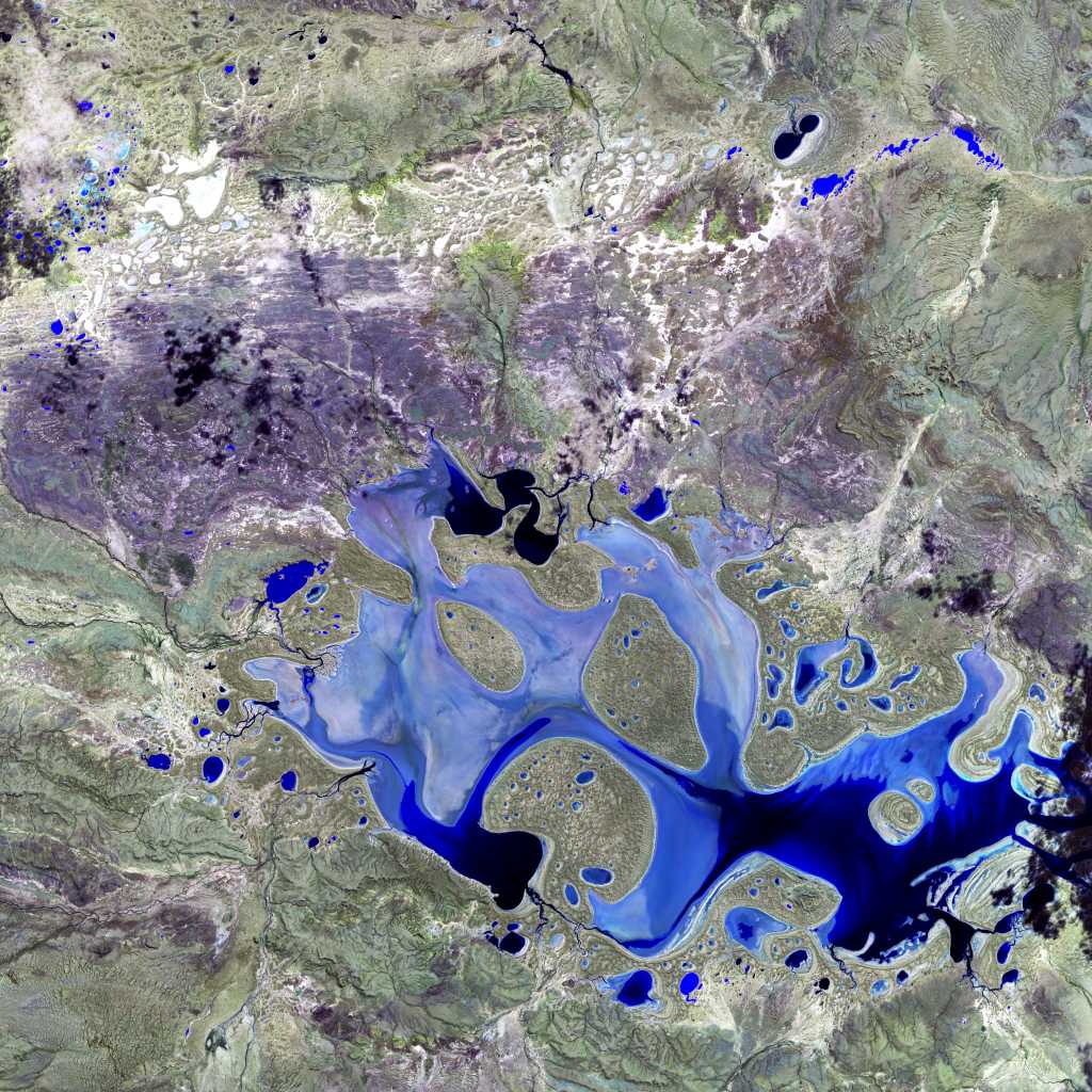
 Northern Italy, European Space Agency, Copernicus Sentinel data (2015)/ESA,CC BY-SA 3.0 IGO
Additionally, the multispectral content in these data sets enables operators to classify land cover and identify areas such as marshes, water bodies, and other environmentally sensitive habitats that must be protected, or entirely avoided, during the development of mine infrastructure.
One of the most important application of multispectral image data during this provenance phase is not only differentiation of vegetation, but also determining its health before operations begin. If the natural environment is already stressed, this must be recorded so the mine is not liable for it later. Multispectral image data in the visible red and near infrared have now been complemented by the Red Edge band in recently launched satellites to accurately calculate biomass and verify plant vigor down to the detail of individual trees.
Assessing vegetative health with satellite image data can be performed much easier today than ever before. Formulas referred to as vegetation indices that combine the key multispectral bands have been developed and integrated into automated algorithms.
Topography is the other aspect of the natural environment that must be mapped when creating the official site record. Best captured in 3D with Digital Elevation Models (DEMs), terrain data measures the elevations and steepness of slopes, escarpments, and all surface features. For the mine operator who will be moving tons of Earth in every phase of activity, this data is critical in modeling existing drainage patterns that must be understood -- because altering surface water runoff can have devastating impacts to areas downstream.
More specifically, the operator must know where surface hydrology might carry pollutants in the event of a toxic leak or spill once extraction begins. Accurate modeling of topographic contours and drainages also plays an important role in determining where spoil heaps should be placed on the site to minimize the likelihood of dangerous toxic runoff from them as well.
Satellites acquire cost-effective 3D data for mining applications. Some optical satellites have stereo imaging capabilities, capturing overlapping data sets from which highly accurate 3D elevation models can be derived. Another popular source for this data is synthetic aperture radar (SAR) satellites, which have the advantage of capturing extremely accurate elevation data in densely vegetated locales, even in regions often covered by clouds.
UP42 offers customers a choice of purchasing processed DEMs from Airbus andIntermap at varying resolution levels. Or the customer may buy data acquired by the following satellites to generate their own elevation models:
Ongoing Monitoring
In many parts of the world, regulated mines are required to submit periodic reports on natural conditions in and around the site. This compels the operator to monitor the condition of terrain and surrounding flora and fauna on a regular basis. For the owner, this information also builds the provenance record. With so many remote sensing satellites now in orbit and available through the UP42 platform, mine managers can schedule repeat image capture on a frequency that meets their needs, from daily to annually and everything in between.
In addition to the numerous satellites that can be tasked on the platform, UP42 also offers automated algorithms that use machine learning technology to detect change from one image capture to the next. This can serve as an early indicator of a problem at the site. For example, the unexpected identification of stressed vegetation near the mine in multispectral imagery could indicate a toxic leak has occurred, potentially giving the site managers time to remedy the problem before significant damage is done.
Ongoing monitoring of terrain movement is also important. Subsidence above an underground mine could be a precursor to a cave in, while slope creep in an open pit mine can foretell a wall collapse. Disasters like these not only pose risk to the natural environment but also to the people who work at the site.
The expansion of environmental stewardship by mine operators under the ESG auspices has also extended the applicability of geospatial technology to include better protection of human life near the site.
"Social licensing is the term used for mines to keep track of people–workers and nearby residents–who are impacted by operations," said Steenkamp.
Returning to Nature
When the mine finally plays out and shutdown begins, the geospatially derived provenance record serves as a guide that can be used in returning the site as close as possible to its natural appearance and environmental condition. Ideally, major damage to the ecosystem was avoided thanks to monitoring throughout operations so that late-stage remediation is minimized. The record of environmental conditions also helps shield the operator from unwarranted liability stemming from pre-existing damage.
For those mines that began operation long before geospatial data was routinely incorporated into the provenance record, details about the original site may still be obtained from satellite image archives, depending on when the mine opened. Archived Landsat and SPOT satellite imagery are available dating to the 1970s and 1980s, respectively.
By their nature, however, most mining sites continue to pose risk to surrounding natural and social ecosystems and present potential liability for the owner long after activities have ceased. Continued monitoring of any area in the world with the reliable, and unbiased, sensors carried aboard an ever-growing list of remote sensing satellites is readily available now.


