Partner Profiles | Terra Cover's mission is to deliver insights about the Earth’s continually changing surface by leveraging data, machine learning, and physics. Hear directly from Founder and CTO, Ankush Khandelwal, about how they are pursuing this mission.
Hi Ankush, it's great to speak to you. We're super excited to have Terra Cover as a partner at UP42. What inspired you to create Terra Cover and why?
Hi Nathan! I have always been interested in using satellite imagery to learn about our ever-changing Earth. I have a strong desire to not only create new algorithms but also build systems that leverage these algorithms to provide actionable insights to stakeholders.
I worked on several satellite imagery applications during my PhD and starting Terra Cover to bring new techniques to market was a very natural and exciting next step for me.
How do you describe actionable insights?
The world benefits when we provide access to solutions and not just tools. A new AI/machine learning technique is a tool but a data service that provides actionable insights using that algorithm is a solution that stakeholders need.
While we are very heavily involved in developing cutting edge technology, we prioritize the customer's end goal and package our algorithms as data services that deliver intelligence using the technology. For example, I developed a number of physics-guided machine learning algorithms to address the challenges of cloud and classification errors that are inherent in satellite imagery analysis.
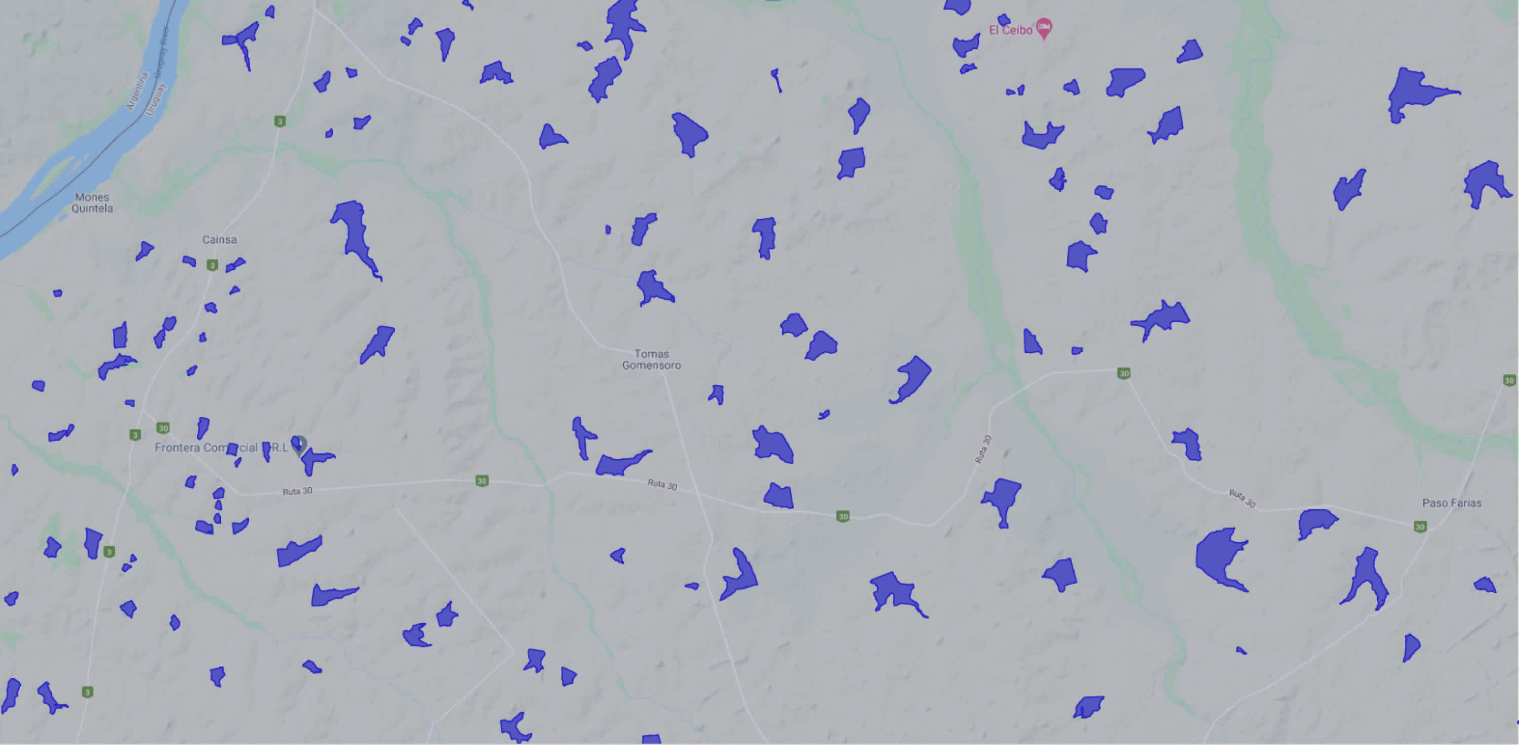
While developing algorithms was sufficient for my research goals, I used the algorithms to create a database of ~ 0.5 million water bodies and their changes from 1984 - 2015. The dataset has much more value for stakeholders than algorithms published in papers.
Why did you decide to work on water? What are the other sectors that you are excited to focus on in the future?
We firmly believe that water is going to be the most important resource in the coming years and decades. Moreover, there are relatively few companies in this space currently, so we decided to focus our initial efforts on water. Since the vast majority of my PhD work was on developing new machine learning techniques for tracking surface water changes, we have a very good set of solutions that we can bring to market in a relatively small amount of time.
Once we establish our solutions for surface water monitoring, we intend to build solutions that bring together satellite imagery, machine learning, and physical models to manage and forecast water availability. At a very high level, we are passionate about solving problems at the intersection of the food-water-energy nexus. For example, we are currently exploring applications at the intersection of the water and mining industry.
What do you mean by physics-guided machine learning algorithms?
Currently, a vast majority of AI techniques for satellite imagery analysis were developed for computer vision applications, and hence do not use any knowledge of the underlying physical processes that drive most of the changes on the earth’s surface.
The key theme of our research and development is to advance the state-of-the-art by incorporating physical constraints into machine learning algorithms. For example, incorporating physical constraints enables the algorithms to better handle issues due to cloud cover.
 Surface area changes of a reservoir in Uruguay. Physics-guided machine learning algorithms improve the ability to handle cloudy images.
Can you tell us more about your algorithms and data blocks on UP42?
Currently, we have one data block which provides access to an open-source dataset of ~ half a million water bodies that I created during my PhD. The user can provide any bounding box and a temporal duration, and the data block returns the monthly shapes of lakes and reservoirs in that bounding box.
In the coming weeks, we plan to release the processing block which will provide regular monitoring capability for these water bodies. Initially, the regular monitoring block will use Sentinel-2 imagery, but we plan to merge information from LANDSAT as well as Sentinel-1 to improve the temporal coverage. From the user’s perspective, they will continue to get a seamless data service that provides access to surface water extents regardless of the imagery source and resolution.
What are your plans for Terra Cover in the next year?
We are working towards three major water intelligence products - surface water monitoring of lakes and reservoirs, flood extent mapping, and monitoring changes in rivers. Our goal is to work with the early customers for these services and refine the product/technology for wide-scale adoption.
How do you see UP42 being part of Terra Cover’s future?
We are really happy with the UP42 platform and ecosystem and will continue to add our services to the platform. Our hope is that our intense focus on water and breadth of services will be very synergistic for both UP42 platform users as well as Terra Cover.
What brings you the greatest satisfaction in your work?
As I mentioned before, building solutions that can bring change to how we use our limited resources gives me a lot of joy and energy. Over the past few years of my entrepreneurial journey, I have learned that people are the most important aspect for success. I am enjoying the process of communicating ideas with our team and customers to bridge the gap between technology and problems to be solved.
What is your favorite planetary perspective?
I don’t have a single image or perspective, but I am fascinated by the idea of data-in-art and art-in-data. Whenever I find an image, graph, or map that looks like more than just data, I try to collect them. For example, I have seen a lake that looks like the bone structure of a human foot.


