UP42 and Vexcel team up to expand aerial imagery and geospatial data portfolio on the marketplace

High-resolution and Accuracy in 30+ Countries for Utility, AEC, Energy, Insurance, and Telecoms Applications
BERLIN, March 28, 2023 -- UP42, the geospatial developer platform and marketplace, has significantly expanded its aerial imagery and elevation data portfolio through a partnership with Vexcel--a 30-year industry leader in the photogrammetric and remote sensing space. The Vexcel Data Program delivers geospatial data products with high accuracy, spatial resolution, and consistency.
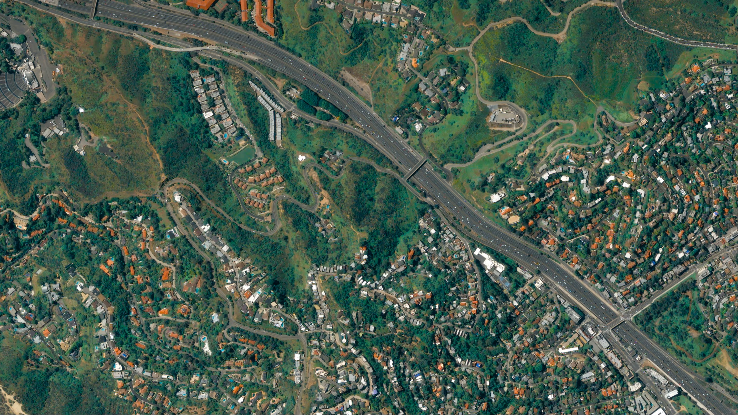
Vexcel's aerial data collection initiative is the largest in the world capturing ultra-high-resolution imagery (at 7.5 to 15cm resolution) and related geospatial data in more than 30 countries, including the U.S., Canada, U.K., Western and Eastern Europe, Australia, New Zealand, and Japan. Known for their remarkable image quality, Vexcel products are used extensively by local governments, utilities, telecoms, and AEC (architecture, engineering, construction) companies.
"With a rich heritage in the geospatial industry, the Vexcel name is synonymous with reliability and quality," said Sean Wiid, CEO of UP42. "Our partnership with Vexcel highlights UP42's commitment to offer our customers a portfolio of products that continues to grow in diversity and geographic coverage."
Vexcel has built its excellent reputation over decades in the geospatial sector, first as developer of the market-leading UltraCam airborne sensor line deployed globally by aerial mappers. Leveraging the UltraCam's ultra-high resolution and accuracy combined with world-class processing software, Vexcel launched its data collection program and amassed a comprehensive library of cloud-based aerial imagery and elevation data.
"Our aerial data helps end users solve some of the toughest geospatial challenges, especially when it comes to infrastructure and asset management," shared Jason Jones, Director of Channels and Alliances for Vexcel. "End users are able to support better decision-making, enhance workflows, and generate more accurate automated insights using our premium imagery. We're thrilled our partnership with UP42 provides this opportunity to their customers."
The clear and accurate Vexcel aerial imagery now available on the UP42 marketplace enables users to gain greater context and insights from the world around them. These products include:
- Oblique and True Ortho urban images at 7.5 cm resolution, or better
- Orthos at 15-20 cm, and
- Digital Surface Models (DSM) at 7.5cm resolution and Digital Terrain Models (DTM) at 15-20 cm resolution
The consistent quality of Vexcel image products across all geographic locations delivers insights and analysis in a variety of applications, including:
- Vegetation management and infrastructure monitoring by energy utilities and telecommunication companies,
- Site inspection and property assessment by AEC firms, and
- Urban planning and environmental protection by local governments.
"We launched UP42 with the objective of becoming the one-stop-shop that changes the way geospatial data is accessed and analyzed -- and our partnership with Vexcel further assists us in achieving that goal," said UP42's Wiid.
For more information on the Vexcel data products on the UP42 marketplace and to place an order, please visit the following pages:
Viviana Laperchia
Senior PR and Communications Manager, UP42
About UP42
UP42 is changing the way geospatial data is accessed and analyzed. The platform and marketplace bring together multiple sources of data such as satellite imagery, weather data, and more---together with algorithms to identify objects, detect change, and find patterns. Industry leaders use UP42 to inform business decisions and build scalable customer solutions. Know when and where to fertilize crops. Measure air quality and map emissions. Count cars, trucks, planes, and ships. Developers and data scientists across all industries now have access to a platform to build, run, and scale projects in one place. Visit: www.up42.com.
About Vexcel
For over 30 years, Vexcel has been the industry leader in the photogrammetric and remote sensing space, providing the world's largest aerial imagery library of cloud-based geospatial data. Vexcel's Data Program provides the highest caliber of aerial data to help solve real-world problems, drive better AI/ML results, and strengthen innovation across multiple industries . Vexcel's unique technology stack results in unrivaled image quality, helping customers streamline workflows and integrate data into third-party platforms with confidence and ease. Vexcel currently collects imagery in 30+ countries around the globe, from Oblique to True Ortho, DSM to Multispectral products. Learn more at vexceldata.com.
Related posts

Subscribe to our newsletter
Stay up to date and learn about our fast-growing new features
