Detail and Refresh Rate Ideal for Utility, AEC, Local Government Monitoring Apps
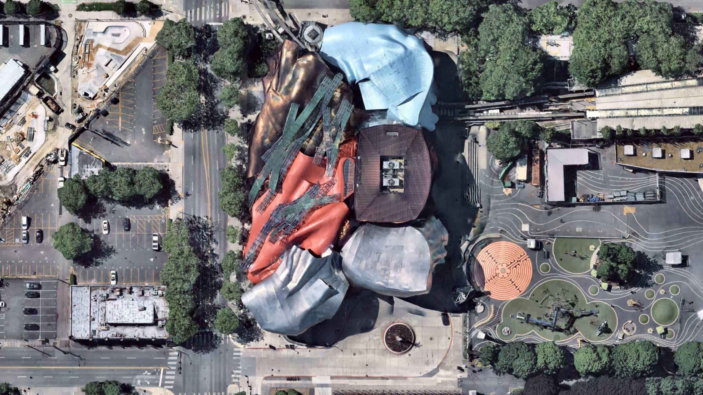
BERLIN, April 7, 2022 -- Nearmap's high-resolution aerial imagery of major urban areas in the United States, Canada, Australia, and New Zealand will soon be available through UP42. The initial offering will include the Nearmap vertical imagery, which is updated multiple times each year at 5.5- to 7.5-cm (2.2" to 3") spatial resolution for more over 1740 urban areas in the US and over 100 in Australia.
With global headquarters in Sydney, Australia, vertical imagery from Nearmap provides an orthogonal imagery base layer that offers consistent clarity, precision, and spatial detail for cities and their surrounding areas. In the United States alone, coverage includes more than 80% of its population with 308,000 unique square miles -- including some of the most rapidly growing municipalities -- surveyed each year.
The Nearmap Vertical imagery archive dates from 2011 in Australia and New Zealand, and 2014 in the US -- with an annual refresh schedule of 3X to 6X per year. New imagery is orthorectified, georeferenced, and uploaded to the cloud for purchase within days of collection.
"Our partnership with Nearmap delivers value to UP42 customers by providing direct access to high-precision urban imagery of remarkable quality and detail," said UP42 CEO Sean Wiid. "The extensive Nearmap archive and refresh rate combined with other geospatial data sets on the UP42 platform enable highly detailed monitoring applications related to asset management in the utility, construction, and local government sectors."
UP42 is lowering the barrier to entry for customers to extract unique geographic insights and create scalable geospatial solutions. To this end, customers can integrate the Nearmap Vertical imagery with other data sets available from UP42. The marketplace currently contains over 160 products from more than 50 of the world's leading geospatial organizations.
"We are pleased to deliver our current, clear and consistent high-resolution imagery to UP42 customers," said Nearmap North America General Manager, Tony Agresta. "Combining our industry leading aerial imagery with UP42's extensive database, will ensure customers are getting the most up-to-date and reliable data as they make business decisions."
UP42 customers will find the Nearmap Vertical images, as well as Digital Surface Models and 3D data sets, deliver consistent spatial detail, confident measurements, and frequent updates for any geospatial application. The following use cases will be among the most beneficial for UP42 customers using Nearmap data:
Energy and Water Utilities -- The Vertical imagery provides the refresh rate and spatial detail to continually monitor the condition of utility infrastructure and surrounding environments. The centimeter-level resolution and vertical measurements that can be taken from the imagery also serve the needs of 5G wireless network planners.
Construction -- Nearmap data is used extensively by Architecture, Engineering and Construction (AEC) firms to select suitable construction locations and to monitor the progress of major building projects underway, especially in remote locales.
__Local Government __-- City managers can rely on frequently refreshed Nearmap orthoimage products to monitor municipal assets, while Urban Planners use the data to predict growth and to accurately plan when and where new infrastructure should be built to keep pace with development.
To request a Nearmap image search or to place an order, please contact an UP42 technical expert. They are also available to assist customers in selecting other geospatial data sets and processing tools to fully leverage the value of Nearmap imagery in specific end-user applications.
Graphics: https://drive.google.com/drive/folders/14UTVJ313tweCTLgN5_MXZj7NLtnh4VHl?usp=sharing
Caption: "Photo provided by Nearmap"
For all media inquiries, please contact:
Viviana Laperchia
Senior PR and Communications Manager, UP42
[email protected]
Taylor Cenicola
PR North America
[email protected]
About UP42
UP42 is changing the way geospatial data is accessed and analyzed. The platform and marketplace bring together multiple sources of data such as satellite imagery, weather data, and more---together with algorithms to identify objects, detect change, and find patterns. Industry leaders use UP42 to inform business decisions and build scalable customer solutions. Know when and where to fertilize crops. Measure air quality and map emissions. Count cars, trucks, planes, and ships. Developers and data scientists across all industries now have access to a platform to build, run, and scale projects in one place. Visit www.up42.com.
About Nearmap
Nearmap provides easy, instant access to high resolution aerial imagery, city-scale 3D content, AI data sets, and geospatial tools. Using its own patented camera systems and processing software, Nearmap captures wide-scale urban areas in the United States, Canada, Australia, and New Zealand several times each year, making current content instantly available in the cloud via web app or API integration. Every day, Nearmap helps thousands of users conduct virtual site visits for deep, data-driven insights--- enabling informed decisions, streamlined operations and better financial performance.
Founded in Australia in 2007, Nearmap is one of the largest aerial survey companies in the world and is publicly listed on the Australian Securities Exchange.
END


