Enhancing Applications in Utilities, Insurance, Agriculture, Government
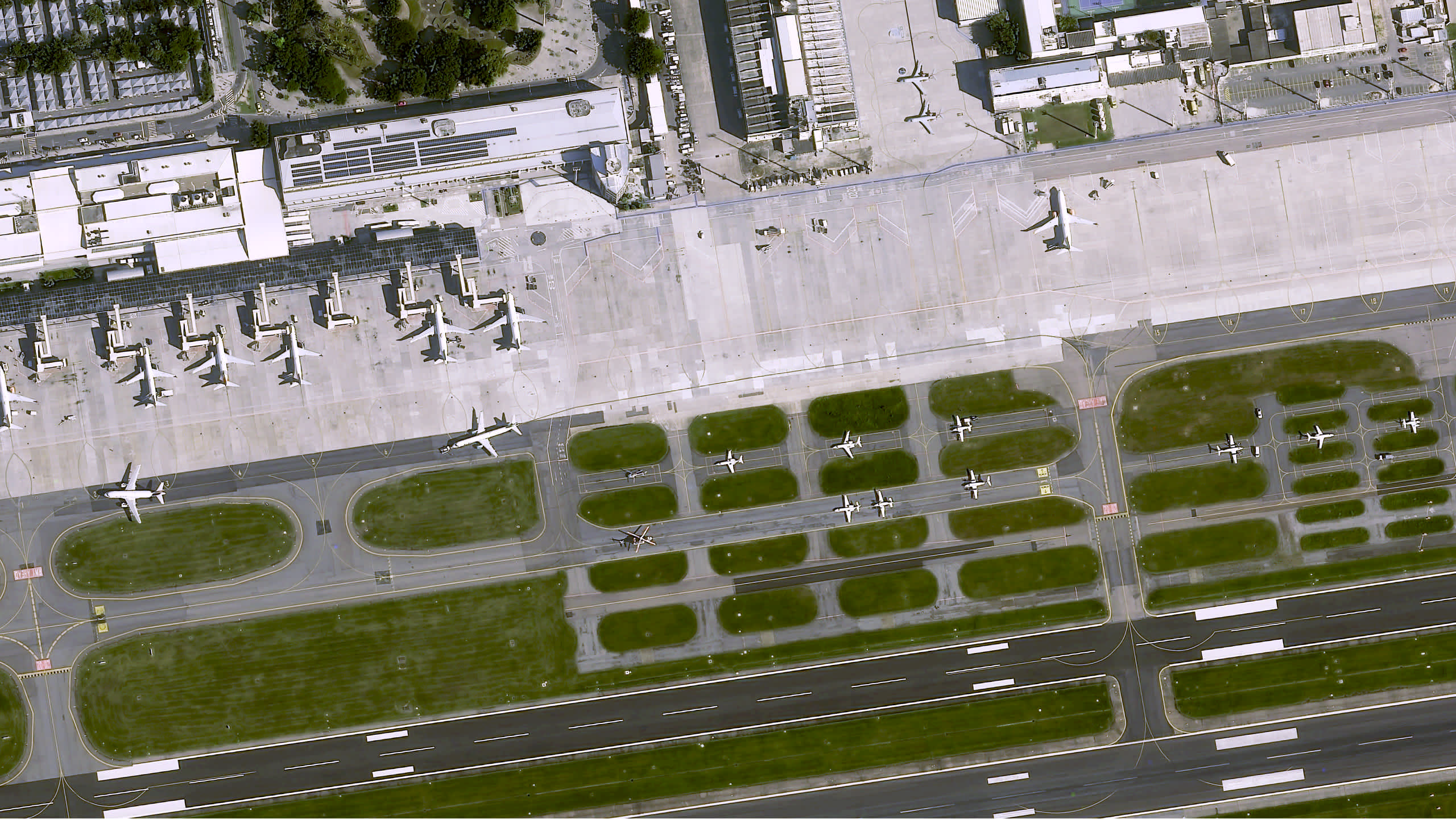
BERLIN, Germany, November 3, 2021 – UP42 is pleased to announce the immediate availability of very high-resolution optical imagery from the Airbus Pléiades Neo constellation on the UP42 geospatial marketplace and developer platform. Pléiades Neo’s unique combination of 30cm native spatial resolution, daily revisit, and faster tasking/data delivery will benefit end users in all sectors, most notably Urban Mapping, Infrastructure Monitoring, Disaster Response, Insurance, and Agriculture.
“UP42 customers now have direct, easy access to Pléiades Neo, the most advanced commercial optical satellite imagery available on the market today,” said UP42 CEO Sean Wiid. “This next-generation constellation is a game-changer, and will play an important role in our ability to help our customers drive social, economic and environmental impact through the use of EO data and analytics.”
The flexible UP42 platform provides the building blocks for geospatial companies to scale their products and businesses faster, further and cost effectively. UP42 customers may now plan, place, and track orders for Pléiades Neo acquisitions. For the many UP42 customers who access data and algorithms through the platform API, Pléiades Neo tasking will be available immediately.
UP42 customers can track the status of their orders through the API or console. Image data will be delivered directly to customers via the UP42 platform.
The Pléiades Neo constellation represents a breakthrough in Earth observation technology from the acquisition capabilities in orbit to the production workflow on the ground. Developed by Airbus, the constellation currently includes two imaging satellites launched earlier this year with another two set for launch in 2022. Each of the highly agile optical satellites is capable of the following:
- Panchromatic imaging at 30cm Ground Sample Distance (GSD) at nadir with <5m CE90 geolocation accuracy
- Global twice daily revisit at 46-degrees off nadir, daily at 30-degrees off nadir,
- Multispectral imaging in the Red, Green, Blue, Near-Infrared plus the new Red Edge, and Deep Blue bands
- Mono, stereo, and tri-stereo same-pass imaging
- Two million km2 per day acquisition capacity
- 12-bit dynamic range
Solutions developers and end users across all industries and sectors will benefit from Pléiades Neo data on the UP42 platform. Some of the most significant advantages will be experienced in these applications:
Infrastructure Monitoring – Twice-daily imaging enables government agencies, security firms, energy utilities, and other organizations responsible for managing sensitive facilities to identify changes in the infrastructure itself or the surrounding environment that may require timely corrective action to be taken. This may include operational wear-and-tear on equipment or vegetation encroachment on energy pipelines and transmission lines.
Urban Mapping – In densely developed urban areas, local governments and utilities can map assets and infrastructure using very high-resolution imagery to accurately locate and identify objects as small as 30cm, or about 12 inches. Twelve-bit radiometric resolution makes it possible for features to be mapped in the shadows of tall buildings. Stereo imaging allows for detailed 3D mapping of built structures and surface terrain for generation of highly accurate Digital Elevation Models (DEMs).
Disaster Response – The ability to place acquisition orders shortly before a satellite overpass and quickly receive image products enables emergency preparedness officials, defense organizations, and insurance companies to identify, assess and respond effectively to rapidly evolving unplanned events, whether natural or human-made.
Marine Applications – The new Deep Blue band penetrates the water column to deliver insights related to depth and water quality in the near-shore ocean environment, as well as in freshwater lakes, rivers, and streams. Twice-daily imaging, combined with other data on the UP42, introduces new capabilities related to port traffic monitoring.
Artificial Intelligence/Machine Learning Analysis – Because the quality of results generated from AI/machine learning algorithms increases with image spatial and spectral resolution, land use/land cover classification, change detection, object identification, and other geospatial analyses performed with algorithms accessed on the UP42 platform and applied to Pléiades Neo data will produce more accurate and precise intelligence.
The UP42 marketplace currently contains over 160 products from more than 50 of the world’s leading geospatial organizations. UP42 technical experts are available to assist customers in selecting the best data set to meet the needs of each specific application. These experts can also help in tasking a satellite for new image acquisition or querying the archive to obtain existing imagery.
To order Pleiades Neo imagery or to confer with an UP42 expert, please visit the following link: https://up42.com/neo.
About UP42
UP42 is changing the way geospatial data is accessed and analyzed. The platform and marketplace bring together multiple sources of data such as satellite imagery, weather data, and more—together with algorithms to identify objects, detect change, and find patterns. Industry leaders use UP42 to inform business decisions and build scalable customer solutions. Know when and where to fertilize crops. Measure air quality and map emissions. Count cars, trucks, planes, and ships. Developers and data scientists across all industries now have access to a platform to build, run, and scale projects in one place. Visit www.up42.com.
UP42 Contact:
Viviana Laperchia
END


