Offsetting CO2 emissions with high resolution satellite imagery
Customer
Founded in July 2021, CarbonStack accelerates the transformation to carbon neutrality by offsetting emissions with local compensation projects. Their mission is to help Europe become the first carbon-neutral continent by supporting afforestation projects.
The transparency of their operations is especially important to CarbonStack: that’s why they use blockchain technology to document their activities, creating a publicly accessible ledger that shows the impact of each afforestation project as well as the link between forest initiatives and the companies that invest in them.
Challenge
Many industries struggle with the transformation to a state of net-zero emissions. Companies aim to reduce and avoid emissions as quickly as possible, but are held back by technological barriers and unavoidable residual emissions. As a solution provider, CarbonStack works with organizations that want to offset their current greenhouse gas emissions, to reach net-zero faster and more sustainably. They do this through afforestation of damaged forests in Europe, to offset currently unavoidable emissions.
CarbonStack wants to accomplish two things. First, there’s the critical task of enabling companies to become carbon neutral. Carbon offsets play a crucial role on our way to the global 1.5°C target. However, a substantial trust issue exists considering the actual impact of compensation projects. Thus, the ecological impact of the companies involved in these compensation projects is often a matter of debate. CarbonStack aims to resolve this issue by creating more transparency for its projects with both satellite observation and blockchain technology. Secondly, CarbonStack enables their clients to invest in local projects that are as close to the corresponding emission as possible. By doing so, they help their clients to improve their standing in local markets.
CarbonStack is currently focused on afforestation projects. Forests make it easier to monitor and visualize the impact of carbon offsets. This task necessitated a deep understanding of many different factors, from finding suitable areas for afforestation to detecting and monitoring the carbon uptake of tree species. Previously, they had been using imagery from drones and airplanes, but this was costly and often wouldn’t provide images of a wide enough area or a detailed enough resolution.
Solution
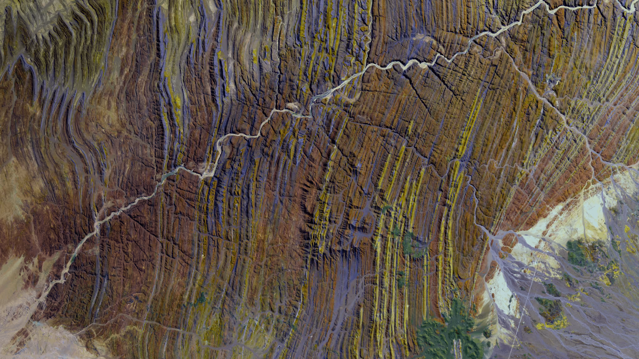
To address these challenges, CarbonStack works with UP42 to gather high resolution satellite imagery. Upon ordering high resolution images for predefined forest areas, CarbonStack can monitor the status of their order and download the assets when they’re ready with UP42’s storage, which centralizes all of their datasets and is accessible via web browser or API. The Pléiades Neo constellation, which captured these images, boasts a 30cm native resolution. This lets CarbonStack clearly identify individual trees, a feat that wouldn’t be possible with lower resolutions. CarbonStack then applies a machine learning algorithm that categorizes trees by species and growth stage in order to measure their carbon offsetting capabilities.

Pléiades Neo’s acquisition capacity of 2 million kilometers squared per day, along with flexible minimum area of interest requirements, allows CarbonStack to order images of the exact scenes they desire. Plus, thanks to UP42’s credit consumption-based pricing, they only pay for what they need.
Result
With Pléiades Neo imagery from the UP42 platform, CarbonStack was able to analyze areas of interest all over Germany, Austria, and Switzerland, to identify and monitor over 1.5 million trees. This monitoring includes nearly 50,000 trees that CarbonStack planted this spring alone throughout the Harz Mountains and the German state of North Rhine-Westphalia for their clients. Projects like this show local populations that CarbonStack’s customers are taking real action to offset their carbon emissions. And the data is then added to Carbonstack’s ledger, which is publicly available on their blockchain for anyone who wishes to access it. This infrastructure delivers a long-needed transparency to the carbon offsetting market. CarbonStack is working with the Algorand foundation to create a new generation of registries for nature-based climate solutions.
By using satellite imagery instead of drones or aerial data, CarbonStack was able to save on time and costs. Looking ahead, they’re planning to expand their areas of operation beyond Europe, starting with North America, where there are many more carbon offsetting opportunities. And they’ll continue to rely on the trusted cooperation with UP42 to do so.
Customer quotes
“UP42 and Pléiades Neo give us the opportunity to use satellite images instead of drones or airplanes for our forest monitoring. This approach is much more flexible and cost-efficient than previous methods.”-Julian Kakarott, CEO of CarbonStack
”UP42’s satellite imagery enables us to monitor the small and scattered forest areas in central Europe. In contrast to areas near the equator, German forests are difficult to monitor in person, because verifiers have to visit every single site. With these high resolution satellite images, we can assess multiple areas at once.”-Julian Kakarott, CEO of CarbonStack
Explore the UP42 platform
Create an account to order, access, and analyze geospatial data.
