Elevation on the Nile: Building escape routes and safe zones for flood-prone areas
Customer
MEEO (Meteorological Environmental Earth Observation) is a consultancy firm based in Ferrara, Italy. Founded in 2004 by atmospheric physicists, the company is a partner of the European Space Agency (ESA), and works with numerous public and private entities to develop and implement Earth observation data innovations.
From air quality and climate issues to land use and marine environment monitoring, MEEO has supported dozens of research projects and initiatives to harness the power of environmental data.
For this project, MEEO was contracted by ENTRO (Eastern Nile Technical Regional Office) to enhance hydrological models with EO data and improve safety for locals through disaster preparedness in case of flooding. Headquartered in Addis Ababa, Ethiopia, ENTRO implements and supports action programs for the Eastern Nile, including water resources planning and management, flood and drought preparedness, and social development.
Challenge
ENTRO, the Eastern Nile Technical Regional Office, needed to build a contingency plan for areas comprising parts of Ethiopia, Sudan, and South Sudan. Past flooding had displaced thousands of residents from villages and cities along this part of the Nile and its tributaries: the Blue Nile, which flows through Sudan and Ethiopia, and the White Nile, which flows through Sudan and South Sudan.
This plan would predict and simulate possible flooding situations caused by strong winds and/or flash flooding. These simulations could then be mapped against road networks in the area, to determine evacuation routes and safe zones for local populations.
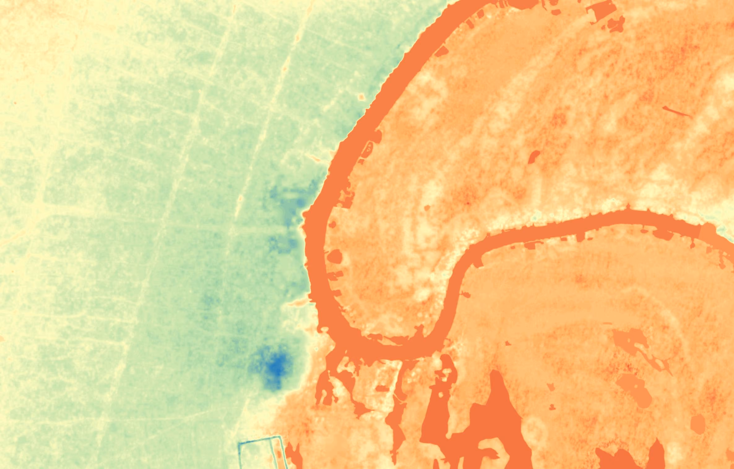
In order to build a hydrological model, ENTRO would need different types of elevation data for areas spanning thousands of kilometers and including several towns and villages. Some of these areas were extremely remote and hard to reach. In addition, ongoing local conflicts and a fragile security situation would make in-person collection of data difficult, perhaps even dangerous. So ENTRO contracted MEEO to understand how to retrieve high resolution elevation data to feed into their model in a safer and more efficient way.
Solution
With the UP42 platform, MEEO found exactly what they needed. They decided on two types of data: Pléiades digital terrain models (DTMs) in 1 m resolution, and Pléiades Neo DTMs in 50 cm resolution. By tasking these two satellite constellations to capture their areas of interest (AOIs) in stereo, which means overlapping captures of the same scene from two different directions, MEEO would gain extremely precise vertical information to feed their model.
MEEO accessed the UP42 platform through the console. Here, they could set their areas of interest (AOIs) on a map, and easily check if any archive imagery existed for their desired AOIs. As stereo imagery didn’t exist for these areas, they needed to task satellites to create new imagery.
For some areas, MEEO already had the exact coordinates, and could upload these to the platform. For others, they outlined their areas themselves, defining the polygons point-to-point. Once their order was sent, they received automatic updates about their order status, from feasibility and order progress to completion.
Result
Through UP42, MEEO had a single integrated solution for placing orders, getting price estimates, and downloading imagery directly into their workflows.
MEEO had originally intended to collect data remotely on two areas, and to collect data on seven areas through field surveys. But due to the UP42 platform’s ease of use, combined with uncertain security situations in their desired areas, they ended up using Earth observation data for all their areas.
By combining their data from UP42 with data from Google Open Buildings and Google Open Street Maps, MEEO was able to build highly accurate asset maps to integrate into the hydrological model to predict and simulate flooding and map out safe areas and evacuation routes. Now, residents of areas across Ethiopia, South Sudan, and Sudan have safety protocols in place next time the Nile’s tributaries overflow, improving safety and disaster preparedness for tens of thousands of people.
MEEO found the entire process smooth, from exploring different providers’ tasking options to downloading their data. They appreciated UP42’s fast response time, as well as how much of the process was automated, eliminating the need for constant emailing back and forth.
Customer quote
"Working with UP42 has been a pleasure. Their sales team and customer support team have always been extremely quick to respond, supporting all of our reiterated requests with detailed information."
—Marco Folegani, Co-founder and Managing Director at MEEO
Explore the UP42 platform
Create an account to order, access, and analyze geospatial data.
