How Sensat eliminated manual engineering work and sped up project deliveries with the UP42 platform
Customer
Sensat was founded in London in 2015. While the company initially operated as a drone services provider, its founders quickly recognised that the true industry challenge wasn't just data capture, but the subsequent speed and accessibility of high-value, large-scale, 3D context.
Traditional surveying methods are slow and expensive. Sensat solves this by providing a unified, cloud-based platform for digital twins, enabling teams to make informed decisions before site surveys even begin. Today, Sensat is the AI-powered digital twin platform of choice for companies all over the United Kingdom, accelerating project timelines and improving decision-making across the AEC sector.
Challenge
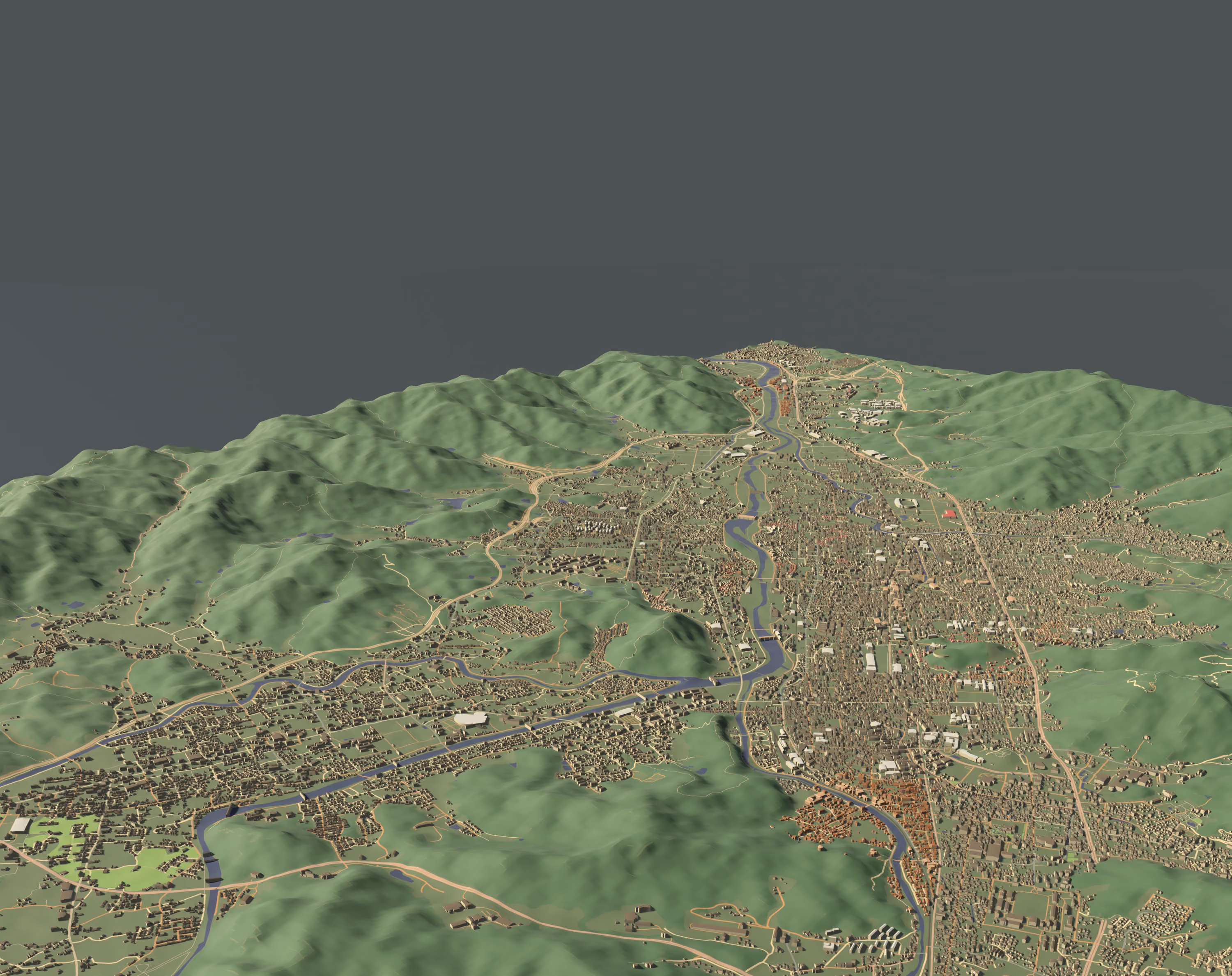
Sensat’s goal is to accelerate time-to-value for infrastructure projects. During early-stage activities in construction and engineering, a foundational 3D context is crucial for route optioneering, site feasibility, and initial design, by allowing engineers and project managers to start work immediately instead of waiting for boots-on-the-ground surveys. Sensat’s Digital Landscape product provides an algorithmically-generated 3D basemap of project areas, which can reach up to hundreds of square kilometers, on demand.
For a computationally expensive product like Digital Landscape to scale, Sensat needed consistent, automated data sourcing. They faced a few major challenges in pursuit of this goal:
- Data acquisition scalability: Securing high spatial resolution imagery over vast and often international areas, consistently and quickly, required contracting multiple providers, leading to logistical bottlenecks.
- Pipeline efficiency: Reliance on manual delivery or less sophisticated data acquisition methods required significant engineering overhead, and slowed down the time it took to ingest, process, and ultimately deliver the final output to the customer. This process needed to be fully API-driven to support the "on-demand" nature of the product.
- Data alignment: Integrating disparate imagery sources with Sensat’s proprietary coordinate reference system and Geospatial AI algorithms required uniformly standardized data formats.
Solution
Sensat needed a partner that could guarantee scalable, consistent, and automated data delivery. Sensat was first drawn to UP42 for their reputation within the industry: the UP42 platform is known for simplifying access to diverse, high resolution data sources. What set the platform apart was not just the breadth of the catalog, but their unified technical interface.
UP42’s API does away with the complexity of integrating disparate data providers, allowing Sensat’s data engineering team to build one scalable ingestion pipeline. With this, they can programmatically define and submit AOIs; apply custom parameters, such as acceptable cloud cover and acquisition date ranges; and automate data retrieval once orders are ready, ensuring a seamless and high-throughput pipeline directly into the processing cluster.
On a more technical level, here’s how they’ve built the pipeline to transform Earth observation data into a customer-ready 3D product.
1. Automated ingestion via API: The UP42 API delivers high resolution imagery and elevation models into a designated cloud storage bucket, in a STAC-compliant format.
2. Pre-processing and coregistration: The Sensat team’s pipeline retrieves the raw raster data and metadata. This step involves precise georeferencing and ensuring that UP42 data is perfectly aligned with Sensat’s internal 3D coordinate reference system (CRS) and the project AOI.
3. Algorithmic 3D generation: The key step is feeding the high resolution data and the seed elevation model into Sensat's proprietary Geospatial AI algorithms. These algorithms perform mathematically complex processes to generate the dense, colorised 3D point cloud that forms the Digital Landscape.
4. Delivery to platform: The final 3D model is optimised for streaming and visualisation and is ingested into the Sensat platform, where it becomes the foundational layer for the customer's Digital Twin, ready for analysis and planning within the browser interface.


"This partnership is a blueprint for Geospatial AI innovation. Sensat is using the programmable data access offered by UP42 to fuel a proprietary, mass-market product that is fundamentally changing how major infrastructure projects begin."—Dr Sheikh Fakhar Khalid, Chief Scientist (CSO) & Head of Data at Sensat
Result
Since they’ve started working with UP42, Sensat has seen huge changes across their whole business.
UP42’s API has massively reduced their data engineering overhead, allowing the team to focus on developing proprietary 3D generation algorithms instead of maintaining complex integrations with multiple vendors. This is saving the team approximately 200-300 hours of manual engineering work annually.
Standardised imagery that doesn’t need to be transformed also eliminates coordinate reference system mismatches and other preprocessing inconsistencies, reducing errors in algorithmic 3D generation by 30–50%.
And then there’s the scalability factor. Access to a wide range of high resolution satellite constellations through one contract allows Sensat to confidently scale their Digital Landscape offering globally without compromising on data quality or delivery time. 3D basemaps can now be generated in hours instead of weeks, or minutes instead of days. For example, a 100 km² AOI that previously took 1–2 weeks to process can now be delivered within a day, an over 80% reduction in generation time. This also includes the optimisation of processing pipelines.
This is especially notable when it comes to large AOIs: before starting to work with the UP42 platform, workflows often struggled to reliably cover more than 50 km² without processing or alignment errors. Now, projects of up to 500 km² can be served directly to customers without problems.
In the end, this translates to immediate project momentum. Customers can begin planning, route optioneering, and feasibility studies immediately upon receiving the basemap, instead of waiting 4–8 weeks for traditional survey data. This accelerates early-stage project timelines by up to 2 months, allowing engineers and project managers to act with confidence from day one. Through this collaboration, the daunting complexity of Earth observation has been decoupled from the end user’s experience.
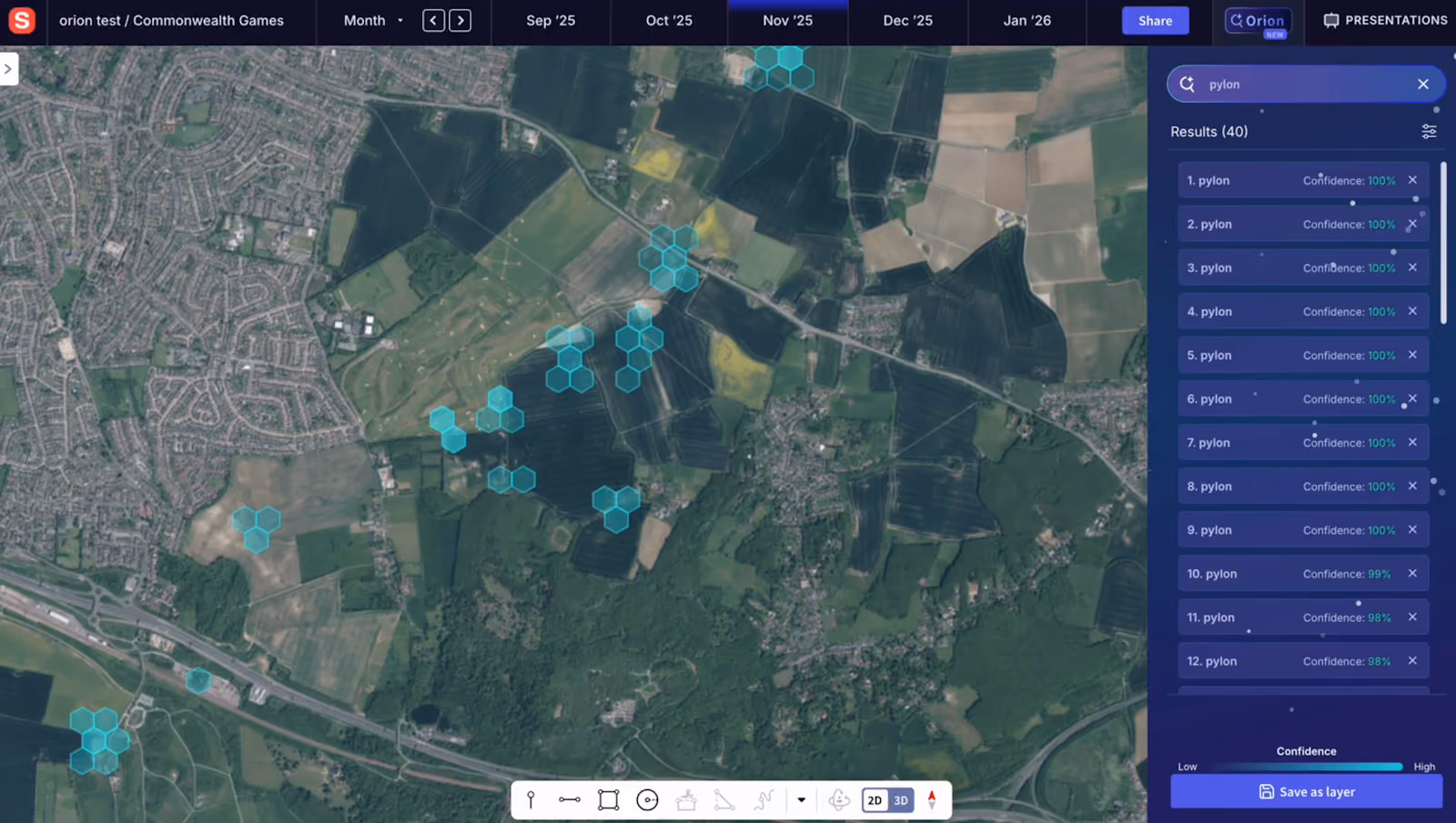
Sensat is already looking to the future with UP42, and see their partnership moving forward with a focus on deeper integration and advanced data sources. This includes exploring opportunities to leverage UP42's tasking API for even faster acquisition of brand-new data.
And last but certainly not least, there’s the Orion integration. Orion is Sensat’s flagship AI-powered visual search engine. The future integration will focus on higher resolution, multi-spectral, or even more frequent revisit data to enhance the detail and accuracy of the algorithmically-generated Digital Landscape product and allow Orion to create a searchable Earth. This continuous pursuit of best-in-class source data is vital for maintaining Sensat’s market leadership in geospatial AI.
"UP42 acts as the critical enabler that allows Sensat to decouple the complexity of Earth Observation from the customer experience."—Dr Sheikh Fakhar Khalid, Chief Scientist (CSO) & Head of Data at Sensat
Explore the UP42 platform
Create an account to order, access, and analyze geospatial data.
