From fragmented data to scalable AI models: How Whiteshield accelerates policy intelligence

Customer
Whiteshield is a global public policy advisory firm founded in 2011 and focused on AI Economics, with its first offices opened in London and Dublin. The firm was established to support governments and large institutions in solving complex strategic challenges (including GDP forecasting, trade enablement, labour policy, and many more) through advanced data science, economic modelling, and policy expertise. Since its founding, Whiteshield has expanded to cover the Middle East with offices in Dubai, Abu Dhabi, and Riyadh, as well as the EU through its AI Hub in Barcelona.
Challenge
Whiteshield builds decision systems and AI use cases for governments and private entities. High resolution geospatial data is essential for their business, with applications ranging from infrastructure monitoring to risk intelligence tools.
But Whiteshield found the entire process of dealing with this data, from sourcing it to integrating it into their solutions, to be a major challenge.
The data provider ecosystem was fragmented. Whiteshield needed many different types of data, which meant negotiating with many different providers, resulting in long procurement cycles. The data they bought was then delivered in many different formats, which made it difficult to smoothly integrate imagery into their automated pipelines. These issues resulted in long procurement times and limited scalability due to the amount of manual work needed.
And beyond technical limitations, the fragmentation limited Whiteshield’s ability to deliver timely insights to governments and institutions, where delays can directly impact policy decisions, risk assessment, and infrastructure planning. Whiteshield needed consistent global coverage through high quality geospatial data. To find that coverage, they had to turn away from individual providers.
Solution
Whiteshield began searching for a scalable platform capable of supporting API-driven AI workflows. It didn’t take long for them to come across UP42.
The UP42 platform provides a single access point to a broad range of providers, covering very high resolution multispectral imagery, SAR and elevation data, thermal intelligence, and more, from satellite and aerial sources.
Whiteshield centralized all geospatial data sourcing into a single platform, eliminating the need to manage multiple providers and contracts. They can easily browse through collections on the UP42 platform, viewing existing archive data in the catalog, as well as set up new tasking orders to capture new data. The tasking process is transparent, with price estimates presented up front.
And just as importantly, they can do all this via the UP42 API, which allows them to automate their searches and data retrieval. They can create and monitor both tasking and archive orders, manage their data, and run processing jobs with the API, meaning they can automate end-to-end data pipelines, removing manual steps and ensuring scalable AI deployment.
The accessibility of the UP42 API made it possible for Whiteshield’s data scientist team, who had no previous remote sensing experience, to deploy GIS applications to production in a matter of weeks.
Through the UP42 platform, they can access data in standardized formats, no matter the original provider, so Whiteshield doesn’t need to spend valuable time on converting and fixing files. The data is ready to be ingested into their pipelines from the moment they receive it.
“The UP42 team has been incredibly helpful from the get-go. They’ve been professional as well as a pleasure to work with: their Customer Success team and Solution Engineers have worked with us through every step of our development to make sure we’re getting the most out of the platform.” —Gianmarco Mazzocchi, Principal AI Economics Lead at Whiteshield
Result
Whiteshield has seen big changes since they started working with UP42.
They’ve built data pipelines that directly integrate satellite imagery into their workflows: once the order finishes, the data slots directly in, feeding into AI models for a multitude of different clients. This has saved Whiteshield enormous amounts of time, as they no longer need to negotiate individual contracts with different providers, or transform data. They’ve named the speed to getting operational as one of the biggest benefits of working with the UP42 platform.
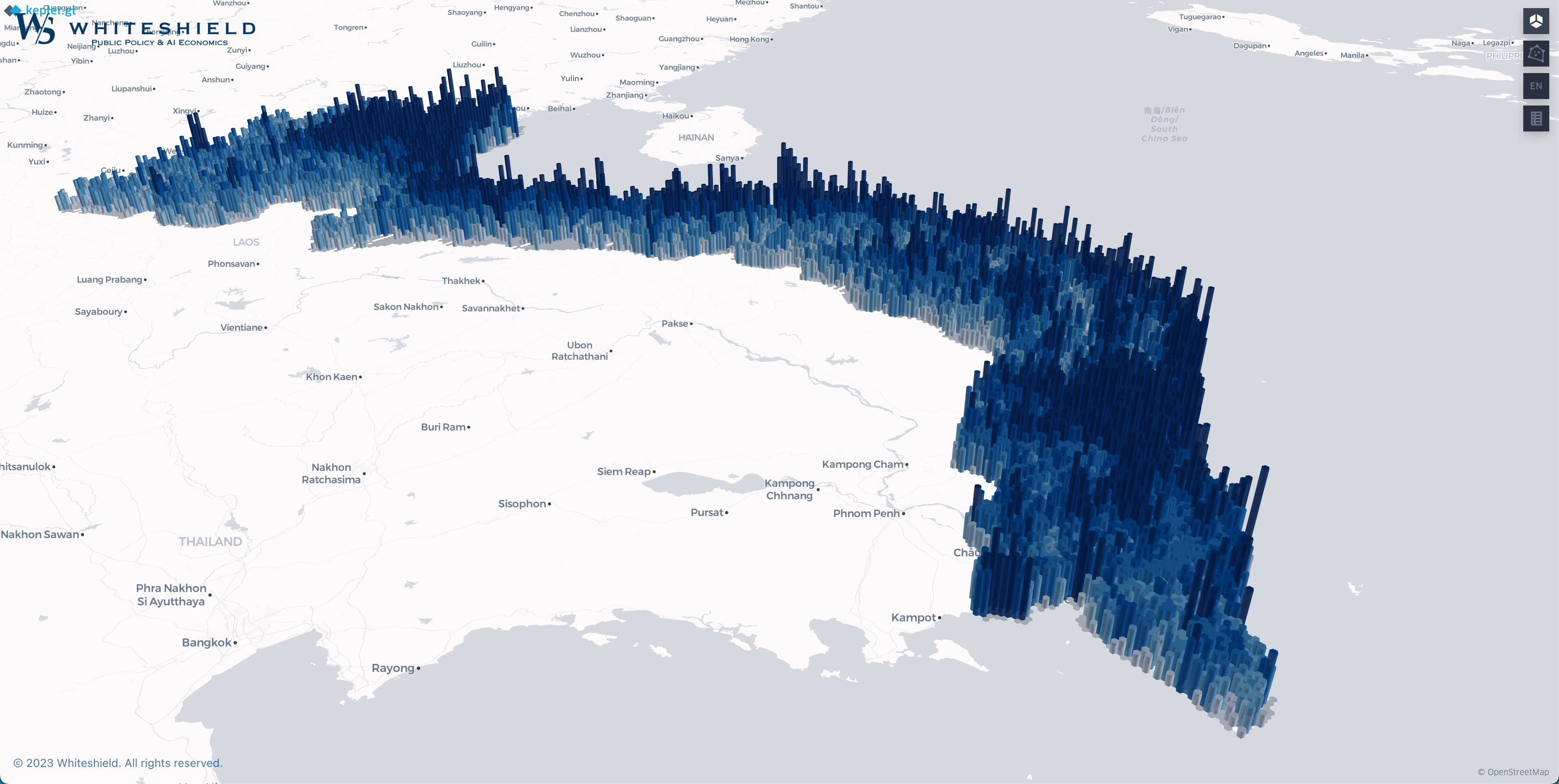
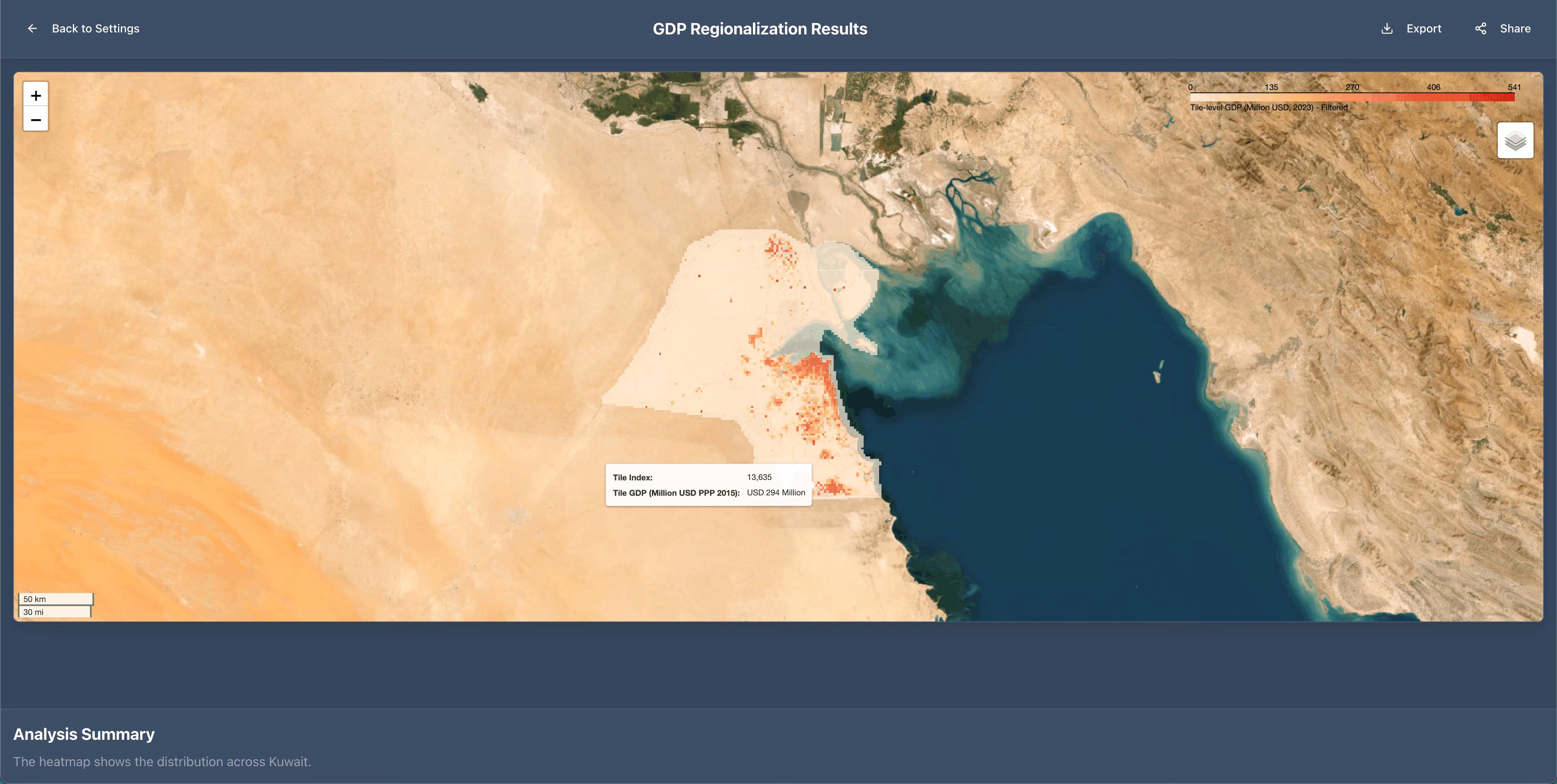
Since the beginning of 2025, Whiteshield has automated the delivery of imagery covering tens of thousands of square kilometers. This imagery is used to assess infrastructure development, land use, construction progress, and economic activity, with the outcomes feeding into regulatory dashboards and policy decision systems. Their partnership with UP42 has resulted in 10+ customized geospatial AI solutions.
The automated pipeline that Whiteshield built to check the UP42 catalog can parse through 1000+ areas of interest per hour. Doing this manually would require more than 40 hours from an experienced engineer.
Through this automation, Whiteshield has shifted their operations from manually assembling geospatial inputs to delivering continuous analysis-ready data streams, building a solid foundation for scalable decision intelligence. By accelerating how geospatial data is integrated into AI models, Whiteshield helps decision-makers act faster and with greater confidence, whether planning investments, assessing risk, or monitoring national development.
"The UP42 platform has been a major enabler of new geospatial use cases by making it possible to aggregate and query catalog imagery at scale. And their support team has been exceptional, especially on tasking, where trusted human support makes a real difference. That reliability has given us strong confidence as we continue to scale our partnership with them.”—Hugo Zlotowski, AI Innovation Lead at Whiteshield
Explore the UP42 platform
Create an account to order, access, and analyze geospatial data.
