Why analysis-ready data speeds up Earth observation workflows
Processing Earth observation data is no easy task. Doing it in-house means downloading massive files, managing local infrastructure, building custom workflows, or standardizing formats across multiple vendors.
We’re trying to make this easier. UP42 brings together data access and processing, allowing you to convert imagery into Analysis-Ready Data (ARD) and direct the outputs into your applications.
The case for pre-processing
Most people have never seen raw EO imagery, and for good reason: it’s a mess. It needs calibration, orthorectification, or spatial alignment before it can yield reliable insights. Pre-processing primary imagery into ARD fixes these issues by standardizing datasets, making them geometrically precise and radiometrically consistent.
Here are some more reasons why pre-processing is helpful.
- It reduces processing costs: Working with ARD removes the need for individual teams to align scenes independently, eliminating duplicate infrastructure costs and custom application overhead.
- ARD improves model performance: Machine learning models trained on ARD achieve significantly higher accuracy than those trained on uncorrected imagery, thanks to consistent surface reflectance values, precise spatial alignment, and reduced noise.
- It improves interoperability: By applying corrections for atmospheric noise and terrain displacement upfront, ARD can be ingested immediately into analytical workflows without the need for remote sensing expertise.
Built-in standardization and infrastructure
To help with integration across datasets and providers, the UP42 platform harmonizes all delivered assets using cloud-native, open standards. Raster data is automatically converted into Cloud Optimized GeoTIFFs (COGs), vector assets are delivered as GeoJSON files, and asset metadata is structured according to SpatioTemporal Asset Catalog (STAC) specifications for faster querying.
Beyond asset harmonization, the platform provides a processing infrastructure engineered for scalability and transparency. You can check compatibility and run algorithms across multiple scenes in parallel. Outputs are delivered directly to your data management storage, ensuring every insight can be traced back to its source scene. Outputs can also be visually verified on an interactive map before deployment to downstream analytics.
On-platform ARD algorithms
Many data providers offer various levels of processed imagery through our platform. Our ARD capabilities allow you to process data from different providers in the exact same way for further use.
Let’s take primary Earth observation data as an example. A typical sequence used to prepare primary imagery into standardized ARD includes:
Orthorectification: Removing terrain distortion
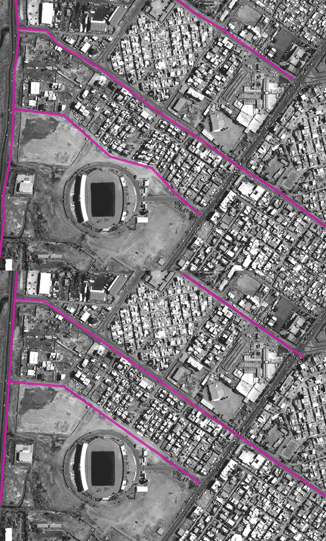
Orthorectification corrects remote sensing imagery so the physical scale is uniform across the entire scene, eliminating geometric distortions caused by topographic relief and sensor tilt. This process utilizes NEXTMap’s 1 m resolution Digital Terrain Models (DTMs) to rectify terrain displacement. By converting oblique satellite captures into more accurate map layers, teams can conduct precise distance, surface area, and asset boundary measurements without the delay or cost of manual ground-truthing.
Pansharpening: Improving the native resolution of the image
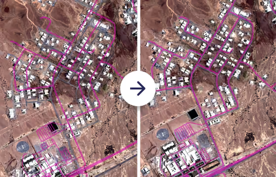
Primary optical data is often delivered as a multispectral dataset (containing Red, Green, Blue, and other spectral bands) paired with a higher-resolution panchromatic band from the same sensor. Pansharpening uses the higher-resolution single-band image to increase the spatial resolution of the color bands. This is a fast and cost-effective method. It maximizes spatial details across your assets, improving feature extraction accuracy while keeping procurement costs low.
True Color Conversion: Converting analytics data to streamable display visuals
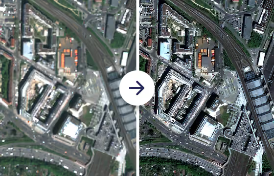
True Color Conversion (TCC) scales 16-bit analytics imagery down to an 8-bit dynamic range, making the data display-friendly for visual models. This capability generates lightweight visual assets required for human review. Beyond visualization, this step enables instant Web Map Tile Service (WMTS) streaming across GIS environments, reducing bandwidth overhead and accelerating browser-based visualization for distributed teams.
Co-registration: Achieving temporal alignment
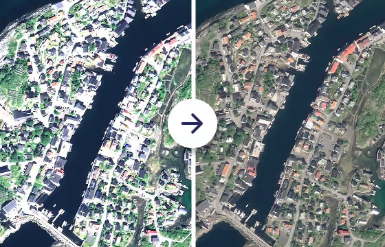
Co-registration improves the positional alignment of imagery relative to a designated spatial reference, handling clouds and seasonal land cover changes natively, even across different sensors or resolutions. It ensures that multi-provider datasets align accurately at the sub-pixel level so computer vision models can isolate true physical changes rather than pixel alignment errors.
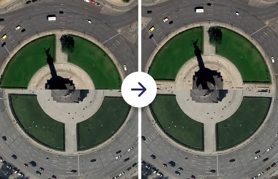
Upsampling: Using AI to further improve image sharpness
As a final step to making data analysis ready, upsampling can be run on RGB bands in Pleiades, Pleiades Neo, Vantor or Sentinel imagery. Upsampling uses a conventional neural network, which is trained to fill in gaps and improve detail, to improve image resolution by a factor of 2 to 3 depending on the input sensor.
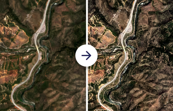
Example sequence: The raw imagery to ARD flow
To see how these capabilities operate in practice, consider a land or vegetation monitoring project using a newly acquired primary Pléiades Neo optical scene:
- Orthorectification: Terrain displacement over hilly sections is corrected to ensure accurate horizontal alignment.
- Pansharpening: Primary 1.2 m multispectral bands are fused with the 0.3 m panchromatic band, sharpening visual boundaries across the corridor.
- True Color Conversion: Imagery is converted to 8-bit COG, enabling real-time WMTS streaming to field inspection applications.
- Co-Registration: The newly processed scene is co-registered against a historical baseline grid, removing spatial offsets.
- Upsampling: Resolution across critical asset locations is increased from 30 to 10 cm to detect minor structural modifications.
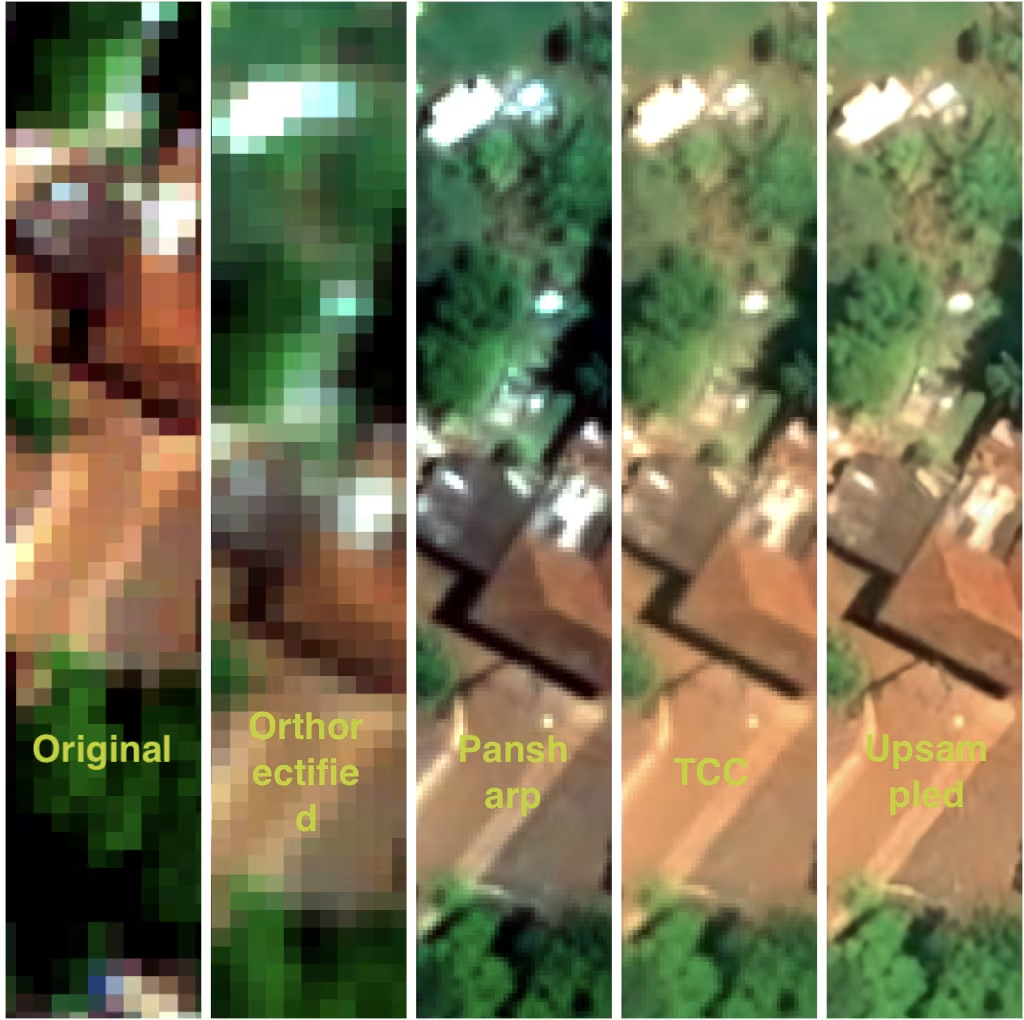
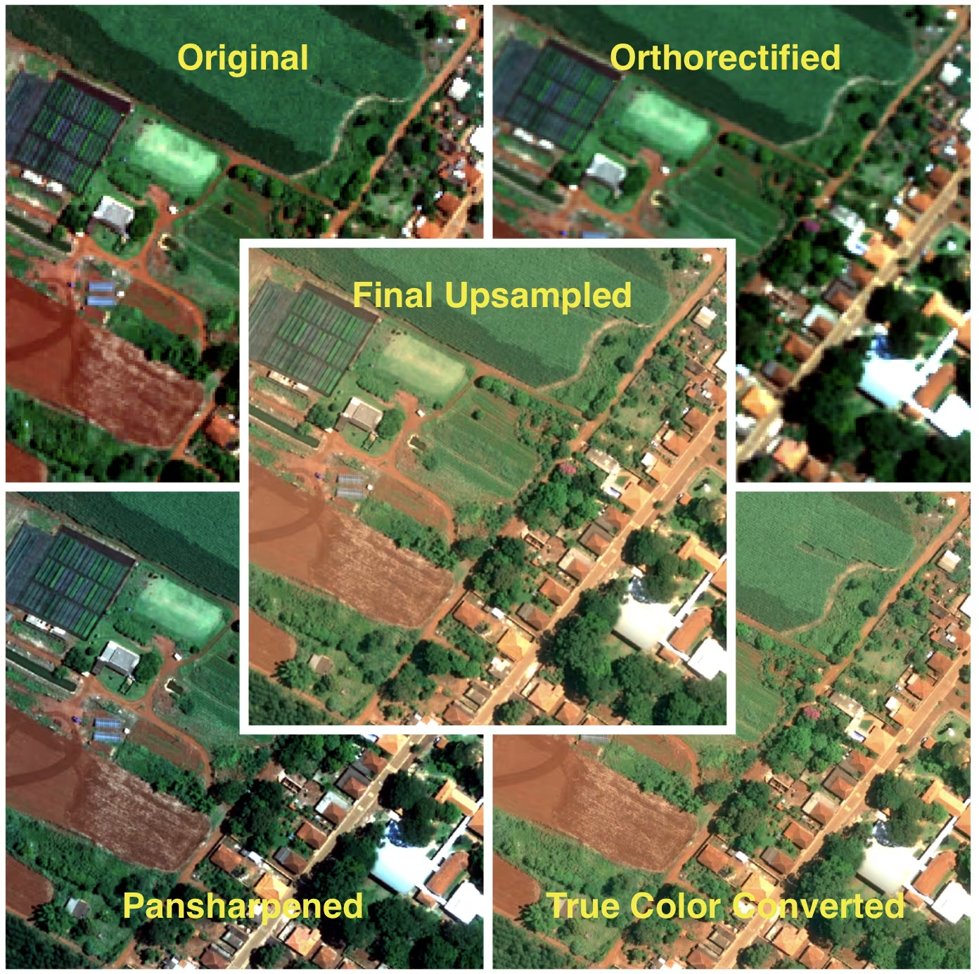
Whether you’re running multi-temporal change detection or deploying AI models, processing directly on UP42 ensures you control the processing carried out on the image, allows you to inspect and keep all intermediate products, and generates analysis-ready data for further analysis.
Scaling geospatial operations requires a flexible processing infrastructure. By combining multi-provider data access with automated ARD capabilities, the UP42 platform allows analytics teams to standardize workflows and accelerate time-to-insight.
Try processing on the UP42 platform now.

Subscribe to our newsletter
Stay up to date and learn about our fast-growing new features
