What’s new
Release notes
Keep up with the latest releases and improvements.

Bringing STAC to UP42 storage
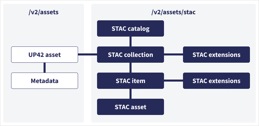
The geospatial industry has exploded over the past few years and with it, the number of image providers and data volume. SpatioTemporal Asset Catalog (STAC) is a specification designed to establish a standard in exposing geospatial data, simplifying data management for providers, developers, and users. It allows searching across multiple providers for geospatial assets which share a common structure and set of metadata. Today, UP42 is further strengthening its commitment to the STAC standard by integrating STAC in the UP42 storage and ensuring a common metadata format across providers.
We now provide a STAC API endpoint for asset searches in the UP42 storage. UP42 will extract the metadata for your geospatial assets from existing user storage and make them searchable through our STAC asset service. You can search by AOI, cloud cover, acquisition date, order ID and much more.
Read more about the STAC specification and methodology here or explore our storage capabilities.
NEXTMap® elevation data suite available on API and console
Intermap’s 3D foundation layers provide the framework necessary for precise spatial analysis and informed decisions. We are happy to share that search, estimation, and ordering of NEXTMap One, NEXTMap 6 and NEXTMap 10 data as DSM, DTM and combined DSM and DTM products are now available on the UP42 platform. NEXTMap DSM contains elevations of natural terrain features including vegetation and cultural features such as buildings and roads; while DTM provides elevations of the bare earth where surface features such as buildings, vegetation and other infrastructure have been removed.
Place your order through our console or via our API.
View feasibility study results for your order directly on the UP42 platform
Tasking now includes a Feasibility tab to show the results of your order’s feasibility study. When the feasibility study is ready, you will receive an email notification. Follow the link in the email or go to Tasking -> My orders -> Feasibility to see the study results presented as options.
Choose the option that best suits your project needs. That's it. You are now one step closer to activating your tasking order.

Check out this new feature here.
UP42 storage: now with search and filter functionality
Just two week into 2023, and we already have some exciting news to share. In line with our commitment to keep enhancing your data management capabilities, you can now search by title, order ID and name in the UP42 storage, as well as filter for collection, producer, tags and source. Filter options are currently available for API only and will be brought to the console for you soon.
WorldDEM™ Neo available on API and console
We now have elevation data on the UP42 platform. WorldDEM™ Neo offers a high-resolution digital surface model with 5 m pixel spacing and global geographic coverage. Search, estimation, and ordering of WorldDEM™ Neo data are now possible through the UP42 console and API.
Place your order through our console or via our API.
Explore the UP42 platform
Create an account to order, access, and analyze geospatial data.
