What’s new
Release notes
Keep up with the latest releases and improvements.

UP42 Marketplace with Seamless Console Integration
As a one-stop shop for geospatial data and analytics, the UP42 marketplace is a core part of the value that we offer to our customers. We have worked hard over the past year to increase the variety of data sets that you can find on the marketplace. With seamless integration built-in between our marketplace and console experience, we wanted to make it easier for you to find the data set that you are looking for.
As the first major step in this direction, we have revamped our marketplace to highlight the Spot and Pléiades data sets that you can immediately purchase within the catalog. For the following blocks on the marketplace, you will see an “Order in Catalog” CTA that lets you purchase Spot or Pléiades data for the specific AOI that you are interested in. Currently, we offer the following data sets through the catalog:
- SPOT 6/7 Display (Download)
- SPOT 6/7 Reflectance (Download)
- SPOT 6/7 Display (Streaming)
- Pléiades Display (Download)
- Pléiades Reflectance (Download)
- Pléiades Display (Streaming)
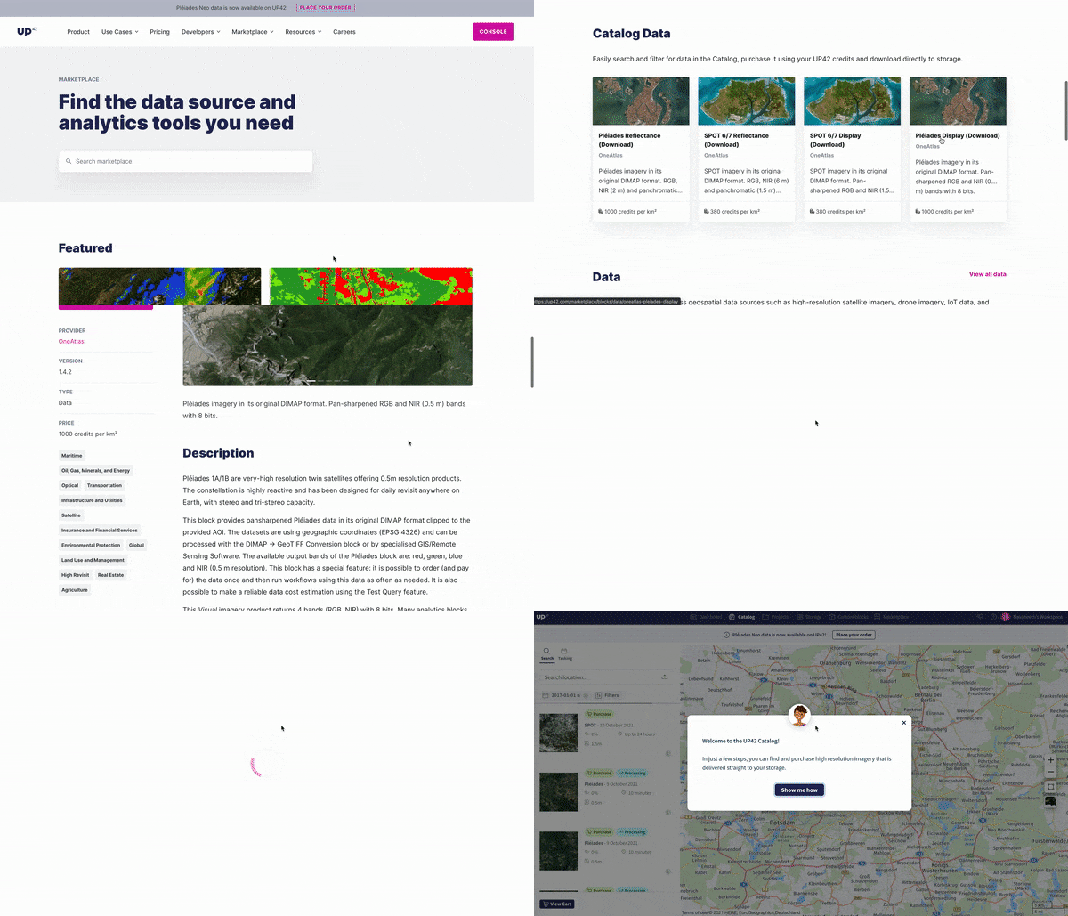
Check out the new marketplace here.
New Orders Page with Catalog and Tasking Order Information
It is important to get up-to-date information about the status of your archive and tasking data orders for planning further action. We have enriched our orders page to ensure that you can easily monitor your active and past data deliveries, with a detailed breakdown of your archive and tasking data orders.
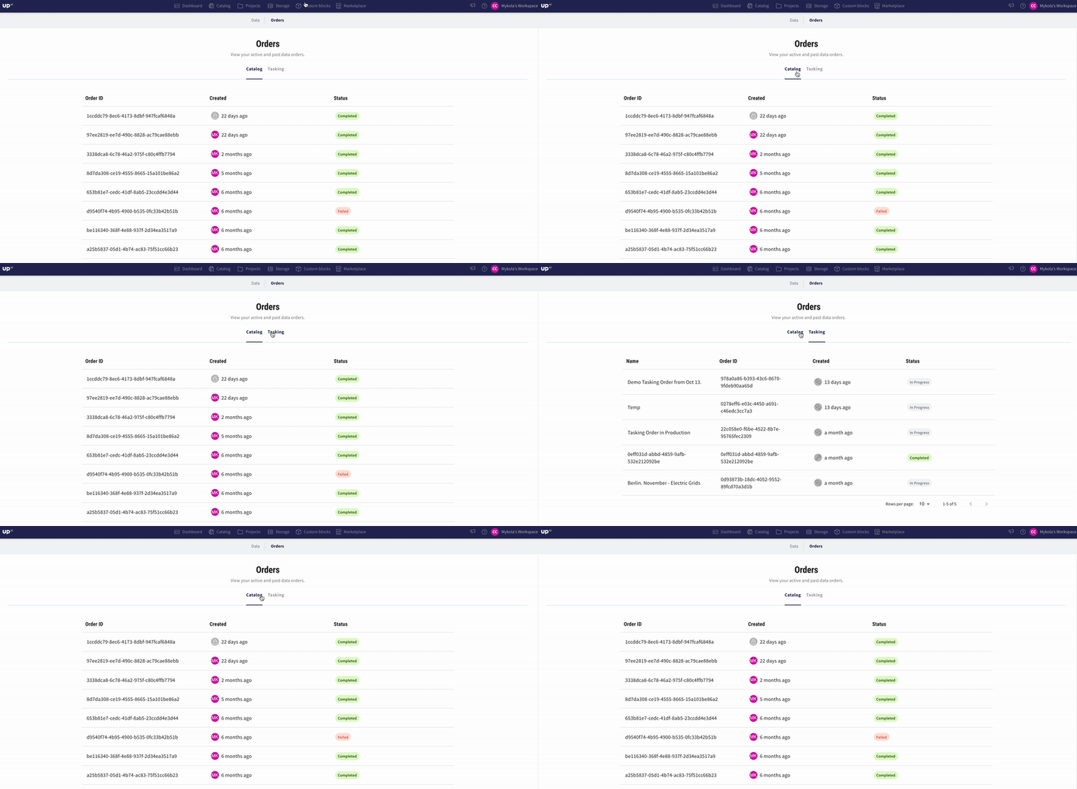
Check it out here.
Preconfigured Workflows for Speedy Set-up
We wanted to make sure that our customers could easily set up jobs on UP42 without investing a lot of upfront time and effort. With pre-configured workflows, you and your team can hit the ground running.
Preconfigured workflows let you bypass all the effort of reading product descriptions and documentation to set your parameters and ensure you have a workflow to test out that yields good results. Once you have added the images of your choice to your cart on Catalog Search, you can select any one of the prconfigured job templates to run a job in seconds. Currently, we have preconfigured workflows set up for the following use cases:
- NDVI Threshold and Vectorization Pléiades / SPOT (available)
- Infrastructure Change Detection Pléiades / SPOT (available)
- Aircraft Detection
- Car & Truck Detection
- Ship Identification
- Tree Detection and Height from Shadow
Click here to sign up and get started fast with preconfigured workflows!
Export Credit Usage
Now you can easily export a report of the credits you've consumed in account, separated by categories like data block, infrastructure, and tasked order. These credit usage reports give you structured, consolidated, and up-to-date information about your credit usage. Capturing both credit allocation entries and credit spend entries, now you are more empowered than ever to leverage UP42 for your future financial planning and decision making within your business.
A Revamped Console Experience
Working with geospatial data can often be a complex process. When we set out to democratize access to geospatial data, one of the key things that we wanted to do was to simplify the end-to-end process involved in purchasing and analyzing geospatial data.
In that regard, we took a big step forward this month. We have revamped the console dashboard experience for our customers. When you log in, now you are greeted with a 'Getting started' list that lets you immediately focus on your specific jobs to be done:
- Purchase new imagery from the catalog
- Access and manage your purchased images in storage
- Process an image by creating a workflow
In-app Guidance for Catalog Data Purchase
When managing geospatial projects, it is easy to get lost in the weeds, especially when you are working with complex AOIs sourced from multiple data sets. We are focused on making our catalog search and purchase process as intuitive as possible for our customers. Introducing an in-app tour that will serve as a smart guide through the whole satellite data purchase process on the UP42 catalog! Give it a spin today and let us know what you think.
Give it a try here.
Real-time Updates on Credit Consumption & Usage
Now, you can get up-to-date visibility into your ordering patterns and credit consumption directly from the dashboard now. This lets you make informed decisions about your data orders based on real-time insights.
Check out the new dashboard here.
Explore the UP42 platform
Create an account to order, access, and analyze geospatial data.
