What’s new
Release notes
Keep up with the latest releases and improvements.

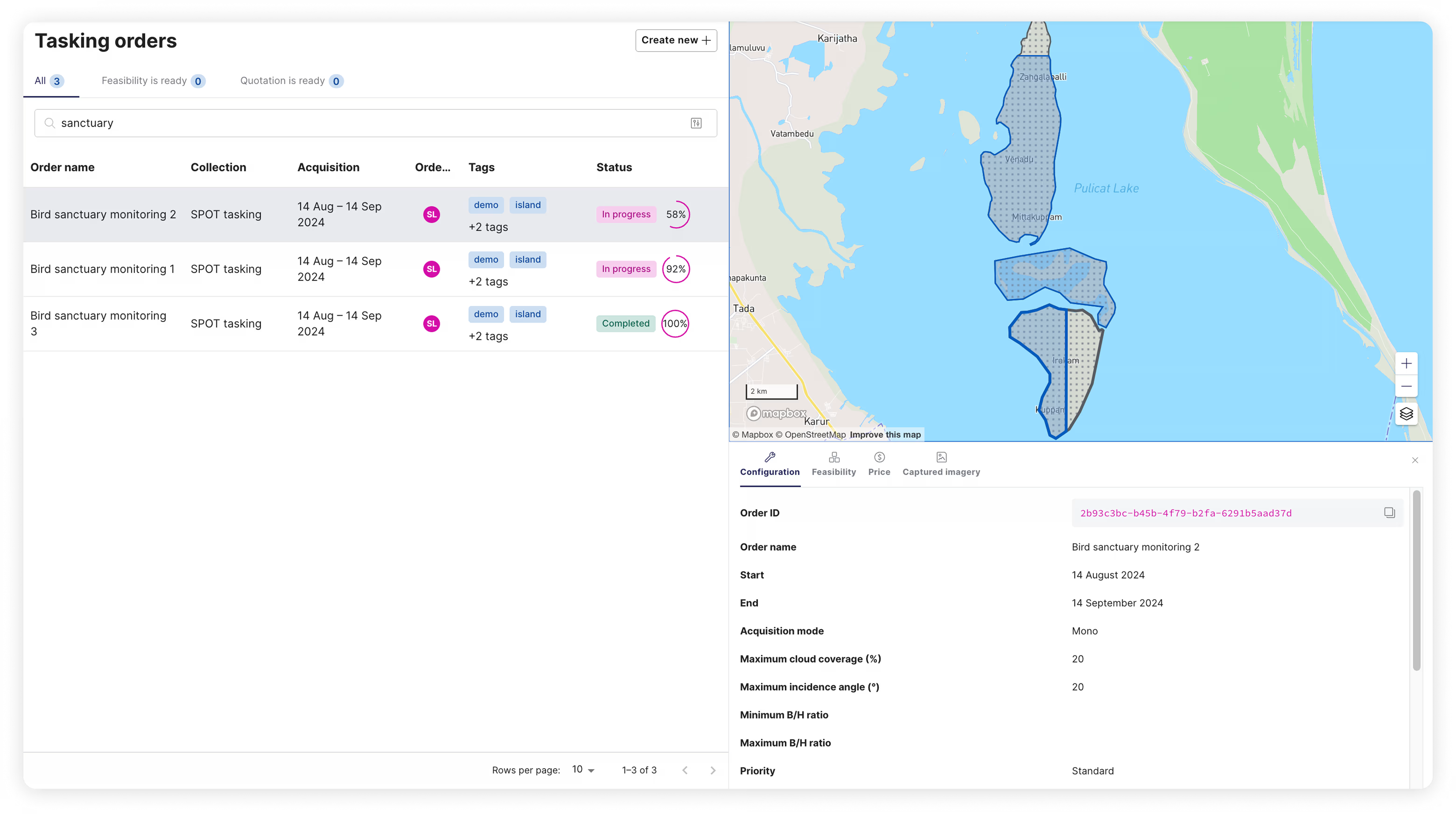
New tasking dashboard: See all your order geometries at once!
We've just released a new tasking dashboard, designed to give you a more powerful view of your projects. Here’s what it can do for you.
Display multiple AOIs and assets from your tasking orders and projects simultaneously on an interactive map. Instead of switching between individual AOIs, you'll get a consolidated map view of your entire project. Easily filter by name, status, or tags, or use the existing tabs that categorize orders by feasibility and quotation status to quickly find specific tasking orders.
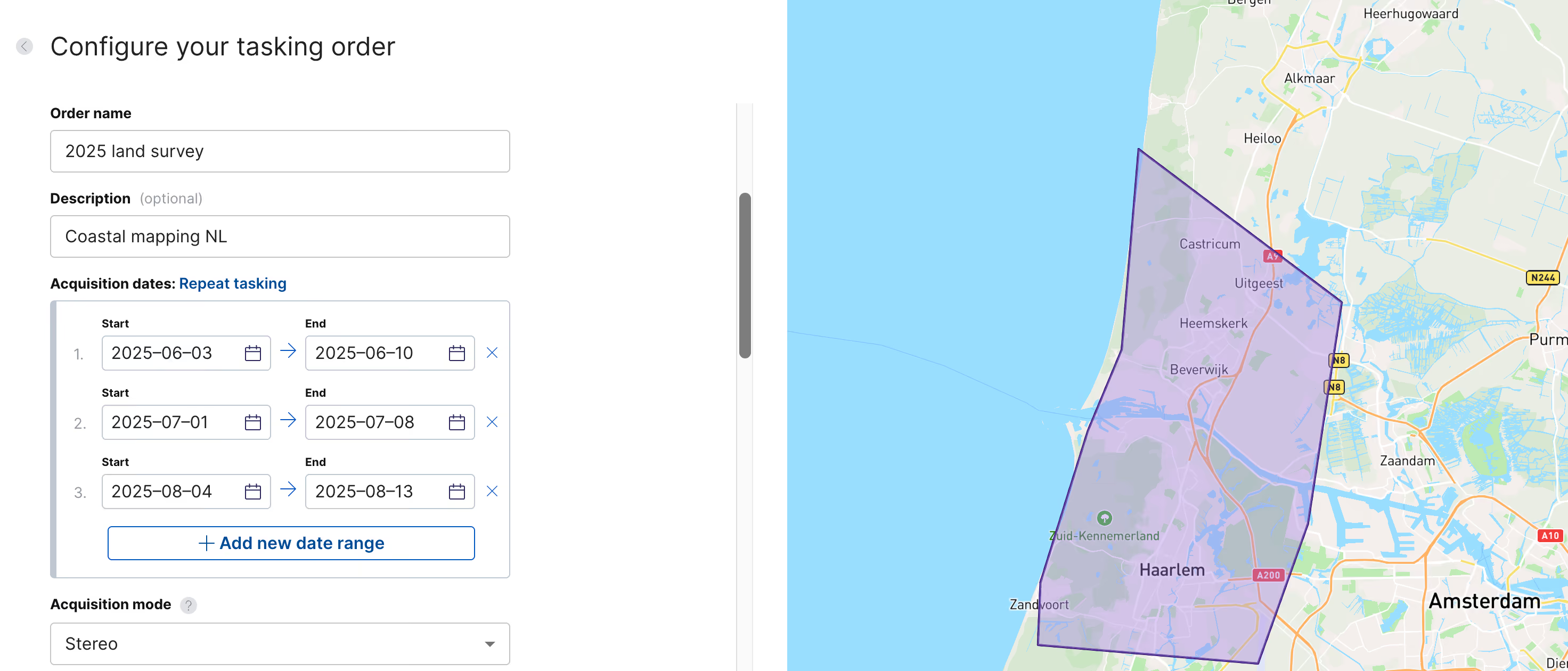
Easily schedule repeat tasking orders
Need to monitor the same AOI over multiple time periods? Now you can create repeat tasking orders in just a few clicks with UP42. After selecting the collection you need and uploading your AOI, simply choose between a one-time tasking or a repeat schedule across multiple intervals. It’s a faster, more flexible way to monitor your project AOIs over time.
Maxar’s high resolution, frequent revisit data now available for tasking on UP42
We’ve expanded UP42’s optical data portfolio with the most advanced commercial EO constellation in orbit. You can now access 30 cm and 50 cm resolution imagery from Maxar’s WorldView, WorldView Legion, and GeoEye-1 satellites. Maxar provides a wide range of spectral bands and stereo tasking options, with global coverage and up to 15 daily revisits to ensure consistent data collection.
GÖKTÜRK-1: very high resolution 50 cm imagery now available for tasking on the platform
With the integration of GÖKTÜRK-1, our platform now offers increased tasking capacity, ensuring reliable access even during peak demand for high-resolution data. GÖKTÜRK-1 captures very high resolution imagery at 50 cm resolution every 3 days anywhere on the globe. Mono, stereo, and tri-stereo acquisition modes are supported.
Task GÖKTÜRK-1 on the UP42 platform or check out our documentation for more information.
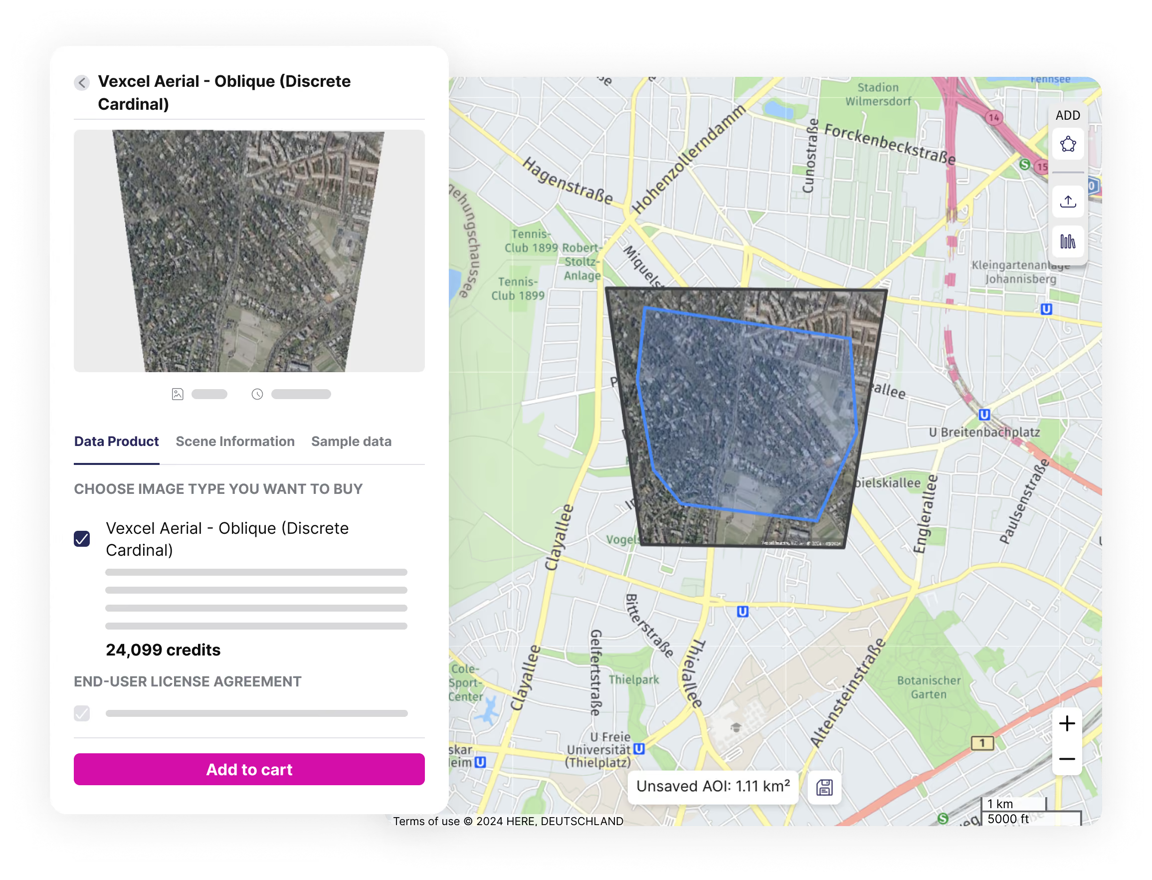
Explore new use cases with Vexcel's aerial imagery
In addition to Vexcel’s existing portfolio of very high resolution Oblique, Ortho, TrueOrtho aerial data, and elevation products, we've now integrated their discrete RGB imagery. Captured in the visible RGB spectrum, discrete imagery is minimally processed, closer to the raw data, and enriched with a more comprehensive set of metadata. This provides you with more flexibility when processing the imagery for your specific use case.
Vexcel's discrete imagery is also readily available for emergency response, as demonstrated by the availability of imagery after Hurricane Milton. Furthermore, additional metadata and image previews are now available across all Vexcel products, enabling more advanced applications like 3D reconstruction.
Explore the UP42 platform
Create an account to order, access, and analyze geospatial data.
