What’s new
Release notes
Keep up with the latest releases and improvements.

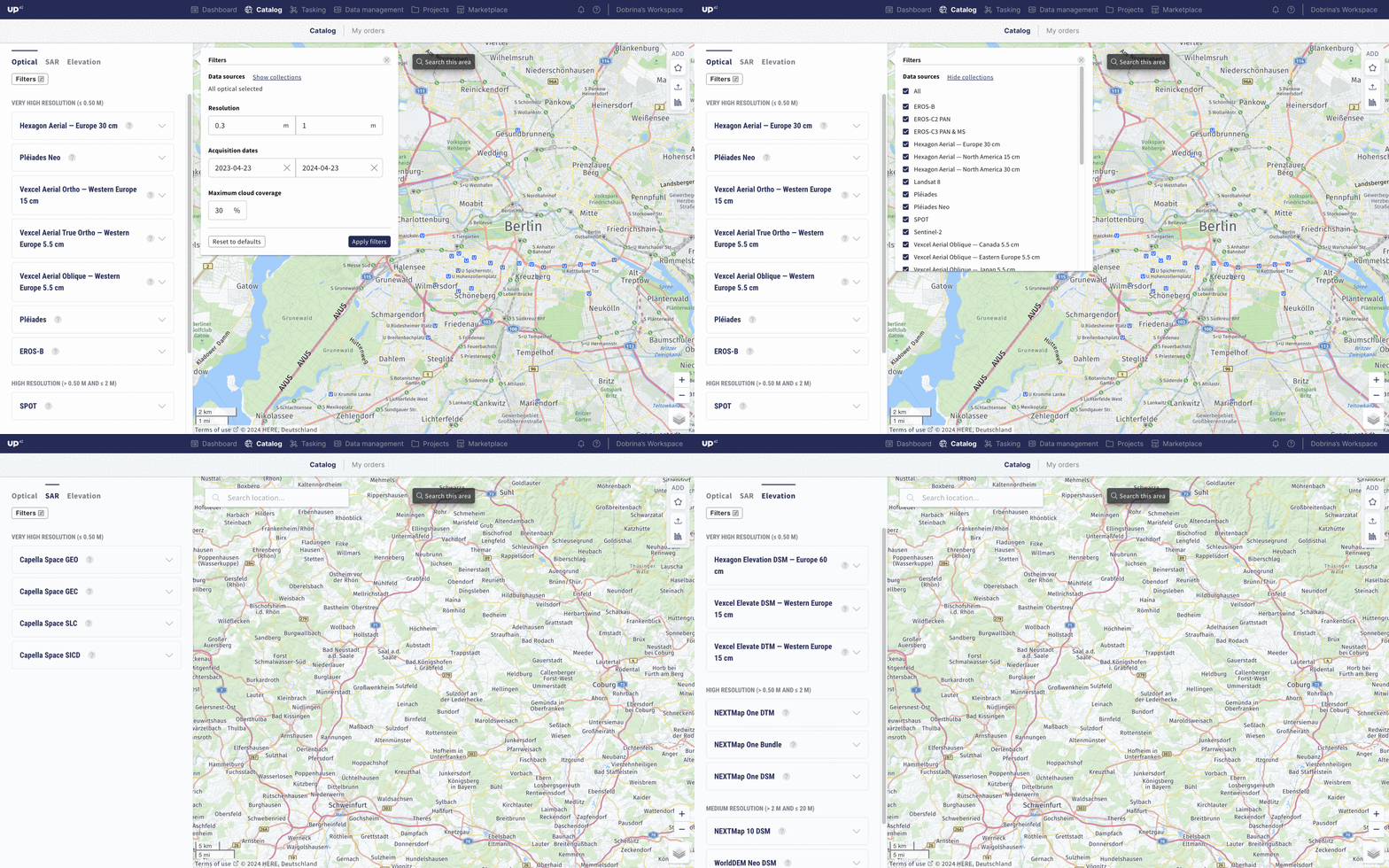
Discover our enhanced catalog experience
We are continuously improving the way you discover data in the catalog. Now, it's easier than ever for us to showcase our growing selection of collections while enabling you to effortlessly explore and order the right data for your needs.
Explore the new tabs categorizing each data type and experience our enhanced filtering capabilities.
Effortless geometry management—now in data management
We are excited to announce the seamless integration of our AOI management capabilities with data management. Save time and effort by managing your geometries directly within the catalog or data management interface.
What's new?
You can effortlessly draw or upload your AOIs, store them in your library, and make modifications such as renaming, adjusting coordinates, or generating new AOIs based on existing ones—in the catalog or data management. The convenience doesn't stop there! If you have AOIs stored in the catalog, you can easily access and utilize them within the data management interface. The shared library ensures consistency across the platform. Plus, when switching between tabs, your AOIs will remain on the page, no need to recreate them from scratch.


Go ahead and try our streamlined AOI management.
Hexagon Elevation DSM and EROS-C3 archive data from ISI now available on console and API
Our archive data offering keeps growing!
- Hexagon DSM offers very high resolution 30 cm and high resolution 60 cm digital surface models, acquired over North America and Europe. The collections contain data from 2014 to 2023.
- EROS-C3 offers very high resolution 30 cm optical satellite imagery, acquired worldwide with a daily revisit rate. Catalog datasets are available starting from 2021.
Expanding UP42's processing capabilities with algorithms from Orbital Insight, Spacept, and Airbus Agrimetrics
As promised, we are re-introducing more processing algorithms to our platform. Get insights from your data in a more scalable way with:
Orbital Insight
Spacept
Airbus Agrimetrics
Recap—the benefits of our new processing platform
- We leverage STAC as an input and output for our processing engine
- See compatibility and price estimate immediately in the process
- Use the algorithms with as many compatible scenes as you want
- Process deliveries and access the output in your data management
- Easily trace your workflow from order to processed output
How can I process my data?
- In the console, go to data management, and in the map section, select the scenes you want to process
- The selected scenes are automatically validated before processing—no actions for you
- If a scene is not suitable for processing, we will tell you why and give you the option to remove it from the selection
- Run your selected processing algorithms on as many scenes as you want and track the status in the Jobs table
Alternatively, you can create a new processing job using the UP42 API.
Track the order coverage of your tasking orders
After you place a tasking order, it’s essential that you get a clearer idea of the status of your order. The new order coverage feature gives you the % of order that is already completed, and lets you download the remaining and covered AOI as KML files.
While placing complex tasking orders, you now get a more precise visual representation of the status of your order. As the assets are delivered for your order, you get a complete picture of the tasking order progress and the remaining areas that are still pending. This allows for better and faster internal decision-making while dealing with complex orders. You can also leverage the downloaded KML files as a starting point for new archive and tasking orders, saving time and ensuring accurate project planning and reporting.
Explore the UP42 platform
Create an account to order, access, and analyze geospatial data.
