About Bluesky and the role of women in the geospatial industry
UP42 is excited to welcome Bluesky International as a partner. We sat down with Rachel Tidmarsh, Bluesky’s Chief Executive Officer, to talk about the company and their solutions, as well as the role of women in the geospatial industry.

UP42: Hi Rachel, we are thrilled about our partnership with Bluesky International. Can you tell us more about the company and its roots?
Rachel: Bluesky International (Bluesky) was founded in 2003, during the transition period from analogue to digital aerial survey cameras. I was one of three founding partners, having previously sold and bought back a small aerial survey company I had co-founded in 1996 and from there, our growth journey began.
Today, I am the only founding partner remaining and I am pleased to say we continue to be a growing and thriving business, having acquired a small aerial survey company in the US, established a production facility in India and become a leading aerial survey company in the Republic of Ireland. Our head office is currently based in the Leicestershire town of Ashby de la Zouch.
UP42: You have an impressive portfolio of aerial imagery, elevation data, as well as bespoke solutions and services at Bluesky. Can you give us more information about your products and their unique applications?
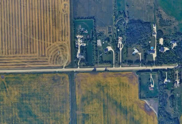
Rachel: Our core product range consists of national 12.5 cm resolution aerial imagery, which in some urban areas can also be provided at 5 cm resolution. In addition, we also produce national Digital Surface Models and Digital Terrain Models from the aerial imagery. These products are all provided free at the point of use to all UK public sector organisations via an umbrella contract with the UK Government Cabinet Office. Outside of this contract, our products are licensed to private organisations in sectors such as utilities, insurance, engineering and environment for applications such as planning, asset management, line of sight analysis and logistics.
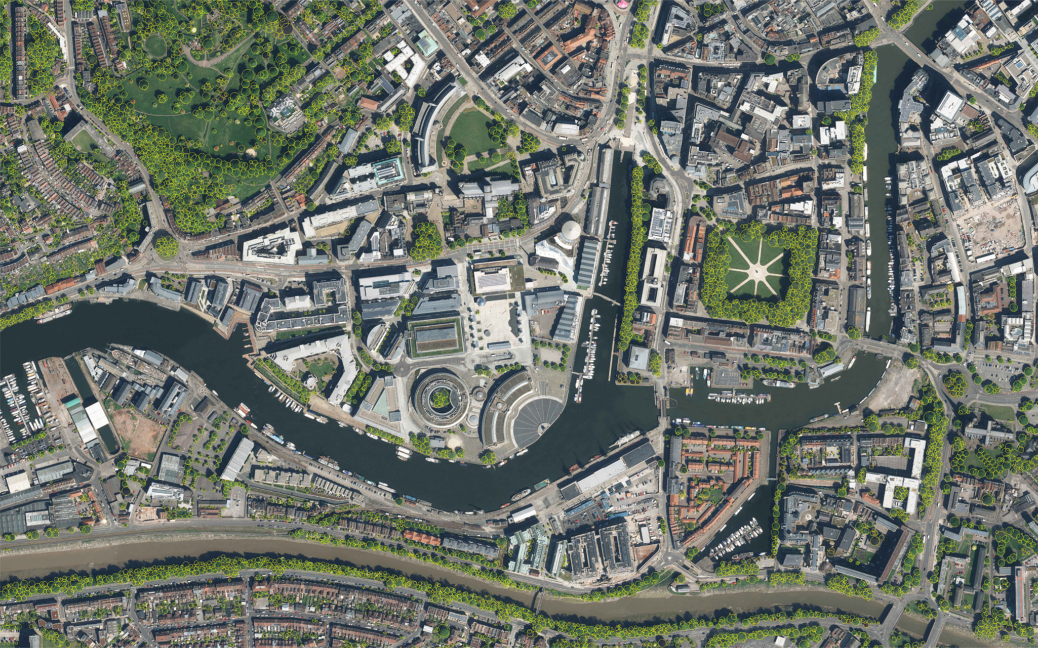
We have also created our unique National Tree Map (NTM) which is derived from the above datasets, using algorithms that have been applied to extract the height, location and canopy information of trees 3 m and taller in Great Britain and the Republic of Ireland. No other detailed tree mapping dataset covers this extensive area. Since its launch nearly 12 years ago, it is proving increasingly valuable as a tool to support climate change and environmental projects, as well as land and forestry management schemes, planning and development and the insurance sector for subsidence risk. The NTM and our other datasets are all updated via our three-year rolling update programme.
Our newest product range is MetroVista, which includes mesh models and oblique imagery. With the advent of digital and smart cities we are seeing a growing interest in MetroVista, as the mesh models we provide form the perfect baseline geometry for any smart city or digital twin application.
In terms of further applications, I have already mentioned climate change. This is becoming of increasing importance because learning and understanding the changes in our environment will be one of the keys to helping us manage the impact it will have, and help us understand how we can tackle it. Geospatial datasets are a valuable tool in supporting this work and providing the information that is needed to ensure informed decision making at policy level.
UP42: You launched Bluesky International almost 20 years ago now. Can you share more details about your personal journey, as well as your current role?
Rachel: I graduated with a BCs Hons in GIS from Kingston University and through my education I had an increasing passion and interest in geography and was keen to apply this and what I had learnt into my work. My first role was at The National Remote Sensing Centre (now Airbus) as a Project Manager where I gained an insight into the world of aerial survey and satellite data. The department I worked within focused on the education sector and after a year in the team we conducted a management buyout of the department and formed a company called Wildgoose. We sold Wildgoose in 2000 to a plc only to buy it back again in 2003, which was when we formed Bluesky International.
Given I had only been in employment for a year post university at the time of the management buyout, it was a baptism of fire, and I learnt a lot about running a business at an early age. It was very much sink or swim! So far, I haven’t drowned although there’s certainly been some challenges along the way, including recessions and COVID. There has been so much technological change within the industry during this time and, as a small business, we have had to keep up to date and continually reinvest in new technology. However, I think this has paid off for us as it has helped ensure Bluesky remains at the forefront of our industry.
My role as CEO at Bluesky continues to challenge me every day and is a constant learning curve. There is still so much I want to achieve with the business! I am lucky to be supported by a fabulous team who are as committed and passionate as I am about growing Bluesky and providing exceptional products and customer service.
UP42: In your opinion, what are the biggest challenges women in geospatial are facing today and how can we create more opportunities for them?
Rachel: One of the biggest challenges is that it is a particularly male-dominated industry and, therefore, there is a lack of female role models and mentors for women to be inspired by or to talk to. There are obviously plenty of opportunities for women and the next generation within our industry, but we need to do a better job of spreading the word and showcasing what these opportunities and roles are. Having visible role models and women that can provide mentoring support would definitely help.
I am a board member of EAASI (European Association of Aerial Survey Industries) and we are trying to promote careers opportunities within the industry to young people, as well as to under-represented groups, including women. At last year’s EAASI annual summit there were only five women out of a total of 70 attendees which demonstrates the need to attract more women, so that we can have a more diversified industry. Was I aware at school or even to a degree at university, about the potential roles available within our industry? The answer is no.
Ultimately, it boils down to awareness and all the businesses and organisations in the sector have a role to play in this. Generally, people know very little if anything at all about this industry and the associated careers that are on offer. As a result, at Bluesky we are looking at ways we can increase awareness via schools and universities in the local area to our head office. We have some great female role models at Bluesky in a wide range of capacities, including Airborne Operations Manager, photogrammetrists, GIS specialists as well as accountants and sales and marketing personnel. They would all be keen to talk to young people and women about the opportunities available to them in the industry. This is something we are currently putting in place to try to inspire women and the next generation to join our industry.
UP42: Based on your experience, what advice would you give to women just starting out in this field?
Rachel: My advice would be to get yourself out there! There are numerous industry events, conferences and exhibitions you can attend to meet the companies and their teams in the industry. Be proactive and approach them, ask for placements or even volunteer for work experience. We recently had a young female graduate approach us at a conference and we were able to offer her a 6-month placement. You can hear about her story here. Attending exhibitions and conferences will enable you to build your network and learn about the different companies and the services they offer. It is also important to keep up to date with geospatial news and technologies so, subscribe to online newsletters and publications! There is so much changing and new advancements in the industry, and it is important to keep abreast of what is happening.
UP42: What value do you see in partnering with us? How do you think companies like UP42 will influence the future of geospatial technology?
Rachel: I see one of the key values for Bluesky partnering with UP42 is the global exposure it will provide for our products. UP42 has created a one-stop-shop for global customers beyond Bluesky’s traditional marketplace and industries. UP42 has developed a platform which makes it easy to apply analytics to geospatial datasets which offers customers much-needed solutions as well as the data itself which is where we see immense value. A solutions-based service maximises the value of our data products which is great for Bluesky and UP42 customers. We are extremely pleased to be working with them and look forward to a successful partnership.
Check out Bluesky's products on the UP42 marketplace.
Subscribe to our newsletter
Stay up to date and learn about our fast-growing new features
