Aerial imagery explained: Top sources and what you need to know
Editor's note: this article was originally published by Nikita Marwaha Kraetzig on September 20th 2020. It was revised and updated by Kevin Enright on November 6th 2025.
Aerial imagery is one of the earliest forms of remote sensing. With origins in 1858, thanks to French balloonist Gaspard-Félix Tournachon, it's evolved from kites to stratospheric balloons, drones, and planes.
Today, it remains one of the most widely used and cost-effective methods of remote sensing.
If you’re looking for aerial imagery and need a refresher on what it is and where you can find it, you’ve come to the right place.
What is aerial imagery?
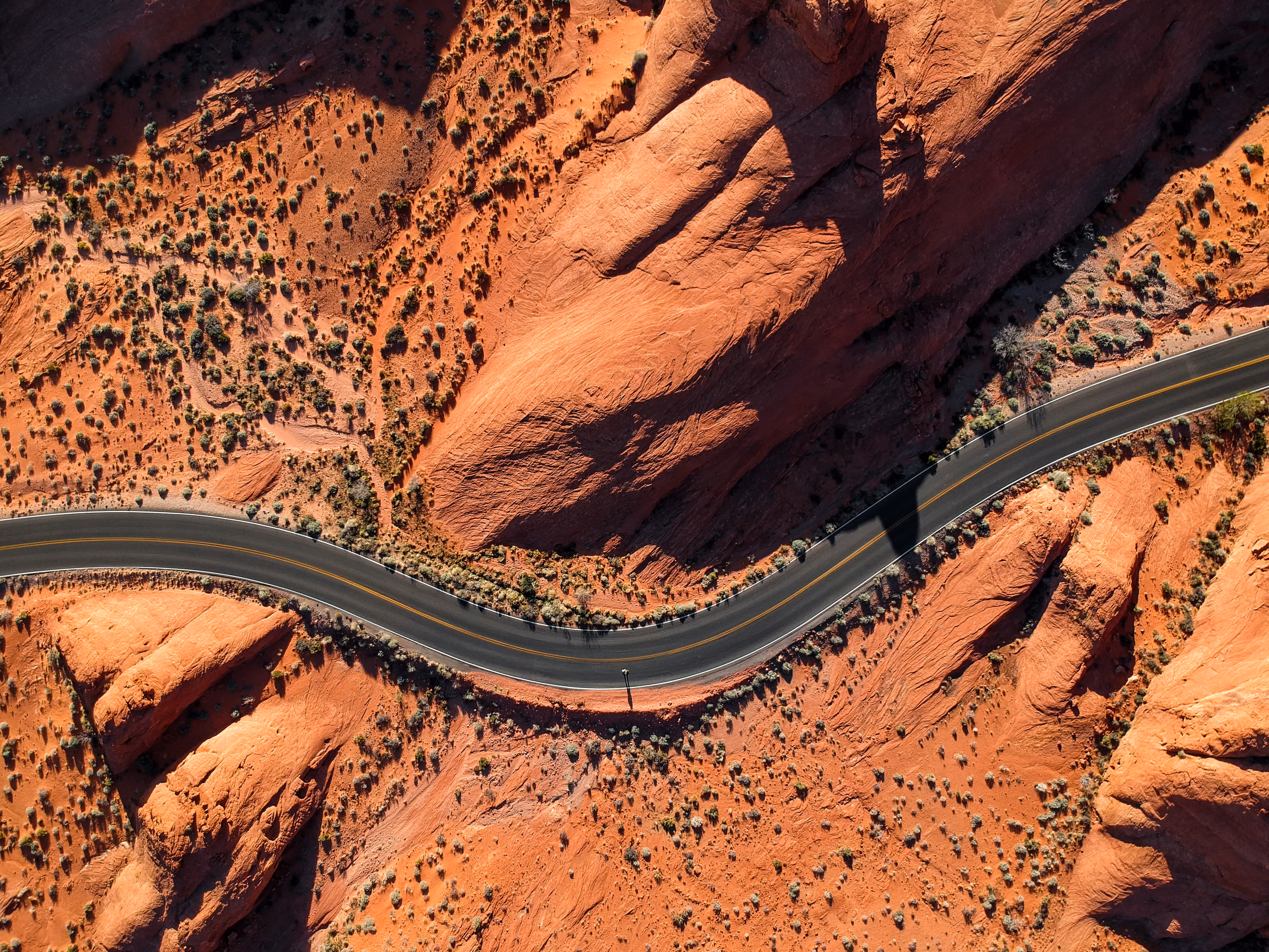
The term aerial imagery refers to all types of imagery taken from an airborne craft which can include drones, balloons, or airplanes.
How does aerial imagery compare to satellite imagery?
Aerial and satellite data complement each other in terms of what they offer.
Satellites provide high temporal resolutions, often with regular revisits over the same area of the globe. On the other hand, aerial imagery offers incredible spatial resolution—up to 1-5 cm per pixel.
The field of view covered in an aerial photograph is much smaller compared to satellite images. Satellites orbit the Earth and can capture much wider swaths from their higher vantage points.
Due to these differences, the kinds of projects that you can use aerial and satellite imagery for vary depending on what you’re looking to do.
For example, satellite images have greater large-scale applications thanks to their high temporal resolution, while aerial photography is great for more localized applications that make the most of their high spatial resolution.
This complementary relationship between the two makes both aerial and satellite data powerful sources of useful geospatial information.
What are the different types of aerial imagery?
Aerial photography is classified into three different types according to the camera axis, scale of the image, and the type of sensor used:
Vertical aerial photographs
The camera axis is in a vertical position in vertical aerial photos. Most often used in mapping, there is no tilt in the camera and a smaller amount of area is imaged.
Low oblique aerial photographs
Low oblique images capture an area at an angle, usually no more than 3°. The horizon is not visible in low oblique photographs.
High oblique aerial
With high oblique photographs, the camera axis has a higher degree of tilt. The camera angle is intentionally inclined at around 60° from the vertical axis. In high oblique aerial photos, the horizon is visible and a larger area of land can be photographed.
What kind of aerial photograph should you use?
It depends on the purpose. Oblique aerial imagery is helpful to reveal topographic details of the land—useful for geological or archelological investigations. Low and high oblique imagery is often used in reconnaissance surveys. Oblique can also be used for 3D models.
Users often combine images of the same area from two or more different directions and use analysis techniques that yield 3D models. These images are called stereoscopic images’—’tri-stereo’ for three directions, or ‘stereo-image pairs’ for two directions.
On the other hand, vertical photographs are better for mapping and most object detection use cases.
Types of aerial imagery based on scale
Aerial photographs can also be classified on the basis of scale. The scale of an aerial image is the ratio of the distance in the photo, compared to the corresponding distance on the ground.
If the scale of an aerial image is known (and it should be), then the lengths and areas of features can easily be calculated. This is done by measuring the distance on the photo (photo distance) and multiplying this by the scale factor—which is always equal to the ratio of the photo distance to the ground distance.
Aerial imagery scales determine what area of land is covered by the photograph and in how much detail.
There are three main types of aerial photographs based on scale:
Large scale aerial photographs
When the scale of an aerial photograph is 1:15,000 or larger, it is a large scale photograph. These photos are taken at lower elevations and (despite the name) less of an area is captured—but seen in a bigger dimension. That’s why low elevation aerial imagery is known as large scale imagery, making it more useful for measuring objects and mapping features.
Medium scale aerial photographs
Aerial imagery with a scale ranging between 1:15,000 and 1: 30,000 is usually referred to as medium scale photographs.
Small scale aerial photographs
This kind of aerial imagery has a scale that is smaller than 1:30,000. Small scale imagery covers larger areas, in less detail. It's ideal for studying relatively large areas with features that you’re not looking to measure or map in great detail.
Types of aerial imagery based on sensor
There are many categories that aerial photographs belong to, depending on the type of sensor used. They vary in properties and can be used in a variety of ways:
Black and white panchromatic imagery
Black and white panchromatic sensors record the amount of light reflected by objects in varying tones of grey between black and white.This is useful for photogrammetry, as well as pan-sharpening when capturing higher resolutions at faster speeds.
Natural color imagery
This type of aerial photography replicates colors as seen by the human eye, and is a great base layer for land planning and creating soil maps. Color photography is also helpful to map vegetation or other tasks that benefit from color separation.
Infrared or thermal imagery
Infrared sensors are sensitive to infrared waves, in the spectral region of 0.4 micrometers to 0.9 micrometers. Available in black and white, color, and thermal—infrared is useful for taking photographs at night if there is a source of infrared radiation, as well as studying bodies or water or vegetation.
Radar imagery
Radar remote sensing captures reflected radar waves by sending out pulses of microwave electromagnetic radiation from an ‘active’ sensor. Radar photographs often contain noise and require corrections. Radar imagery is ideal for weather analysis, 3D analysis, and terrain monitoring.
Sources of aerial imagery
Now that we’ve covered what aerial photography is, how can you purchase aerial imagery?
We have plenty of providers on the UP42 platform, including:
Vexcel
Vexcel provides very high resolution optical and elevation aerial data (5.5 cm) over Canada, Europe, Oceania, and the United States. They're known for having one of the world's largest aerial imagery programs.
Vexcel's archive data on the UP42 platform contains data from 2012 to the present. Check out our documentation for more information.
Vexcel was founded in Austria in 1992. Their global headquarters is located in Boulder, Colorado.
Hexagon
Hexagon is another behemoth in the aerial data space. They offer 15 to 30 cm resolution optical imagery over North America, and 30 cm imagery over Europe.
The UP42 platform provides access to archive data from Hexagon, spanning from 2014 to 2023. You can find out more information here. Hexagon is headquartered in Stockholm, Sweden.
Getmapping
Founded in the UK in 1999, Getmapping provides optical aerial imagery over the United Kingdom in up to 5 cm resolution.
Getmapping's archive aerial imagery on the UP42 platform ranges from 1999 to the present. See all the technical details in our documentation here.
Globhe
Globhe offers drone imagery in very high resolution up to 1 cm, captured worldwide. Through UP42, they're available for both archive data and new tasking orders. Globhe offers a wide range of data types, including optical, elevation, and LiDAR.
Our documentation page contains some free sample data for users to test out.
Globhe is headquartered in Stockholm, Sweden.
Bluesky
Bluesky offers 10 cm optical imagery captured over the United Kingdom. Their archive data is available through UP42. You can also request tasking orders in the console.
Check out our documentation page for all the technical details.
Applications of aerial imagery
Aerial imagery is an indispensable tool for topographical mapping and the interpretation of places, objects, and features. One of its major advantages is its ability to integrate as a base layer into GIS, CAD, and other applications to work with it at scale.
Here are some examples of how companies around the world use aerial imagery.
Aerial for disaster management
When disaster strikes, it is crucial for relief workers, community leaders, and stakeholders to gain an understanding of what has changed and how.
With aerial imagery, especially using drones, this situational awareness can be the difference between life and death.
Drones are estimated to save one life a week. In late 2015 in India, up to 200 people were rescued from severe flooding as a result of drone use—which helped to narrow the search grid for rescue teams to tailor their search for survivors.
Aerial for precision agriculture
Agritech is a growing industry, as farmers across the world use remote sensing data to make informed decisions, maximize crop yields, and reduce waste.
Aerial imagery in multiple wavelengths allows growers to plan scouting, management, and interventions.
Using multispectral sensors and normalized difference vegetation index (NDVI), plant health can be determined and as a result, addressed.
For more information on NDVI and how to use it, here are 5 Things to Know About NDVI.
Aerial for asset monitoring
Traditional methods of asset inspection require time-consuming and expensive logistics. The use of aerial imagery has enabled accessible remote asset monitoring.
From public utilities to private facilities, high-resolution aerial imagery optimizes infrastructure management, while closely monitoring assets over time.
This way, maintaining equipment and infrastructure can be done proactively and preemptively. As a result, saving resources in the long run.
Aerial for habitat protection
Aerial imagery provides dynamic information on global environmental indicators related to habitat loss and climate change.
Ideal for zooming in on regional areas, aerial photographs of land allow us to better identify and mitigate changes over time.
For example, as temperatures continue to rise, many species of fish such as salmonids in Alaska (below) struggle to survive. Being able to identify areas within a stream which are persistently colder than surrounding areas, will be critical to their survival.
Scientists have begun mapping these cold water habitats. This is valuable to protect and restore critical fish habitats and direct monitoring efforts as warming waters continue.
Thermal infrared imagery provides us with another perspective, beyond what the eye can see. Combined with ground-truthing data, aerial imagery applied in this way provides us with the perspective we need to gain, in order to solve the biggest problems of our time.
Summary
Aerial imagery refers to all imagery taken from airborne craft. It is categorized according to camera axis, scale, and sensor.
While satellite images have greater large-scale scientific applications, aerial photography has greater small-scale commercial applications.
There are many aerial imagery providers that capture their own aerial imagery, or distribute on behalf of others in their database.
The remote sensing method collects vital information that can be used for land use, agricultural management, forestry, conservation, urban planning and more.
Capturing the world from above is useful for both regional analysis, as well as zooming in on specific areas. Aerial photographs are snapshots in time, providing us with historical perspectives on how landscapes used to be and how they look today.
Using aerial imagery, we're able to explore connections between elements of landscapes that can be difficult to perceive from the ground. Flying closer to the ground than satellites, aerial imagery provides us with a detailed and high-resolution view from above—revealing otherwise unseen features.
Key takeaways
- Aerial imagery is any image taken from an airborne platform, most commonly drones and planes. It's classified in three main ways: by camera axis (vertical, low oblique, high oblique), by scale (large, medium, small), and by the sensor used (e.g., natural color, infrared, radar).
- Aerial and satellite imagery work well together: while satellite imagery provides high temporal resolution (frequent revisits) for large-scale monitoring, aerial imagery offers better spatial resolution (up to 1 cm) for more detailed applications.
- Aerial imagery's higher resoution makes it invaluable for many use cases, including disaster management, precision agriculture, asset monitoring, and habitat protection.
- One key use of aerial data is as a detailed base layer in GIS, CAD, and other software. It provides a unique bird's eye view that reveals features and patterns on the ground that are difficult to see otherwise.


Subscribe to our newsletter
Stay up to date and learn about our fast-growing new features
