


The first half of the year has seen an exponential increase in integrations and features. Users can discover and order archive data from more providers than ever before, and tasking orders can be managed end-to-end and automated where possible, independent of the provider.
And that just scratches the surface. To make it even easier to work with all this data, we've adopted the SpatioTemporal Asset Catalog (STAC) specification to ensure a common asset structure and metadata format. We're now preparing for the next wave of value-added data management capabilities in the UP42 ecosystem.
New data, better discoverability, and sample data
- Vexcel: Ultra high resolution aerial imagery, along with DTMs and DSMs (starting from 5.5 cm resolution).
- Sentinel-2: Open data with a spatial resolution of 10 m to 60 m, global coverage, and a 5-day revisit rate.
- Intermap: NEXTMap® elevation data suite available as a DSM, DTM, and combined DSM and DTM products. Access 1 m, 6 m, and 10 m collections.
- Hexagon: Aerial data offering a large library of optical imagery with 15 cm and 30 cm GSD in GeoTIFF across North America and Europe.
- WorldDEM Neo: High resolution digital surface models with 5 m pixel spacing and global coverage.
Search, estimation, ordering, and delivery of the above datasets are available via the UP42 console, SDK, and API.
With so many new integrations, the UP42 catalog had to adapt to allow for discoverability across all our products. Enjoy a new sidebar view, and data grouping by collections and resolution!
You can now also find sample data for popular collections on the platform, with more providers coming soon. Use the data to understand the capabilities before committing credits to your specific AOI and use case.
See what's new in the catalog.
Cross-sensor tasking and multiple AOI support
Our tasking platform lets you bypass the complexities of tasking multiple providers. Now you can place orders, accept the feasibility study and pricing, and download imagery, all through one single set of interfaces via the console, or the API and the SDK.
You can also place tasking orders containing multiple geometries through the console. When you upload a geometry file that contains multiple features, the individual geometries will be detected, split, and marked as separate items. The order configuration will be cloned for all orders, saving you the hassle of placing multiple orders for different geometries.
With these capabilities and the ability to place orders in advance, we're seeing customer tasking orders completed weeks ahead of schedule (side note: the weather was on their side too 🙂).
Centralized data management with UP42 storage

We now provide a STAC API endpoint for data searches in storage, ensuring one set of common metadata across providers and enabling a strong foundation for downstream integrations, visualization, and more. You can now:
- Customize data in storage with custom titles and tags for improved project alignment, search for a specific asset property, or create a consolidated view of your assets through sort and filter operations
- Display assets details including metadata and geospatial attributes
- See the asset geometries of all scenes on a map or view multi-scene deliveries like stereo, tri-stereo, tiled, and temporal data
- Integrate assets by using the adapted SDK/ API code snippet
- Manage data ordered on an individual account or wider workspace level
Flexible credit purchases
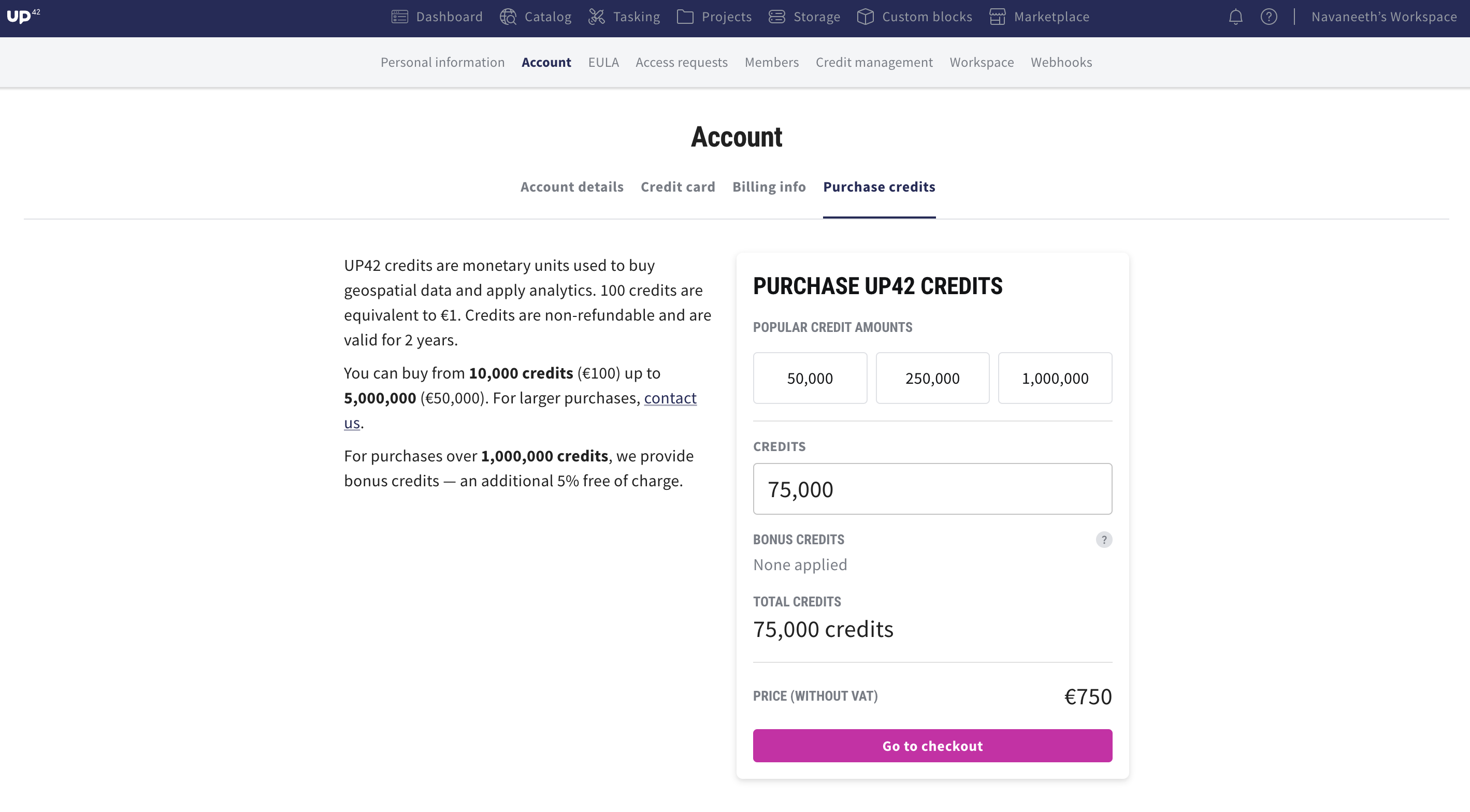
In addition to selecting pre-set credit packages, you can now order a specific number of credits based on your business needs. The whole transaction can be completed within the console with a credit card, reducing the time spent on multiple email and invoice exchanges. By paying with credit card, customers outside the eurozone can avoid the need for international bank transfers to settle their payments.
Thank you for reading! We are committed to making geospatial data more accessible than ever before. Stay tuned for upcoming features and enhancements that will further improve the way you access and manage data on the UP42 platform.


