Satellogic Earth Observation Data Directly Available via UP42 API
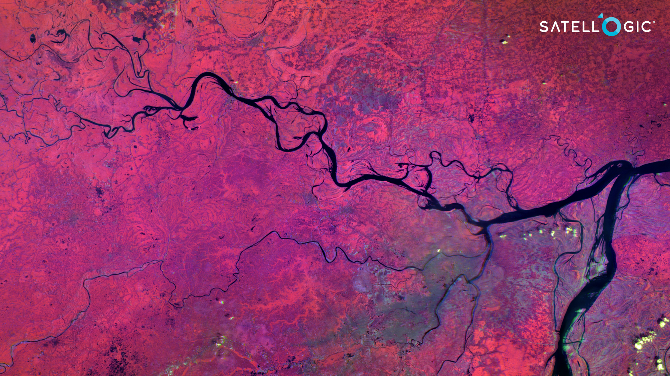
New York, NY – May 11, 2022 – Satellogic Inc. (NASDAQ: SATL), a leader in sub-meter resolution Earth Observation (“EO”) data collection, announced today that it has entered into an agreement with UP42, a geospatial developer platform and marketplace enabling direct access to Satellogic’s satellite tasking high-resolution multispectral and wide-area hyperspectral imagery via the UP42 API-based platform. The agreement includes the archive of high-frequency, high-resolution Satellogic data.
The companies made the announcement today at the Geospatial World Forum in Amsterdam, Netherlands, where UP42 CEO Sean Wiid and Satellogic Business Development & Sales Director Eldridge de Melo are featured speakers.
“This exciting new collaboration gives UP42 customers a distinct advantage in rapidly creating geospatial solutions,” said UP42’s CEO Sean Wiid. "Users can now derive insights from Satellogic data using algorithms and data fusion via our developer-first platform.”
Direct API access to Satellogic’s multi- and hyperspectral-data – with intraday updates – supports rapid, timely and frequent monitoring of critical assets in diverse sectors, such as energy, utilities, local government, and security. The UP42 platform’s REST API and Python SDKs can be fully customized, allowing UP42 users to build cost-effective solutions and quickly deliver end products to their clients.
“Our mission of democratizing access to critical Earth Observation data means making our data available where it’s convenient for end users,” said Thomas VanMatre, VP of Global Business Development at Satellogic. “UP42 is a leading geospatial marketplace with value-added capabilities, enabling its customers to access and analyze data without extensive expertise. It is collaborations like this alliance with UP42 that will increase adoption of EO data across new markets, driving better decision making and outcomes.”
The growing Satellogic constellation currently consists of 22 operational small satellites, capable of acquiring 4-band (RGB NIR) multispectral data at 70 cm (1m native) spatial resolution over a 5km swath and up to 29-band (460-830nm) hyperspectral imagery at 25m resolution over a 125km swath.
During pre-processing, Satellogic imagery is optimized for analysis by Machine Learning (“ML”) and Artificial Intelligence (“AI”) applications – a significant benefit for UP42 users who will have access to more than 75 ML/AI algorithms on the UP42 platform.
UP42 users will be able to apply Satellogic data sets and extracted knowledge to support projects in a range of applications spanning the public and private sectors, including Agriculture and Forestry, Energy and Sustainability, Critical Infrastructure Management, Finance and Insurance, Environment and Climate, and Government.
Graphics: https://drive.google.com/drive/folders/1h1muyYvox_Yb9MvLCCsgnLVpKvoNpbIU?usp=sharing
About Satellogic
Founded in 2010 by Emiliano Kargieman and Gerardo Richarte, Satellogic (NASDAQ: SATL) is the first vertically integrated geospatial company, driving real outcomes with planetary-scale insights. Satellogic is creating and continuously enhancing the first scalable, fully automated EO platform with the ability to remap the entire planet at both high-frequency and high-resolution, providing accessible and affordable solutions for customers.
Satellogic’s mission is to democratize access to geospatial data through its information platform of high-resolution images and analytics to help solve the world’s most pressing problems including climate change, energy supply, and food security. Using its patented Earth imaging technology, Satellogic unlocks the power of EO to deliver high-quality, planetary insights at the lowest cost in the industry.
With more than a decade of experience in space, Satellogic has proven technology and a strong track record of delivering satellites to orbit and high-resolution data to customers at the right price point.
To learn more, please visit: http://www.satellogic.com
About UP42
UP42 is changing the way geospatial data is accessed and analyzed. The platform and marketplace bring together multiple sources of data such as satellite imagery, weather data, and more—together with algorithms to identify objects, detect change, and find patterns. Industry leaders use UP42 to inform business decisions and build scalable customer solutions. Know when and where to fertilize crops. Measure air quality and map emissions. Count cars, trucks, planes, and ships. Developers and data scientists across all industries now have access to a platform to build, run, and scale projects in one place. Visit www.up42.com.
Forward-Looking Statements
This press release contains “forward-looking statements” within the meaning of the U.S. federal securities laws. The words “anticipate”, “believe”, “continue”, “could”, “estimate”, “expect”, “intends”, “may”, “might”, “plan”, “possible”, “potential”, “predict”, “project”, “should”, “would” and similar expressions may identify forward-looking statements, but the absence of these words does not mean that a statement is not forward-looking. These forward-looking statements are based on Satellogic’s current expectations and beliefs concerning future developments and their potential effects on Satellogic and include statements concerning Satellogic’s strategies, Satellogic’s future opportunities, and the commercial and governmental applications for Satellogic’s technology. Forward-looking statements are predictions, projections and other statements about future events that are based on current expectations and assumptions and, as a result, are subject to risks and uncertainties. These statements are based on various assumptions, whether or not identified in this press release. These forward-looking statements are provided for illustrative purposes only and are not intended to serve as, and must not be relied on by, an investor as, a guarantee, an assurance, a prediction or a definitive statement of fact or probability. Actual events and circumstances are difficult or impossible to predict and will differ from assumptions. Many actual events and circumstances are beyond the control of Satellogic. Many factors could cause actual future events to differ materially from the forward-looking statements in this press release, including but not limited to: (i) Satellogic’s ability to scale its constellation, (ii) Satellogic’s ability to continue to meet image quality expectations, to continue to enhance the capability of its network of satellites and to continue to offer superior unit economics, (iii) Satellogic’s ability to become or remain an industry leader, (iv) the number of commercial applications for Satellogic’s products and services, (v) Satellogic’s ability to address all commercial applications for satellite imagery, changes in the competitive and highly regulated industries in which Satellogic operates, variations in operating performance across competitors and changes in laws and regulations affecting Satellogic’s business, (vi) the ability to implement business plans, forecasts and other expectations, and to identify and realize additional opportunities, (vii) the risk of downturns in the commercial launch services, satellite and spacecraft industry, (viii) the risk that Satellogic and its current and future collaborators are unable to successfully develop and commercialize Satellogic’s products or services, or experience significant delays in doing so, (ix) the risk that third-party suppliers and manufacturers are not able to fully and timely meet their obligations, (x) the risk of product liability or regulatory lawsuits or proceedings relating to Satellogic’s products and services, and (xi) the risk that Satellogic is unable to secure or protect its intellectual property. The foregoing list of factors is not exhaustive. You should carefully consider the foregoing factors and the other risks and uncertainties described in the “Risk Factors” section of Satellogic’s Annual Report on Form 20-F and other documents filed or to be filed by Satellogic from time to time with the Securities and Exchange Commission. These filings identify and address other important risks and uncertainties that could cause actual events and results to differ materially from those contained in the forward-looking statements. Forward-looking statements speak only as of the date they are made. Readers are cautioned not to put undue reliance on forward-looking statements, and Satellogic assumes no obligation and does not intend to update or revise these forward-looking statements, whether as a result of new information, future events, or otherwise. Satellogic can give no assurance that it will achieve its expectations.
Contacts
Investor Relations:
MZ Group
Chris Tyson/Larry Holub
(949) 491-8235
Media Relations:
Satellogic
UP42 Viviana Laperchia Senior PR and Communications Manager [email protected]


