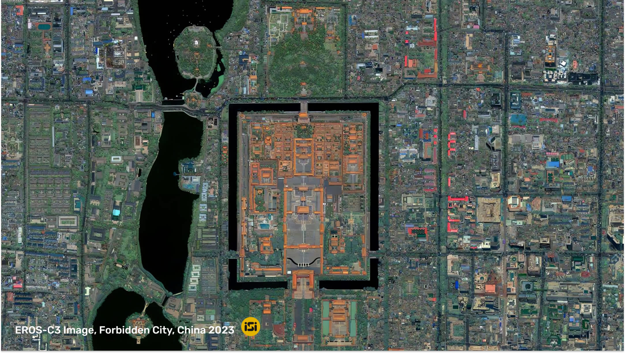
From disaster response to environmental monitoring, operators in essential sectors will have direct access to high-resolution optical imagery.
BERLIN, September 5, 2023 -- UP42, a leading geospatial developer platform and marketplace, is teaming up with ImageSat International (TASE:ISI), a world leader in space-based intelligence solutions, to offer operators in essential sectors worldwide direct access to ISI's EROS NG™ satellite constellation, providing 30 cm resolution optical imagery products, through UP42.
Easier and quicker access to the constellation's imagery enables organizations to make more informed decisions by monitoring and analyzing specific areas of interest, and tracking changes over time. This will be particularly beneficial for companies operating in urban mapping, environmental monitoring, agriculture, natural resource management, infrastructure development, telecommunications, and disaster response.
A pioneer in space-based intelligence solutions, and as part of the EROS NG™ constellation, ImageSat International 4 Earth Observation satellites in orbit (EROS-B and EROS-C1/C2/C3) will be directly accessible through the UP42 platform and marketplace.
"Sustainable communities, resilient infrastructures, and food security, among other UN's Sustainable Development Goals, are paramount to our life on Earth beyond 2030," said Sean Wiid, CEO at UP42. "Our partnership with ImageSat International enables any customer worldwide to take these challenges head-on and meet their complex operational needs in a timely manner."
UP42's marketplace currently hosts more than 150 geospatial data and analytics from over 70 leading providers across the globe. ImageSat International's products will consist of the following:
-
Optical satellites with a spatial resolution of 30 cm
-
Broad area coverage capabilities
-
High revisit rate
-
Diverse imaging time
"Thanks to our collaboration with UP42, a wide user community can now tap into the remarkable EROS NG™ constellation we offer. This enables them to take advantage of our exceptional features, including very high-resolution and broad area coverage imaging capabilities throughout various times of day, and frequent revisits," said Noam Segal, CEO at ISI.
For more information on how to request access to ImageSat International's high-resolution optical data, please visit https://up42.com/marketplace/data/tasking/imagesat-erosc-tasking.
For all media enquiries, please contact:
Viviana Laperchia
Senior PR and Communications Manager, UP42
Suf Barzam
Corporate Marketing Manager, ISI
About UP42
We founded UP42 in 2019 with a clear purpose: to provide quick and easy access to geospatial data and analytics. You'll get the world's leading providers of optical, radar, elevation, and aerial data, all in one place. Our developer-first platform offers flexible APIs and a Python SDK to help you build and scale your solutions. Search the catalog for existing imagery, or task a satellite to capture your desired area. Whatever your use case, UP42 is the one-stop-shop for all your geospatial data needs. Visit us at up42.com.
About ImageSat International
ImageSat International (ISI), is Israel's largest space company, providing its international customers with imagery intelligence based on earth observation satellites from the EROS NG™ constellation and New Space satellites that it has developed. The solutions provided by the company combine very high-resolution observation satellites and a variety of sensors, command and control systems as well as analytics systems and AI-based civilian applications for processing satellite images and other intelligence products. Learn more at https://www.imagesatintl.com.


