A new mapping experience, emissions tracking data, and more

"In a world where geospatial data reigns supreme, every AOI matters, and every polygon tells a story." – Daniel Scarpim, a Senior Frontend Engineer at UP42
Why start with this quote? Because it captures the essence of what’s new at UP42. We've enhanced our platform to provide a more visually dynamic mapping experience, making it easier than ever to navigate geospatial data. With a brand-new basemap, richer colors, improved search, zooming, visualization, and many other cool functionalities, UP42 empowers you to explore and interact with data effortlessly.
🚀 Watch the video below to see UP42’s new mapping experience in action!
More data and more detail
GÖKTÜRK-1’s very high resolution 50 cm imagery is now available for tasking on the platform, offering increased tasking capacity, and ensuring reliable access even during peak demand for high resolution data. GÖKTÜRK-1 captures imagery at 50 cm resolution every 3 days, anywhere on the globe. Mono, stereo, and tri-stereo acquisition modes are supported.
We also welcomed our newest partner, GHGSAT. Their emissions tracking data is available for both archive and tasking. GHGSAT’s fleet can pinpoint emissions down to individual factories and facilities, making them an efficient alternative to ground-based surveying methods.
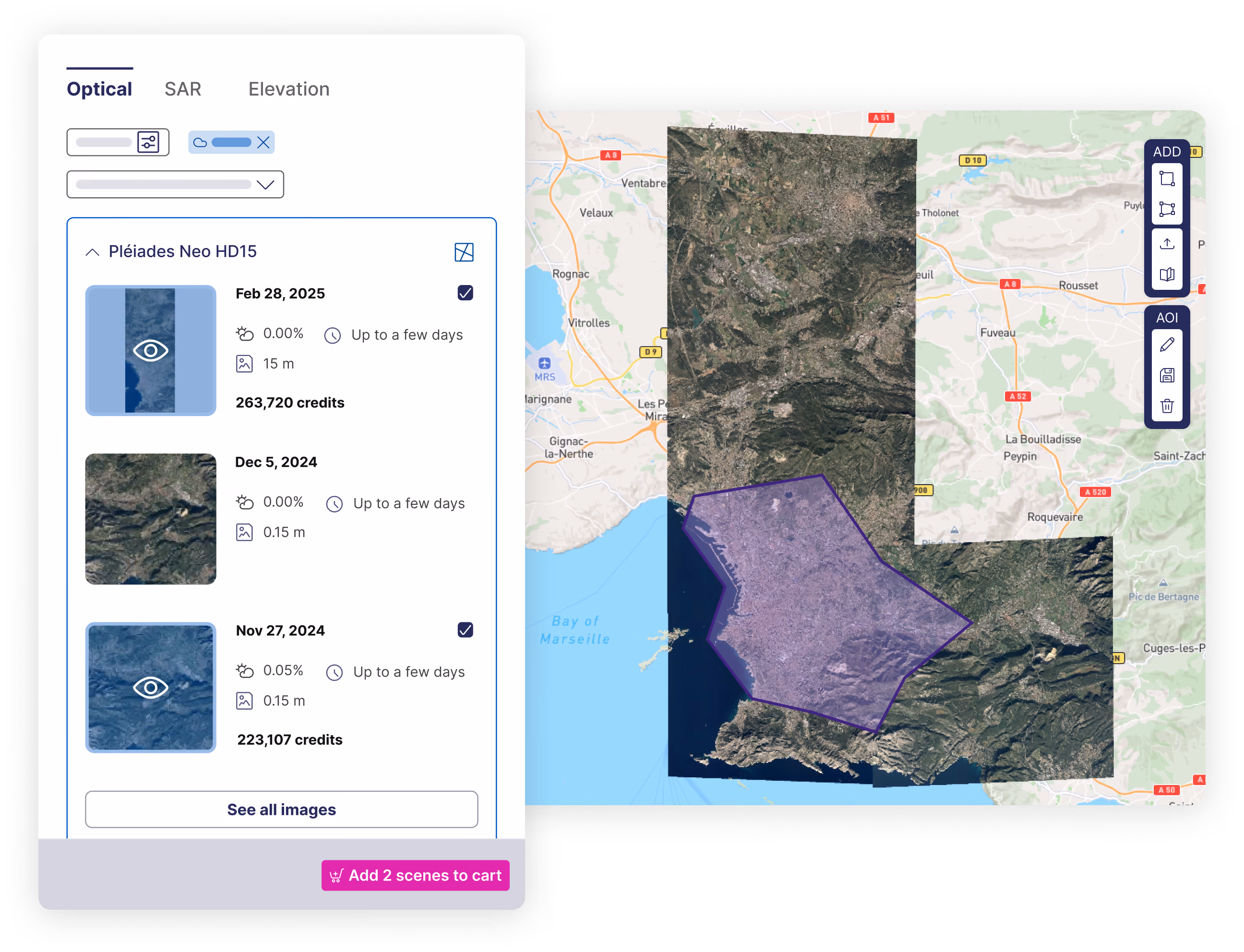
Order multiple archive scenes with ease
In the catalog, you can now select multiple scenes at once, choose a data product for selected scenes simultaneously, and see which scenes are already in the cart—all without losing map previews.
Check tasking feasibility for multiple AOIs at once
You can now get a list of feasibility study options for multiple AOIs by calling the “Get feasibility studies for tasking orders” API endpoint. The provided options will show if feasibility is required for all, some, or none.
Find your existing geospatial data faster
We’ve also made several enhancements to our data management functionalities, so you can now:
- Search your entire UP42 storage and visually inspect imagery simultaneously
- Find all your assets for a specific area on the map and get detailed image information (e.g., incidence angle, cloud coverage)
- Further narrow down your search by applying filters like acquisition date, order, asset id, and more
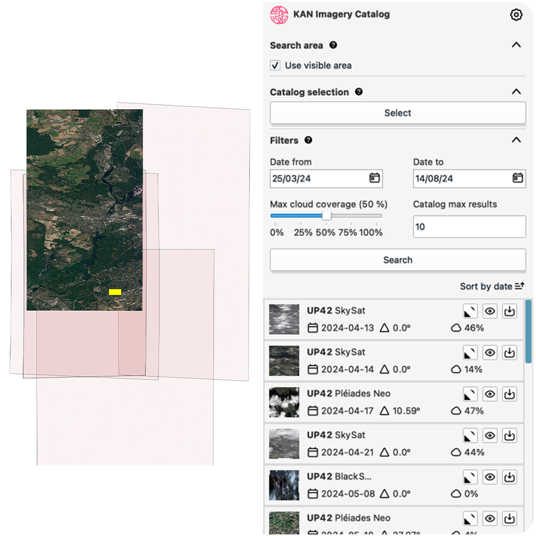
Access UP42 directly through QGIS
Our partner Kan Territory & IT has developed a plug-in that enables you to discover archive data from the UP42 catalog within QGIS. The plug-in (Kan Imagery Catalog) allows you to search for imagery from the world’s leading providers, all through a single touchpoint and without leaving the QGIS environment.
Last but not least, stay informed about the latest updates and improvements to our API and SDK, accessible through our documentation. Thank you for reading!

Subscribe to our newsletter
Stay up to date and learn about our fast-growing new features
