UP42 and Kan Territory come together to simplify access to Earth observation data
A fair amount of articles talk about unlocking the full potential of Earth observation data, and geospatial specialists are working hard around the globe to improve its accessibility and integration. Today, we’ll talk about one such advancement. The Kan Territory plug-in for QGIS, a popular open-source GIS software, enables you to discover archive data from the UP42 catalog without leaving QGIS.
Let’s start off with the UP42 catalog, then dive into what the Kan Territory plug-in can do for you.
The UP42 catalog: a short recap
The UP42 catalog simplifies the discovery and acquisition of EO data by giving you access to a vast archive from the world’s leading Earth observation providers. With a diverse range of optical, SAR, and elevation data from providers such as Airbus, Planet, 21AT, Vexcel, ISI, BlackSky, Capella Space, Hexagon, and Intermap, the catalog offers everything from ultra high 5.5 cm resolution and stereo imaging to flexible processing levels.
The catalog standardizes provider offerings and harmonizes different data types, which cuts down manual work on the user side. You’ll also get advanced tools for sorting, filtering, and visualizing data, including multiple-scene previews for easy comparison.
Features like real-time availability checks and free sample data enable you to easily find the right data for your projects, whereas the ability to add tags allows you to categorize your data, making projects more efficient.
Kan Territory & their QGIS plug-in
Kan Territory & IT (we’ll refer to them as Kan for short throughout this article) specializes in applying geo-intelligence to develop open-source AI, data government, territorial intelligence, and satellite image solutions. Their QGIS plug-in (Kan Imagery Catalog: KICa) allows you to connect QGIS with the UP42 catalog instantly. You can then search for imagery from the world’s leading providers, all through a single touchpoint and without leaving the QGIS environment.
Why use the plug-in?
- Streamlined workflows: Browse the UP42 catalog within QGIS, filter according to your criteria, preview images, order, and integrate into your QGIS projects for further analysis.
- Straightforward analysis: Visualize and analyze purchased images, overlay imagery with other datasets and map layers, conduct spatial analysis, or generate high-quality visualizations.
- Data standardization: KICa and UP42 use the STAC standard to provide you with data in a standardized format, facilitating the query, visualization and downstream integration of geospatial data.
How do I get started?
First, you’ll need to install the Kan Imagery Catalog plug-in. To do so, open QGIS and go to Plugins -> Manage and Install Plugins in the top menu. Type “KAN Imagery Catalog” and then click “Install Plugin”.
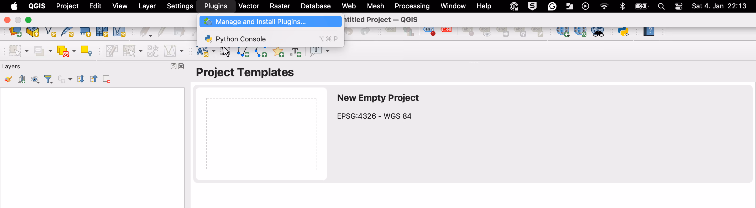
To access the plugin, go to Plugins or simply click on the KAN Imagery Catalog icon in the menu. The KAN Imagery Catalog panel will open on the side of the QGIS interface. Next, you will need to connect to UP42. Go to Settings (the gear icon at the top-right corner of the KAN Imagery Catalog) and log in using your usual UP42 credentials. That’s it—you’re all set!
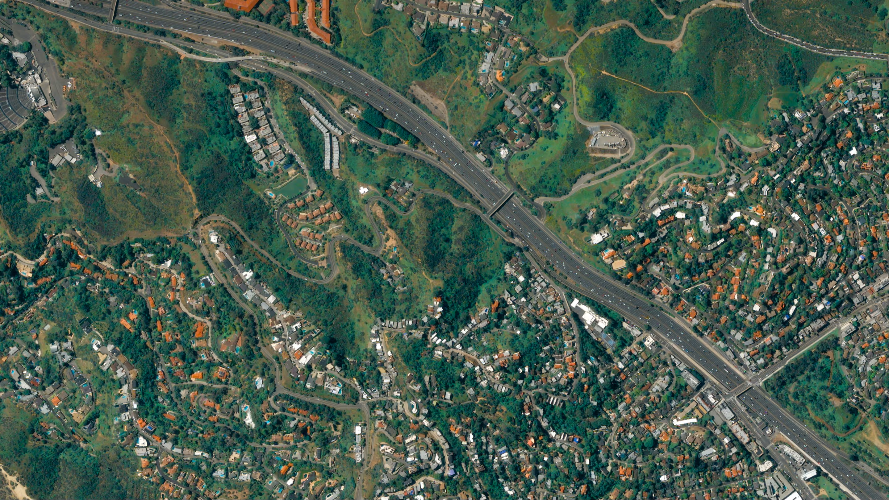
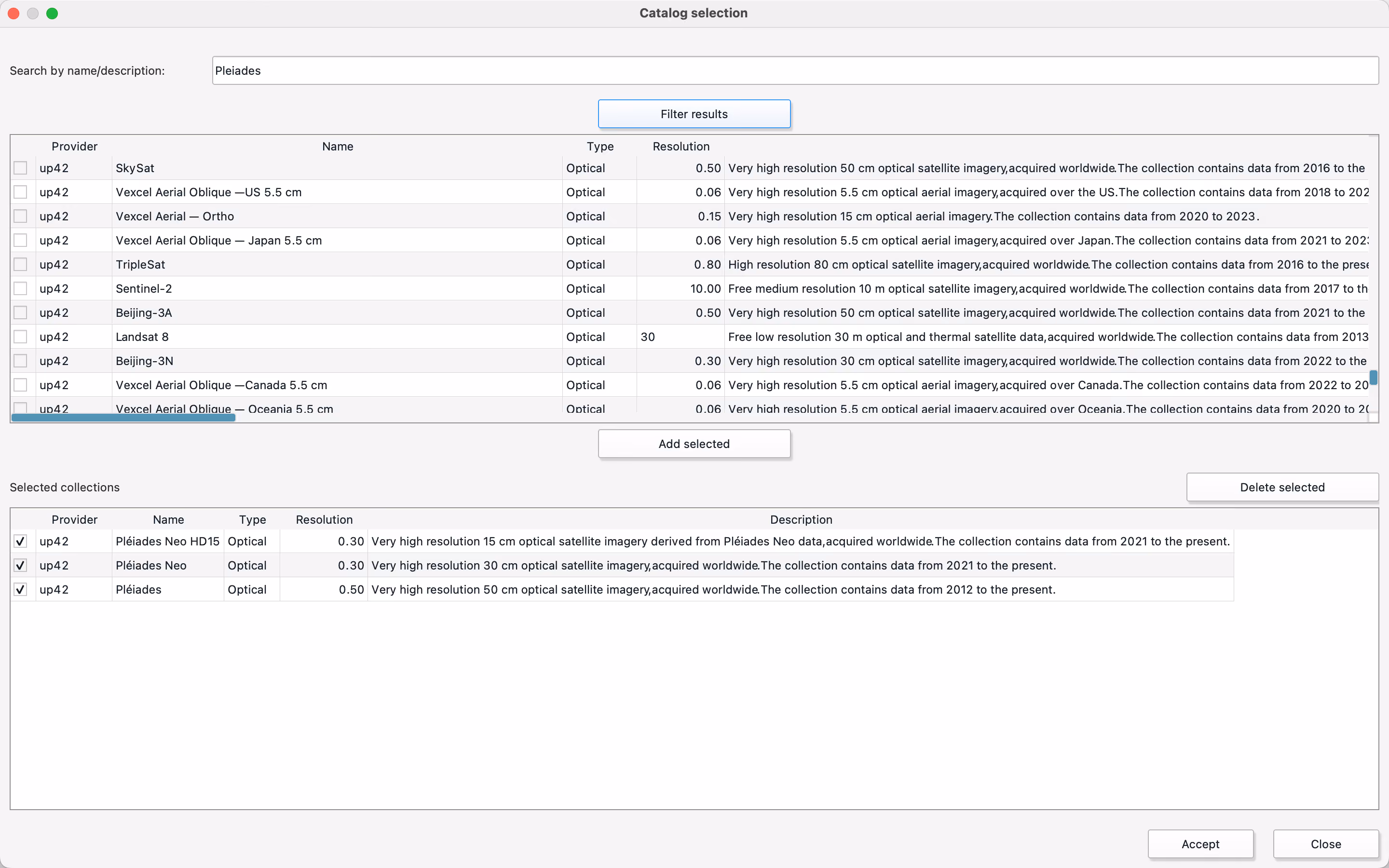
Now, you can define your AOI by importing an existing one into QGIS or manually drawing it on the map. Define your desired cloud coverage and date range, and select the providers you are interested in by clicking on Catalog Selection (in our example, we have chosen Pléiades, Pléiades Neo, and Pléiades Neo HD15). The available data matching your AOI and requirements will then be displayed.
The available scenes will be displayed as footprints on the QGIS map. In the bottom left, you can sort your results by date, find all the information you need on each image, preview their thumbnail, or jump to the UP42 platform to purchase and further process the data.
Here’s a brief tutorial from our partner showcasing the plug-in in action.
With this plugin, the geospatial industry’s been granted another way to access UP42 through one of its most popular tools. Download the plug-in now.


Subscribe to our newsletter
Stay up to date and learn about our fast-growing new features
