What’s new
Release notes
Keep up with the latest releases and improvements.

Double the Data
We've radically expanded the amount of SPOT and Pléiades available through UP42 by enabling the collection of scenes in the OneAtlas Archived Storage.

This brings much more consistency to our OneAtlas coverage and provides you with more options for many AOIs. For example, you can now choose between 2.7 times more scenes in the US than were previously available.
Flood and Water Finder
Flood and Water Finder from the UP42 team generate a binary water or flood mask from Pléiades or SPOT imagery. This enables you to run analysis on SPOT or Pléiades imagery omitting water bodies or flooded areas from your analysis.
Alternatively, you can convert your output into a vector file to use the water body or flooded area as an area-of-interest for any water-related analysis.
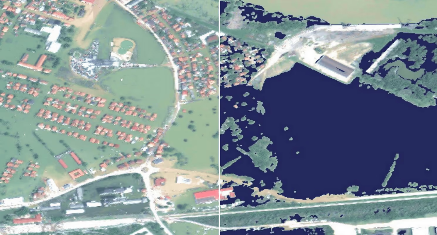
The Water Finder generates a GeoTIFF output highlighting the presence of water on a single SPOT or Pléiades image. Alternatively, the Flood Finder generates a similar output but looking at the area of water that is not present in an initial SPOT or Pléiades image but is present in a subsequent image.
Airbus Basemap
Basemaps act as a layer upon which you can overlay geospatial information and visualize information within its broader context. This essential component of many geospatial analyses is now available through UP42 with sharp, consistent, and fresh imagery from OneAtlas.
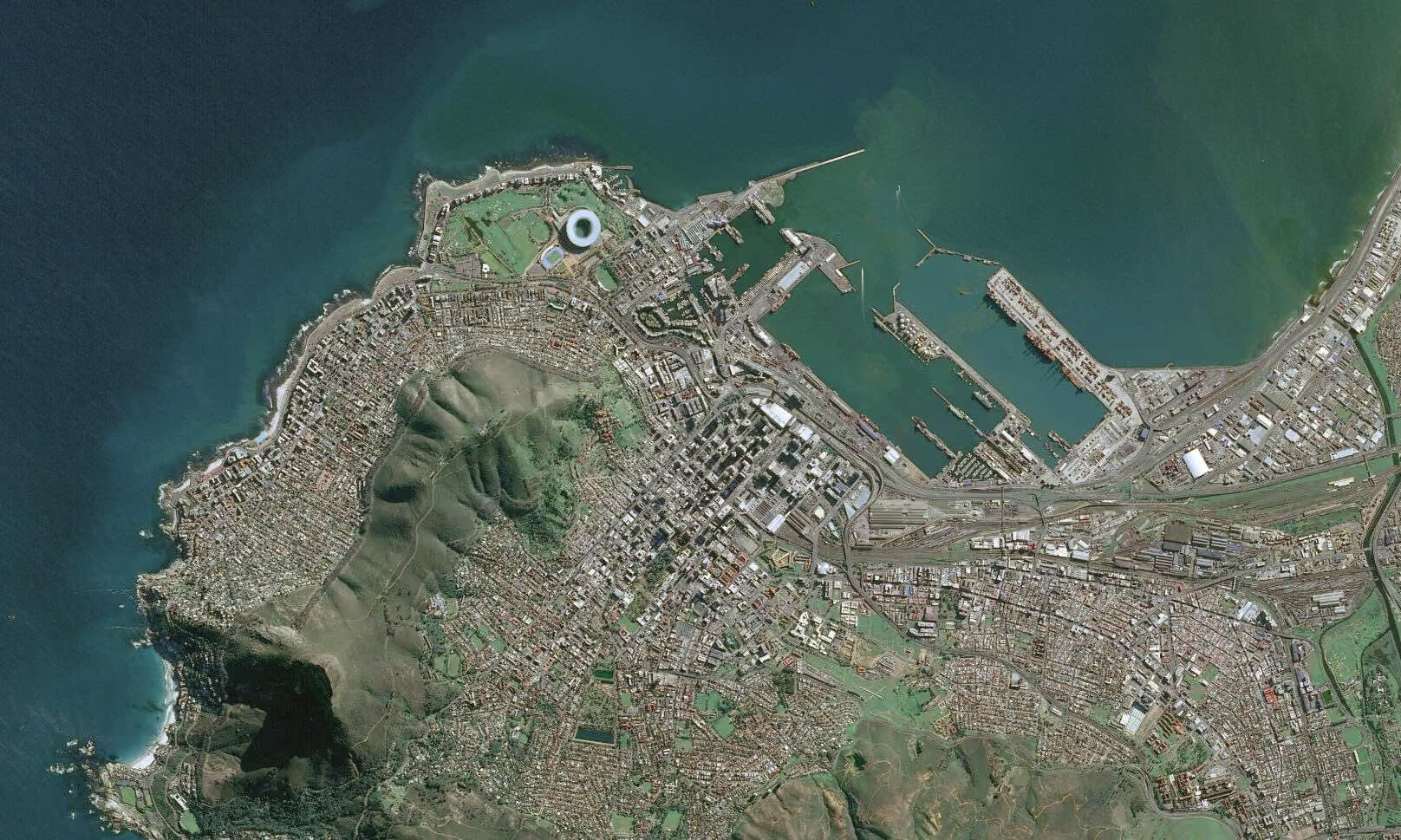
This block provides 1.5 m SPOT imagery globally and 0.5 m Pléiades imagery for major urban areas. The data can be downloaded and streamed from UP42 in GeoTIFF format.
Global Oil Seeps
Detecting oil on the ocean surface and differentiating between natural oil seepage and oil slicks is essential for oil exploration companies.
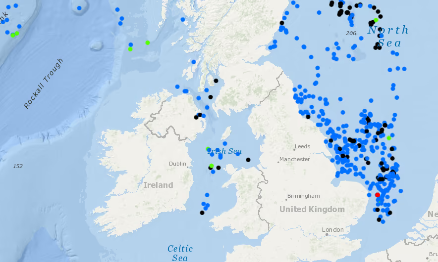
Developed over 20 years, Airbus has collated a global oil seep database covering 76 million sq km. It is updated yearly with new areas and updates on existing areas. This database acts as an invaluable cost-effective risk ranking tool for the OGME industry.
Buy Once, Use Forever
You may recall that we implemented our user storage functionality last month, which enabled the seamless delivery of tasked imagery. We're building on that functionality and are happy to announce that any SPOT and Pléiades imagery you purchase through our download blocks will now be automatically accessible through your user storage.
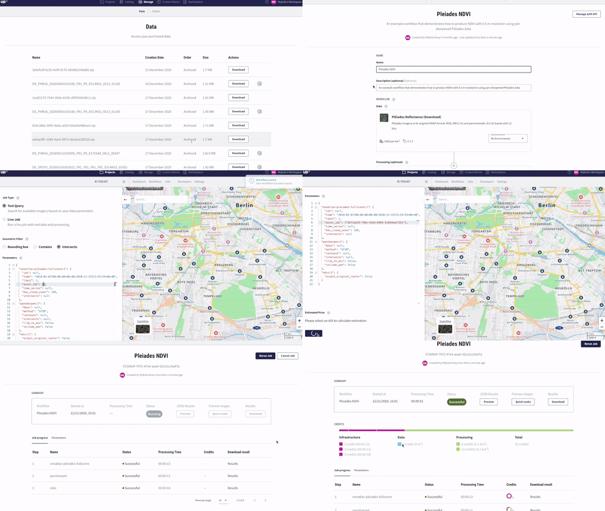
Within the user storage, you'll find the data's asset_id that you can use when configuring a job to reuse the data as many times as you'd like.
Explore the UP42 platform
Create an account to order, access, and analyze geospatial data.
