What’s new
Release notes
Keep up with the latest releases and improvements.

WorldDEM™ from Airbus
We are excited to launch WorldDEM™ from Airbus. Hailed as "The New Standard for Global Elevation Models", WorldDEM™ brings UP42 users a Digital Surface Model (DSM) with pole-to-pole coverage, high accuracy, and consistency.
WorldDEM™ is based on radar satellite data acquired during the TanDEM-X Mission, which had the primary goal of generating a high-quality DSM of the entirety of the Earth's surface, based on SAR interferometry.
The goal of the mission was clearly achieved with all 148.5 million km2 of the Earth's surface being captured in the space of four and half years, driving consistency in the generated DSM and global coverage. The elevation models' accuracy is evident, with the Absolute Vertical Accuracy and Absolute Horizontal Accuracy being <4m and <6m, respectively.
For more information about WorldDEM™ and its use cases, check out the following video:
Intermap Viewshed
Viewshed from Intermap provides the line-of-sight from any point, height, radius, and azimuth on an elevation model. The model outputs a GeoTIFF, with the pixels visible from the point of origin are in green, while the pixels not visible from the point of origin are in red (see below).
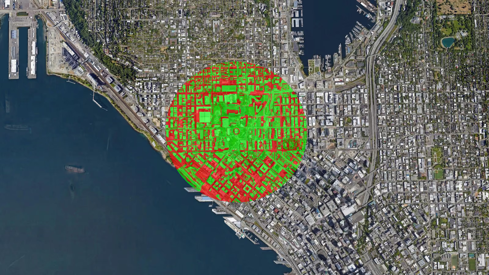
Viewshed is primarily used in the telecommunications industry to evaluate the reach of signals from telecom transmitters. To ensure signal strength is uninterrupted, telecommunications providers must place communicating transmitters within each others' line of sight, avoiding buildings, trees, and terrain. As such, viewshed is the perfect tool to analyze and optimize signal strength.
Sentinel-2 Reservoir and Lake Surface Monitoring
This new processing block from Terra Cover enables you to create a robust surface water extent map using a deep neural network. This allows you to visualize the presence and area of a lake or reservoir for your area of interest. The approach of generating surface extent maps are significantly less impacted by atmospheric disturbances compared to traditional index-based thresholding methods, ensuring the accuracy of the reservoir and lake surface is higher.
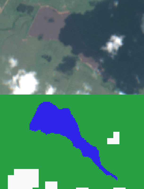
The model first checks for the presence of a lake or reservoir using Terra Cover’s time series data set, also available on UP42. The pre-check ensures that you don’t spend money or time on computationally-intensive deep learning models when there is no presence of water within your area of interest. The block also automatically utilizes the s2cloudless cloud mask to minimize the disruption of clouds in your analysis.
SDK Version 0.15.0
The latest version of the SDK reflects the changes previously announced for the UP42 console. Firstly, you can now order data without running a workflow, whether that data is available directly or needs to be ordered from the OneAtlas archived storage. Orders can now be created using the Catalog.place_order command.
Secondly, you can now reuse your purchased OneAtlas imagery through the Python SDK by specifying your asset ID in the Workflow.construct_paramaters command. This enables you to access and process data that is currently in your user storage.
New Machine Types
Running geospatial analytics at scale requires powerful computing infrastructure. Indeed, as most geospatial developers are painfully aware, complex algorithms can take hours or even days to train or analyze large areas of interest.
With an expanding range of increasingly complex machine-learning algorithms available on the UP42 marketplace, it is incumbent upon us as a company to ensure we continue to provide an efficient infrastructure for such analysis.
As such, we now provide block builders with new options for larger CPU machines with 8 or 16 cores and 40 or 80 GB RAM and a GPU machine type - GPU P100 - to increase performance.
These new machine types will reduce job runtime significantly, ensuring you get the insights you need promptly. We've also significantly reduced the infrastructure costs associated with all our machine types making using UP42 for complex analysis more affordable.
Explore the UP42 platform
Create an account to order, access, and analyze geospatial data.
