What’s new
Release notes
Keep up with the latest releases and improvements.

Landsat 8 now available on API and console
We're adding more open data to the UP42 platform! In addition to Sentinel-2, you can now access Landsat 8, an Earth observation mission from the Landsat programme of USGS and NASA. Benefit from free low resolution 30 m optical and thermal satellite data, acquired worldwide with a revisit rate of 16 days. The collection provides global coverage and contains data from 2013 to the present.
Place your order through our console or via our API.
Map it out: View and search for your scenes in our new data management map view
If you thought that our data management solution couldn't get any better—think again. You can now view your scenes on a map. How? Just use the search bar, enter a location and select a prompt from the drop-down list.
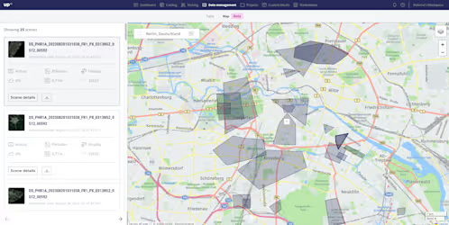
The map comes with even more filtering capabilities than the table view: creation and acquisition date, ground sampling distance, maximum cloud coverage, tag, order ID, product configuration, producer, collection, and source.
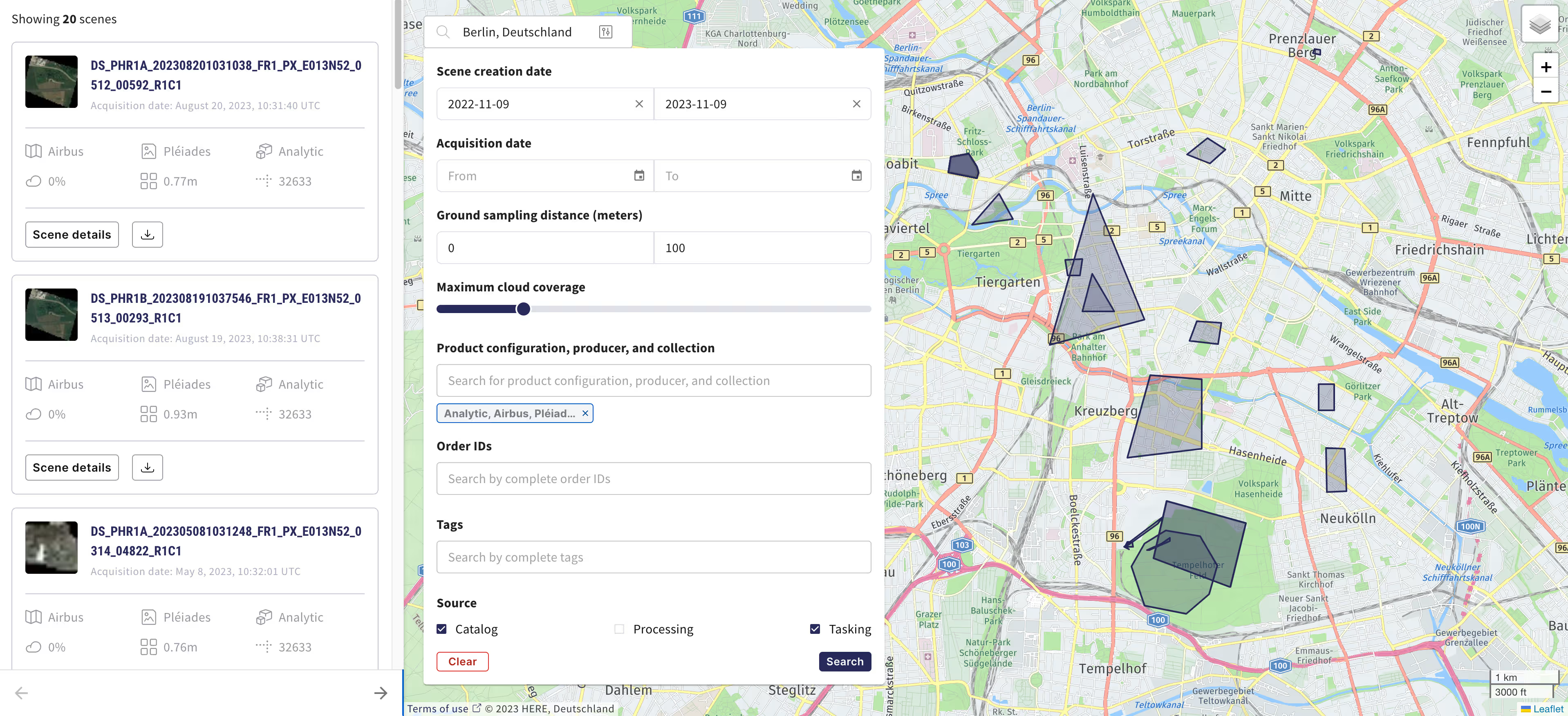
Our map view is still in Beta, so expect more features and updates from us soon. We will continue to invest in our data management capabilities, adding more value for our users and enabling easier downstream integrations.
Explore the map view now.
Simplified account management for admin users
You can now easily make changes to your account without having to contact UP42's customer success team. As an admin of your account, you can remove a user with the Member role from their account.
- Open the console and click the upper right corner → Members.
- Find the user you want to remove. To remove a user, their role must be Member.
- Click on the symbol to the right of the user's current role to reveal options.
- Click Remove user and confirm you want to remove the user.
- The removed user's workspace and assets in storage will remain accessible to existing users.
As an admin and the last user of your account, you can also delete your account entirely from the Account page.
Check it out here.
Introducing effortless geometry management
No more redrawing or re-uploading polygons: save time and effort when managing your geometries in the catalog!
- Store: Draw your AOI or upload a file, and save it in the library
- Use: Access your geometries at any time by loading them from your library
- Update: Modify the coordinates of previously created AOIs
- Recreate: Generate new AOIs by using existing ones as a starting point
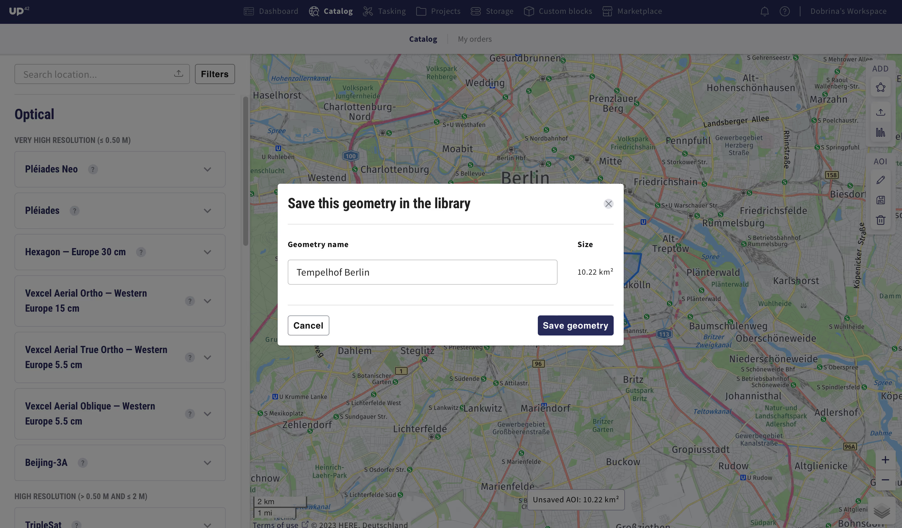
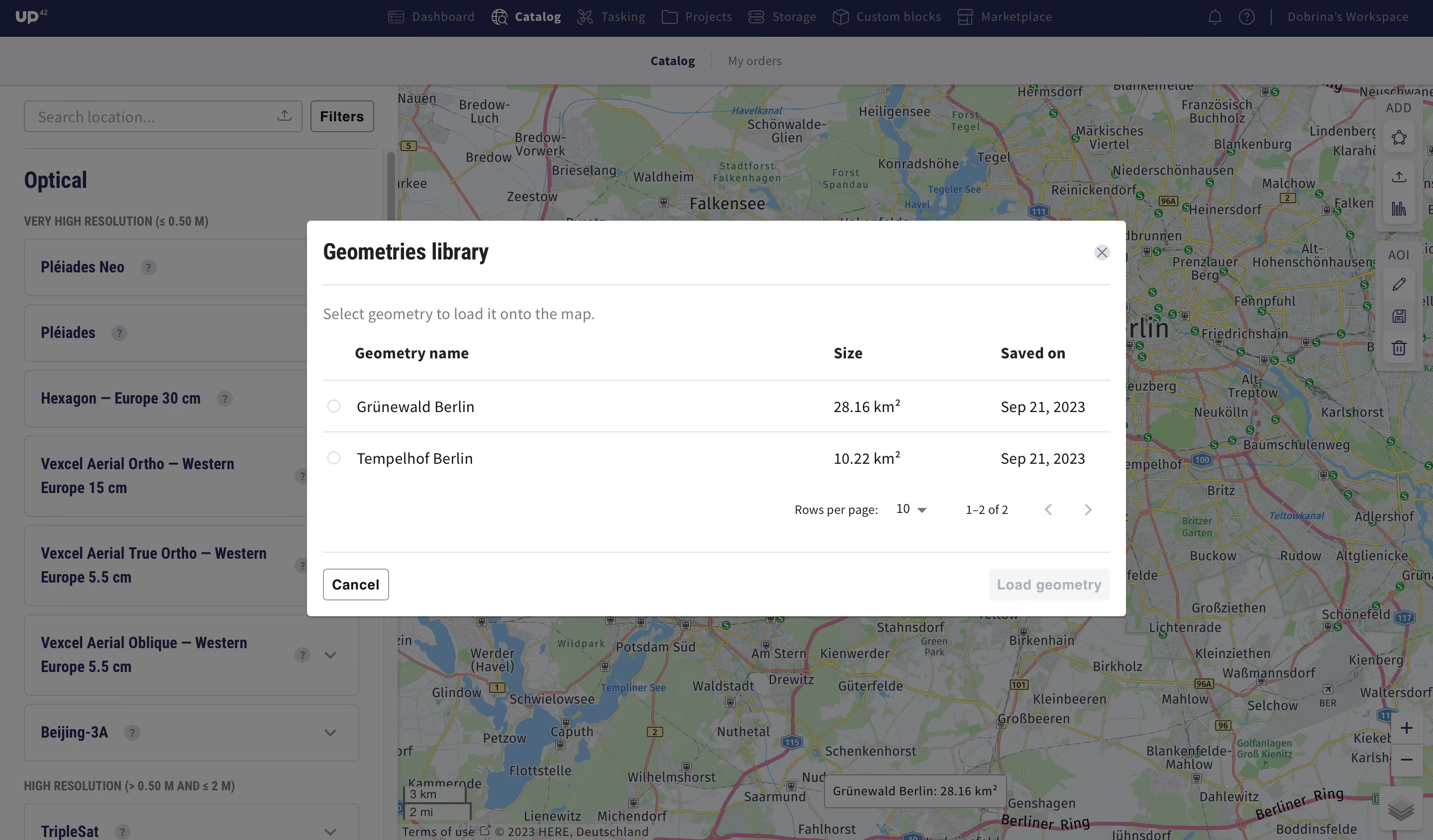
Try out our new geometry management capabilities in the catalog, or use the API.
Introducing UP42's cloud-native asset model: assets are now streamable and available in storage as decompressed individual geospatial features
Earlier this year, UP42 adopted the STAC specification, which allows searching across multiple providers for geospatial assets with a common structure and set of metadata. Thanks to this, users can now do a STAC search in storage beyond simple attributes like date, time, and constellation.
And now, we’ve introduced a cloud-native asset model (CNAM) for assets in UP42 storage. Regardless of provider or delivery format, we will transform UP42 assets into individual geospatial features available for immediate download. Each file will be mapped as a STAC asset under a STAC item, and the original delivery accessible under STAC collection. CNAM will also convert all raster data into cloud optimized GeoTIFFs or COGs for short, and all vector masks into GeoJSONs to enable easier integrations. This will ensure consistency in how an asset is named, its media type (COGs or GeoJSON), and its role (e.g., data, metadata, previews, or masks).
The benefits:
- No need to download a compressed file - stream the part of the file you need
- No need to understand different delivery structures and naming conventions
- No need to access any files to see data and band information
- No need to do complex data transformations
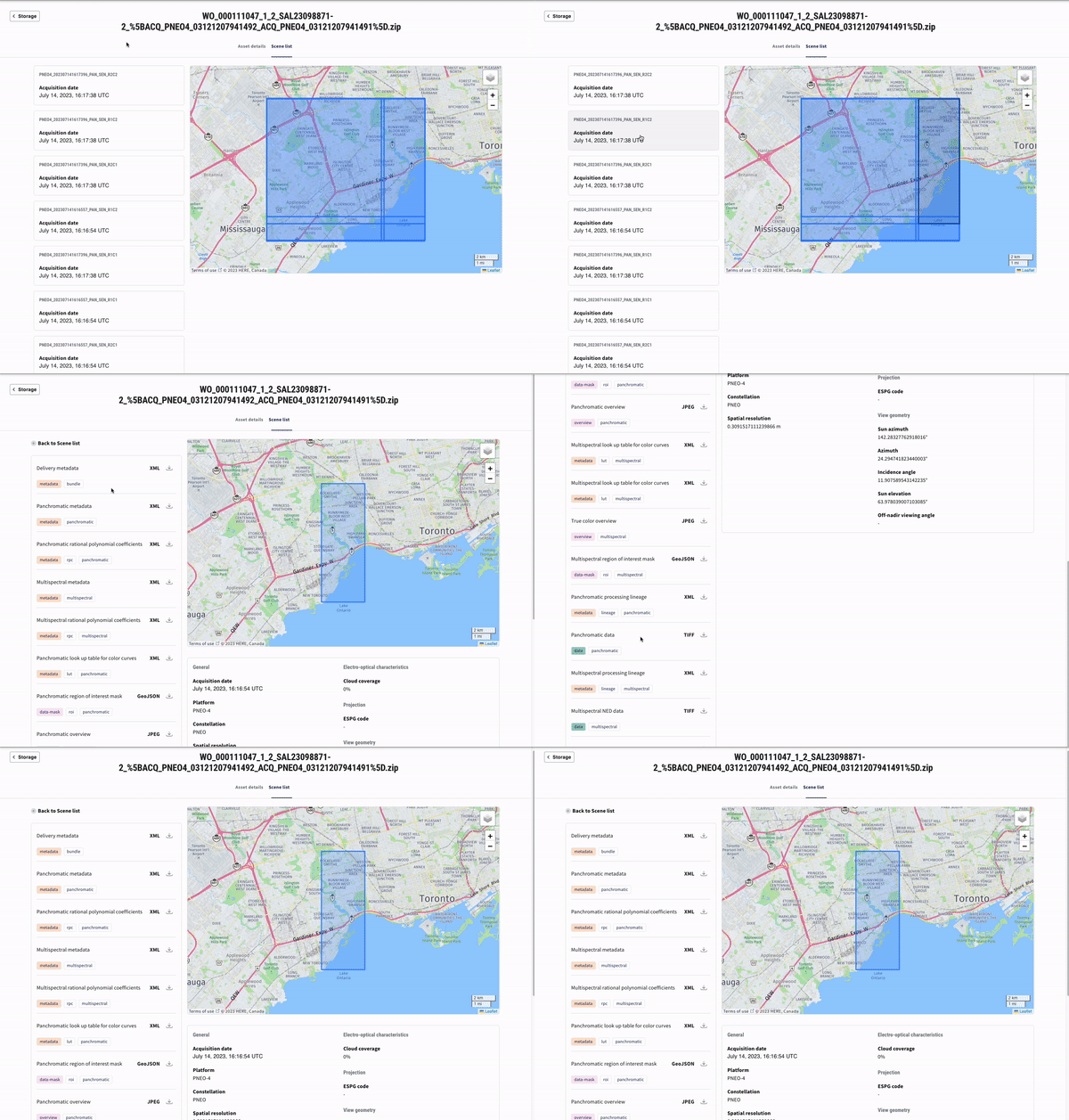
CNAM allows you to easily search for and work with the data. Read about the benefits of UP42's cloud-native asset model in the recent blog, or learn how to analyze STAC assets in our technical information.
Explore the UP42 platform
Create an account to order, access, and analyze geospatial data.
