What’s new
Release notes
Keep up with the latest releases and improvements.

21AT’s Beijing-3A archive data now available on API and console
View the footprint of scenes acquired for your tasking order
Now there is an easier way to monitor and stay on top of complex tasking orders. When a new asset is delivered to storage, the footprint of the acquired scenes are automatically displayed over the order AOI. You can go to the tasking order overview and click on a specific order to get this information. For complex orders with multiple AOIs, now you get a quick, intuitive overview of the acquired scenes.
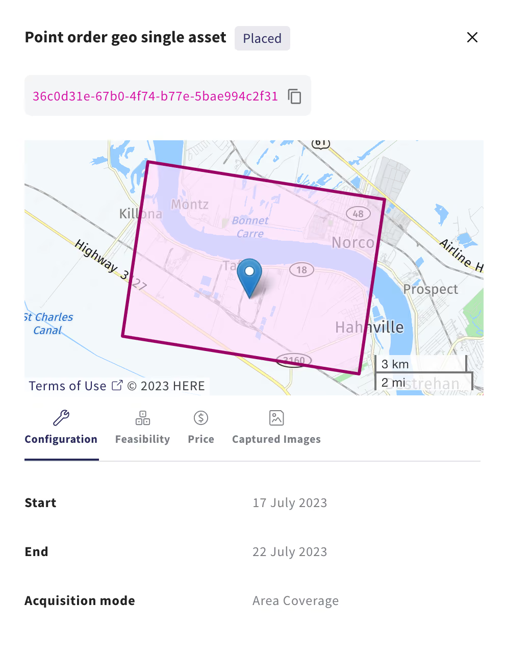

Check it out here.
Vexcel's aerial and elevation data available on API and console
Vexcel's ultra high resolution aerial imagery, along with DTMs and DSMs, is now available on the UP42 platform. Vexcel delivers geospatial data products with high accuracy, spatial resolution, and consistency. The Vexcel Data Program is the largest in the world, capturing ultra-high-resolution imagery (starting at 5.5 cm resolution) and related geospatial data in more than 30 countries, including the U.S., Canada, U.K., Europe, Australia, New Zealand, and Japan.
Sample data now available on the UP42 platform
You have a project and you need geospatial data? Wondering where to start? How about downloading free imagery directly on our platform. You can now find sample data for popular collections with more providers coming soon.
You can access sample data in two ways:
- Via your
DashboardclickingExplore all sample datato view the range of collections and providers available.
- Via the
Catalog, select a collection scene, click onSample data, accept the T&C and download your sample.
Use the data to understand the capabilities before committing credits to your specific AOI and use case.
Please note, that sample data doesn’t correspond to the selected full scene on the console. The sample might have limitations (e.g., coverage) compared to the commercial datasets available. It can however provide valuable insights and serve as a starting point for discovering data from multiple providers.
Flexible credit purchases for simplifying your transactions
Credits let you buy geospatial data, task imagery, or run analytics on the UP42 platform. We have introduced some changes to the console to make it faster and easier for our customers to purchase credits. In addition to selecting pre-set credit packages, you can now order a specific number of credits based on your business needs. The whole transaction can be completed within the console with a credit card, reducing the time spent on multiple email and invoice exchanges. By paying with credit cards, customers using currencies other than euros can avoid the need for international bank transfers to settle their payments.
Please note: You can place orders for credits starting from 10,000 and going up to 5 million. For orders beyond 5 million, you can get in touch with us directly.

Check it out here.
Explore the UP42 platform
Create an account to order, access, and analyze geospatial data.
