2026 is moving fast, and so is the UP42 platform
The latest: we’re expanding global terrain coverage at 50 cm resolution, introducing new thermal intelligence data, and giving you greater control with new granular user roles.
Here's all the news this month.
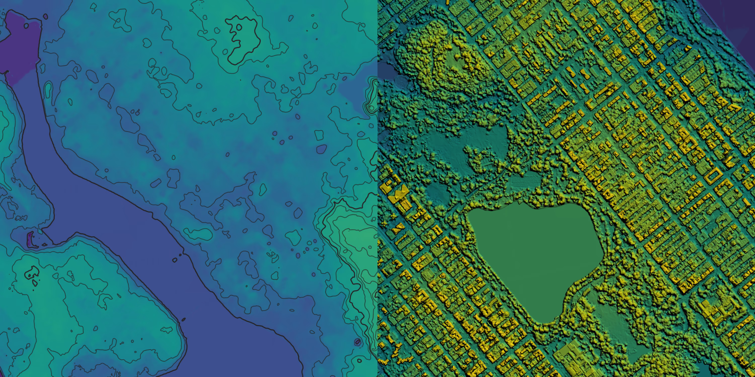
Get precision at a global scale: Vantor 50 cm elevation data
We’ve added new elevation datasets from Vantor. Vivid Terrain gives you 50 cm high resolution elevation data, in the form of digital surface models (DSMs), digital terrain models (DTMs), and a cost-effective bundle option.
With extensive global coverage, Vivid Terrain delivers a high level of accuracy for applications such as urban planning, visibility analysis, environmental monitoring, and many other use cases.This data can be accessed alongside optical and radar imagery through our console, API, and SDK, eliminating the need to switch tools or platforms.
Curious to learn more? Check out our documentation for a deep dive into Vivid Terrain.
See heat patterns with thermal intelligence from constellr
Our newest partner, constellr, offers decision-grade thermal intelligence for use cases that span infrastructure monitoring, urban planning, agriculture, and many more. Thermal sensors can detect movement, heat sources, and anomalies that are invisible to optical and radar sensors.
The constellr portfolio features three offerings built around LST (Land Surface Temperature):
- LSTfusion: cloud-free LST at 30 m resolution, modelled daily by combining constellr measurements with other sources for continuity at scale
- LSTprecision: high-precision, frequently updated LST at 30 m resolution for reliable absolute temperature monitoring
- LSTzoom: higher “sharpness” layer designed to support detailed local analysis (10 m spatial detail layer)
Learn more or order constellr data through UP42 here.
Manage your account with granular user roles
We’ve upgraded our user management model from the previous Admin/Member structure to four distinct roles, giving you more granular control over account access. You can now assign permissions based on actual responsibilities, protecting sensitive account settings while enabling teams to work efficiently.
Available user roles on the UP42 platform:
- Owners are primary account holders with full authority
- Admins manage billing and users
- Members can create orders and run processing jobs
- Viewers can see orders and available data, but cannot create orders or spend credits
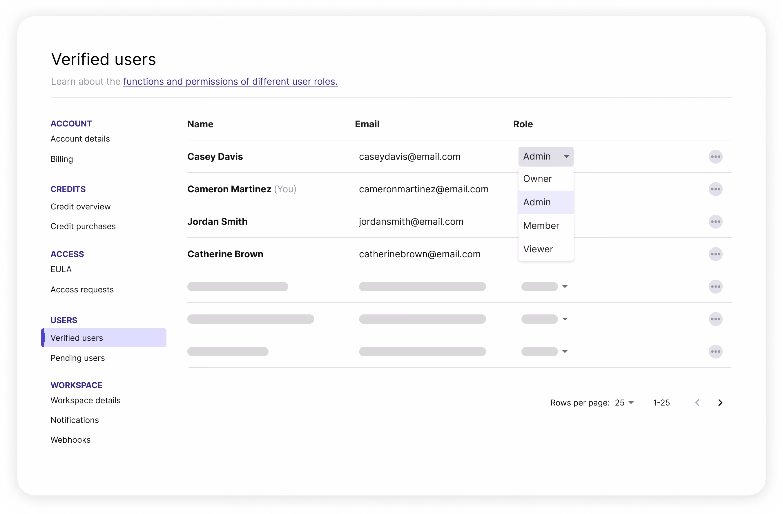
Learn more about setting up user roles for your account.
Find us at events
Our team is constantly on the road, meeting customers and partners worldwide. Recently, we had a great time connecting with the global geospatial community at Distributech, the European Space Conference, DGI, and hosting the local GeoMob meetup at our office.
If you’d like to catch us soon, you can find us at:
- PDAC (Toronto) | March 1–4
- SATSHOW 2026 (Washington D.C.) | March 23–26
- Munich Space Summit (Munich) | March 23–27
- Geospatial World Forum (Amsterdam) | April 27–May 1
- GEOINT Symposium (Aurora, CO) | May 3–6
That’s it from us this month.

Subscribe to our newsletter
Stay up to date and learn about our fast-growing new features
