Nara Space: Enhancing very high resolution satellite imagery

UP42 is excited to welcome Nara Space as a partner. We sat down with Minsik Kim, Director of Image Analysis at Nara Space, for a chat about their history, their goals, and their new super resolution algorithm.
UP42: Hi Minsik. Tell us about Nara Space as a company. What was the dream of the founders, and when/where did it begin?
Minsik: Nara Space was founded in South Korea in 2015. We build nanosatellite constellations and provide satellite image data analysis to help customers quickly identify and address challenges, such as climate change and natural disasters.
Our founders, who come from three different universities, met at a 2014 space science conference in South Korea. Under the motto "Expand our Universe," we started our research in a small office, and we've now grown into a full-fledged company with a total investment of $10 million up to Series A. Nara Space is adapting to market changes by adopting an agile work method that quickly responds to customer needs, makes decisions, and follows through.
UP42: Let's talk about Nara Space's super resolution algorithm, which is hosted on UP42. What exactly does it do, and how does it work?
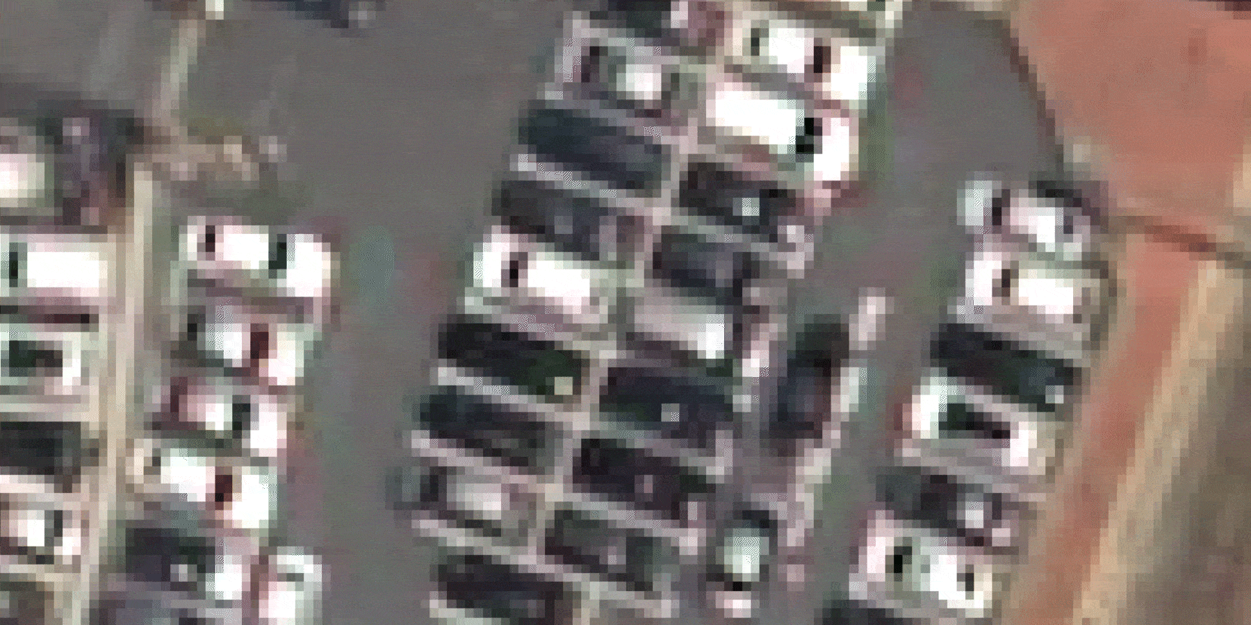
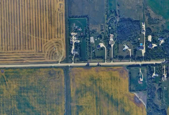
Minsik: Nara Space's super resolution (SR) algorithm is a technology developed to increase the spatial resolution of satellite images. Our algorithm uses a convolutional neural network (CNN) to enhance image resolution. To be more specific, we prepare image sets for different resolutions, using aerial imagery and Pléiades Neo imagery.
Once the data set is ready, we train the super resolution network using a TensorFlow framework. This framework allows the network to identify the information gap between LR and HR images. For instance, the detail of a car in a 0.3 m resolution image and a 0.1 m resolution image differs; after training, the network can close that gap.

UP42: What challenges will the super resolution algorithm solve for customers?
Minsik: Super resolution is a unique technology that can enhance the visual quality of satellite images. However, its real value shows when it gives customers more choice; for instance, a customer only uses aerial images because satellite images don't provide enough spatial resolution. With the help of our algorithm, the customer can consider satellite imagery as another option.
UP42: What satellite providers will Nara Space's algorithm be compatible with?
Minsik: Right now, Nara Space's super resolution algorithm works best with Pléiades Neo, but it's very flexible, so can be compatible with any satellite image. Currently, we've tested our algorithm on various satellite images which span from 10 m resolution to 0.3 m resolution. We also tested it on small satellites that are produced with a New Space philosophy. The result may differ depending on the quality of given input, but consistent resolution improvement was observed.
UP42: What value does Nara Space see in partnering with UP42?
Minsik: The first value to be gained through the collaboration between UP42 and Nara Space is the acquisition of meaningful customers.
Providing satellite image analysis software is not an easy job. Also, it is very difficult for a startup like us to find customers that would need such services. With UP42, we can do both very easily, because UP42 knows how to facilitate integration of software and it already has active users that look for such data processing algorithms.
Secondly, we expect to get direct feedback from customers who use our SR algorithm on the UP42 platform, and the opportunity to maintain and upgrade the algorithm.
UP42: What changes has Nara Space seen in the industry since the company was founded?
Minsik: The biggest change we've seen is the increased privatization of space activities, which has brought us more opportunity. The tech is advancing fast, so we've been able to try new things at a lower cost in a shorter time period. Many investors are fascinated by our fast-moving business model. Now, not only the government, but also huge companies and even NGOs are showing interest and willingness to cooperate with us. Among them, we're looking to partner with companies that are not limited to space, but are working to improve life on Earth as well.
UP42: Is Nara Space working on any other interesting products/algorithms that you're hoping to put on the UP42 platform?
Minsik: Nara Space is developing a nanosatellite called Observer-1, which is scheduled to launch in the second half of next year. Observer-1 is a commercial microwave-sized satellite with 20 cm in width and length, 40 cm in height and 25 kg in weight. Observer-1 is an optical satellite and its main task is to observe the Earth. Although the native resolution is 1.5 m, we are aiming to achieve a resolution of 0.5 m through post-processing using our super resolution algorithm.
We expect to be able to service satellite imagery captured by Observer-1 through UP42's platform soon.
Also, we are preparing the super resolution processing block for other data that UP42 provides. We hope that this will further expand users' choices for their applications.
UP42: South Korea is well-known for successful technology companies. How does Nara Space envision their future in the tech industry?
Minsik: Nara Space aims to expand our offerings in future, from satellite production to data processing and satellite utilization platforms. Based on these customer-oriented services, we want to lead the new space industry in Korea by quickly identifying and responding to consumer needs. We're hoping to play a role in providing insights and solutions to customers by collecting data that's not limited to Korea, but across the entire globe.
Subscribe to our newsletter
Stay up to date and learn about our fast-growing new features
