From discovery to closure: Why mining companies turn to remote sensing data
Are the days of on-the-ground mine prospecting over?
They should be. While people will be needed on the ground at some point, these days, remote sensing has remade the discovery and exploration phases of mining. More and more mining companies are turning to geospatial to save on extra costs, increase efficiency, and improve safety.
It's also true that mining has always presented unique difficulties, no matter the level of technology. But it's an essential part of our world, allowing me to type this and you to read it.
In this piece, we'll go over some of the challenges mining companies face in their pursuit of remote sensing data, then talk about how UP42 addresses those challenges, and finish with some examples of what mining companies use the data for once they get it.
The biggest challenges for mining companies
Nobody's ever said that geospatial has a low barrier to entry. If you work in mining (or a related industry) and need data, some of the following points will be familiar to you.
Mining usually happens in remote locations, far away from towns and cities. Existing EO imagery for places like this is rare, and aerial acquisitions, whether done with drones or another aerial platform, are expensive and logistically complex. So you often need to task new satellite data. And once you have the data, you probably also need it to be updated regularly.
To cover data requirements, you have to juggle relationships and contracts with different providers. This dilutes your buying power, and a lack of centralized procurement sometimes causes issues, such as accidentally buying the same data twice. The rate at which this happens might surprise some of our readers.
It's not just procurement: there's also a lack of centralized data access.This creates missed opportunities for multi-use applications and analytics. Companies might lack in-house experts to get the most out of their data, and staying up to date with emerging geospatial tech presents a separate challenge.
How can UP42 help?
Many of these problems aren't just found in mining. The UP42 platform was designed to make working with geospatial data easier across industries. Starting with...
- Data access
The UP42 platform hosts the world's top providers of Earth observation data, all together in one place. No more jumping between PDFs and emails to compare quotes.
Through a single interface, you can view scenes on a map, select your areas of interest (AOIs), and choose your data provider. It's easy to check if archive imagery already exists, and if not, task a satellite to capture new imagery.
You can access the platform through the browser-based console, or scale up using our API or Python SDK.
Users can be separated into admin users and regular users. With centralized enterprise management, admins get full visibility into their organization's purchase history, order status, and compliance status. No need to go searching for existing data, and no buying more than you need.
- Data flexibility
When you order data on UP42, beyond your choice of provider, you have lots of other options.
Tasking on UP42 comes with customizable parameters, from the acceptable level of cloud cover and sensor angle to the geometric processing level. This allows you to choose the data format for your organization, based on in-house capabilities.
Not sure where to begin? Have no fear. That brings us to our next point...
- Comprehensive documentation and customer support
If you have questions, our documentation team has the answer. UP42's documentation hub has information on all of our archive and tasking collections, and is full of walkthroughs on how to use the platform.
Still need assistance? Our customer support team is here to help. UP42's users are constantly finding new and surprising uses for geospatial data. It's the best part about working in such a rapidly advancing industry. Here are some of the biggest ones at the moment.
How are mining companies using remote sensing data?
These pain points exist because there's a need for remote sensing data in mining, and companies are willing to go through lots of hassle to get it. We're here to minimize the hassle so that they can focus less on the paperwork and acquisition, and more on the actual insights.
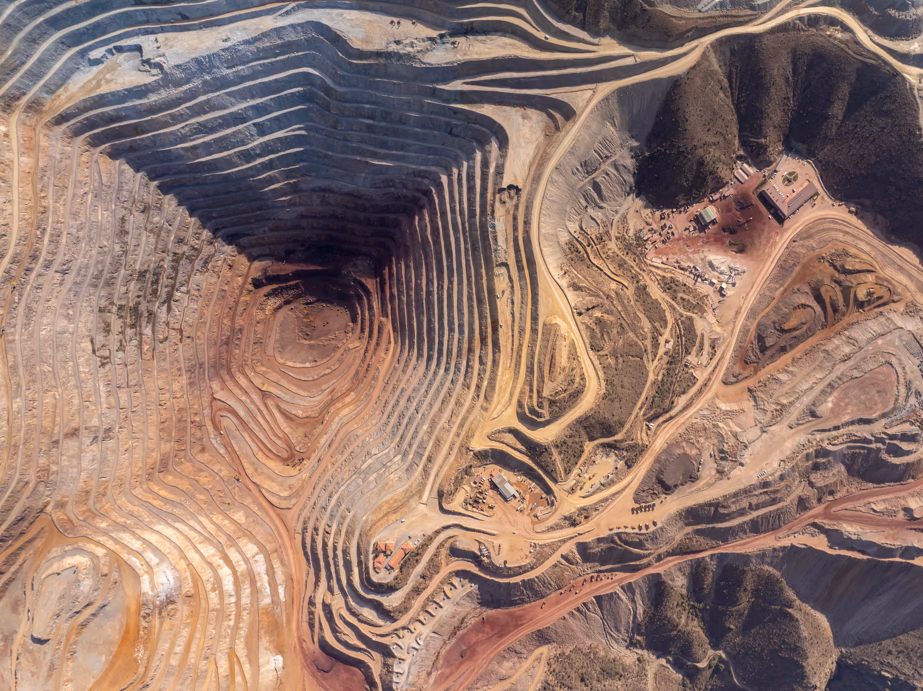
And one of the biggest sources of insight for mining operations is the Digital Elevation Model. We've written about DEMs before, so in short, it's a 3D rendering of the Earth's surface in grid form, where every point has its own elevation value. DEMs are created by using remote sensing data to capture the same AOI from multiple angles, often through stereo optical imagery.
This kind of data is incredibly useful for mining companies. It allows them to plan mine site layouts, including roads and infrastructure. DEMs also help with calculating the volumes of earth that will need to be moved, or measuring how much has already been moved. They're also used to monitor topographical changes, such as erosion, and support in detecting potential dangers like landslide and flooding risk.
Elevation data available on UP42 includes products from Airbus, Intermap, Bluesky, and more.
High resolution optical imagery is another sought-after data type. With frequent revisit rates, mining companies can use this for change detection, whether for tracking construction progress, monitoring inventory, or checking road conditions. With providers like BlackSky offering revisit rates of up to 7 times per day, mining companies can easily monitor operations all over the globe.
Optical imagery on UP42 comes in many different varieties, from panchromatic high spatial resolution imagery (grayscale) to high spectral resolution imagery across the visible spectrum and beyond, including near-infrared. For some products, like Pléiades Neo, pansharpened imagery combines the best of both for high spatial and spectral resolution data.
And when it's time for a mining site to close, very high resolution imagery comes in handy for documentation purposes and for close-up examinations to ensure legal and environmental compliance.
Lower resolution data is also useful, especially open data: by using free data in the discovery phase, companies can use a tip and cue strategy. This allows a medium or low resolution data set or sensor to image huge swaths of Earth's surface, pinpointing potential interesting areas for examination by higher resolution sensors. It's a great way to save operating costs during exploration. UP42 currently offers archive SENTINEL-2 data from ESA, dating from 2017 to the present, and LANDSADT-8 data from USGS, dating from 2013 to the present.
We’ve talked about SAR data lots in previous posts. For mining companies, it’s a good way to monitor ground deformation over time.
Last but not least, there's hyperspectral imagery. This is an emerging field, but it's already showing promise. Hyperspectral data captures detailed information across a wide range of the electromagnetic spectrum. So it can precisely identify minerals based on their unique spectral signatures, making it another useful tool for exploration, and an ideal candidate for the tip and cue strategy.
Hyperspectral won't be the last. New use cases for remote sensing data keep popping up. Got one for us? Reach out—our sales team would be happy to help.


Subscribe to our newsletter
Stay up to date and learn about our fast-growing new features
