Tasking Maxar satellites via UP42
We recently welcomed Maxar into our partner ecosystem. This was a major milestone, allowing us to both offer users global access to Maxar’s data, and further strengthen our portfolio. Let’s take a closer look at what this partnership means for you, and how you can benefit from tasking a Maxar satellite through the UP42 platform.
Maxar’s technology
You can now order 30 cm and 50 cm resolution imagery from Maxar’s satellite constellation, including WorldView Legion, directly on the platform. Maxar provides very high revisit rates—up to 15 times per day—and offers both mono and stereo formats. And it’s not just spatial resolution: Maxar’s data is available across multiple spectral bands. With an average positional accuracy of less than 5 m CE90 (you can be 90% confident a feature is within a 5 m radius circle around where the image suggests), Maxar’s technology ensures that images are closely aligned to a known coordinate on planet Earth.
These capabilities enable users to tackle real-world challenges across industries such as oil, gas, mining, and energy, from infrastructure monitoring to environmental compliance. You can read more about Maxar’s optical imagery here.
Tasking Maxar on the UP42 platform
UP42 has developed an easy-to-use tasking solution that lets you manage the entire tasking journey in one place—from complex orders and instant price estimates to tracking order progress and downloading imagery.
Choosing the right data
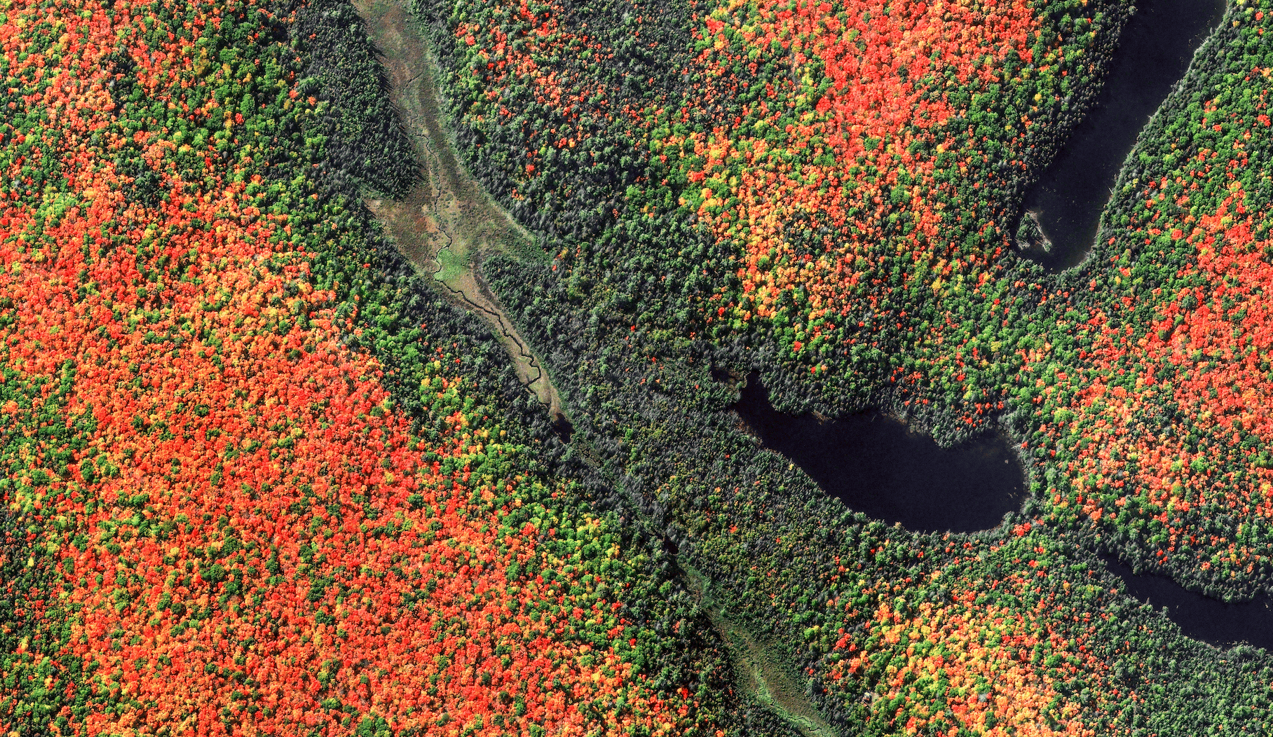
Let’s begin with data selection: the platform allows you to easily compare collections by filtering based on data type, resolution, acquisition mode (e.g., stereo or tri-stereo), and tasking priority. At this stage, you can also see the approximate price for each collection, as well as order limitations (for collections where a minimum order size applies).
For this example, let’s proceed with Maxar’s 30 cm collection (50 cm is also available on the platform).
Placing your order
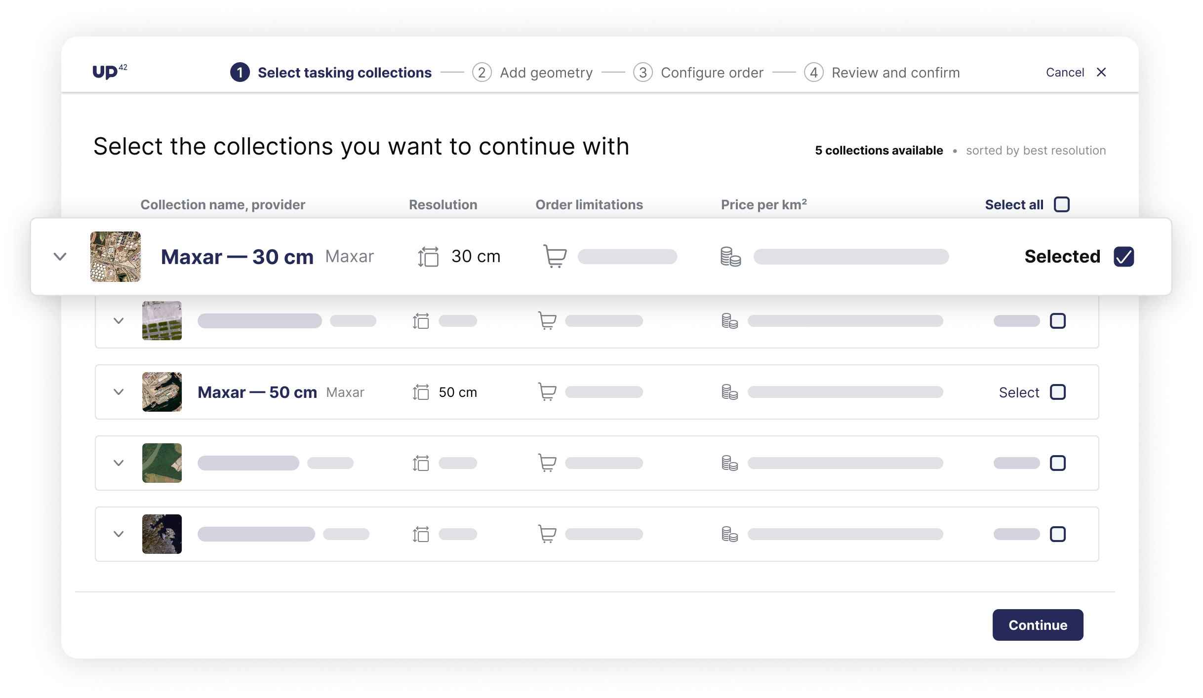
At this stage, UP42 offers several useful features:
- Multiple AOI support: Upload complex AOIs and instantly see if they meet the provider’s conditions. When you submit the order, each geometry file will be processed as a separate order in our system.
- Instant price estimates: Along with immediate compatibility checks, you’ll also receive instant visibility into pricing.
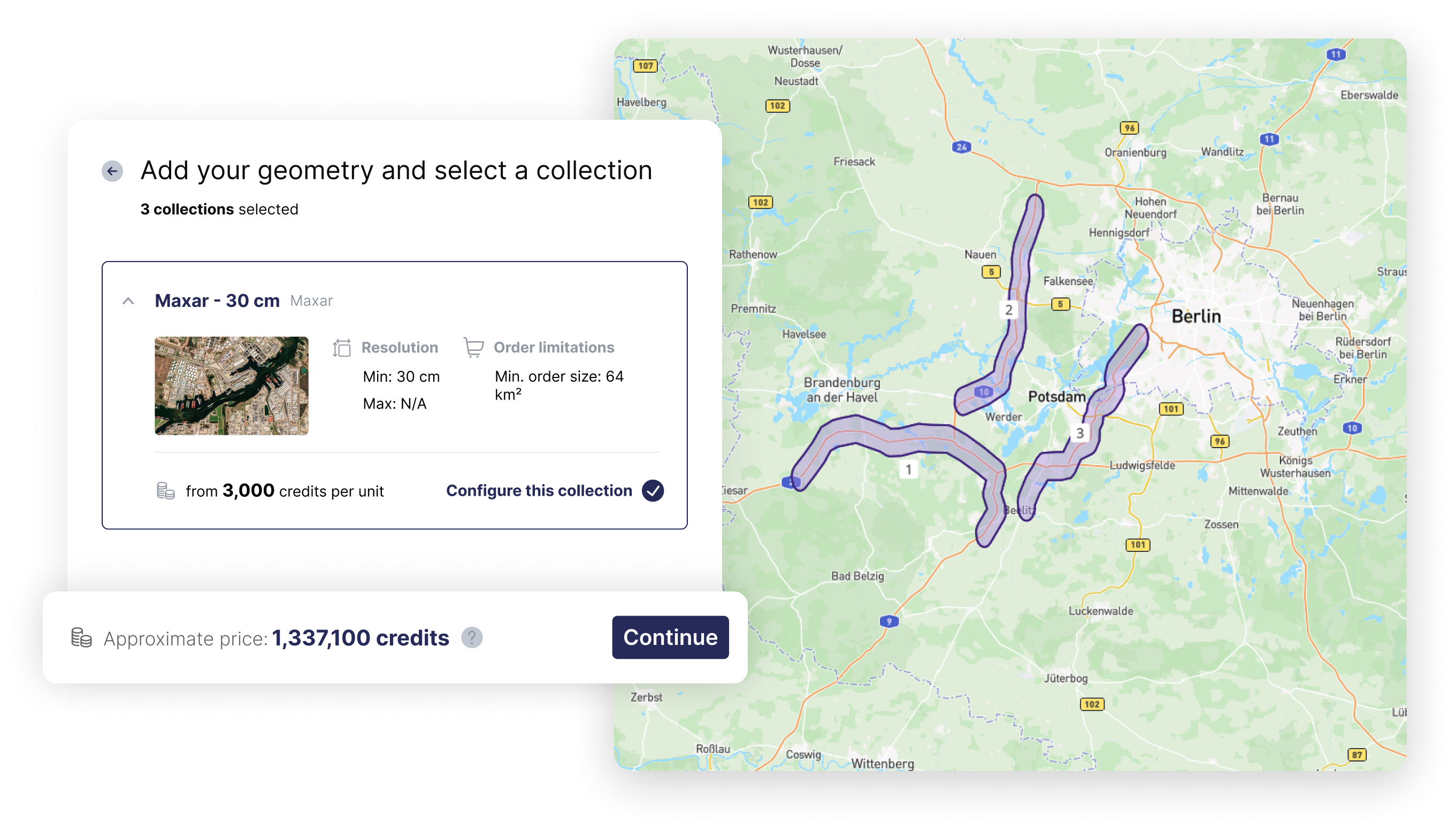
- Order tags: Add tags when creating an order to organize, search, and track the progress of all orders within your organization. You can also add, remove, or edit tags at any time. For this example, we are interested in the location of the project and will use Brandenburg as the tag name.
- Feasibility & Opportunities: You can review feasibility options and accept them directly on the platform. For supported collections, you can view potential tasking time slots and check whether a feasibility study is required, giving you better visibility into when your tasking order can be fulfilled.
- Repeat tasking orders: And if you need to monitor the same AOI (or multiple AOIs) over time, you can schedule repeat tasking orders by simply choosing between a one-time tasking or a recurring schedule across multiple intervals.
- Templates: Beyond creating repeat tasking orders, you can create templates for orders with consistent parameters, tailored to specific projects or use cases. Templates can be saved for a specific collection along with parameters such as cloud cover, processing level, incidence angle, and more. Your template library can then be shared and reused across your organization.
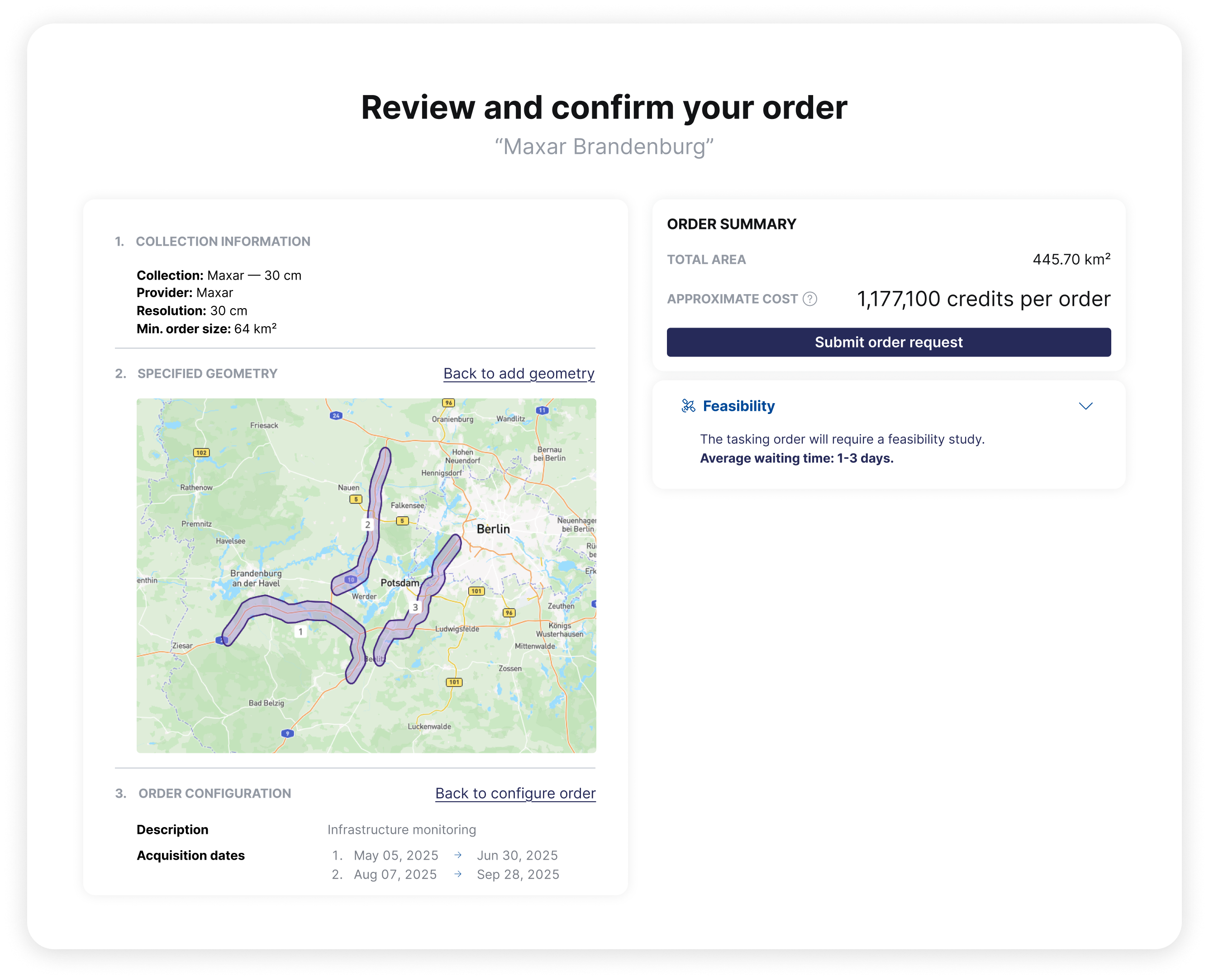
- Order summary: Lastly, you can view a complete summary of your order before submitting.
Monitoring your order
After submitting your order and accepting the price quotation (also directly on the platform), you want to be able to easily track and manage it. UP42 can help you here too.
- Progress monitoring: View the exact footprints of acquired scenes, the completion percentage, and the area in square kilometers for both delivered and pending imagery. You can also download the covered and remaining AOIs as KML files. If your tasking order is delayed, you have the option to search for archive imagery to fill in pending areas and keep your project on track.
- Notifications: If you’re working on a project with other team members and want to receive notifications about a tasking order created by someone else, you can subscribe to their workspace notifications.
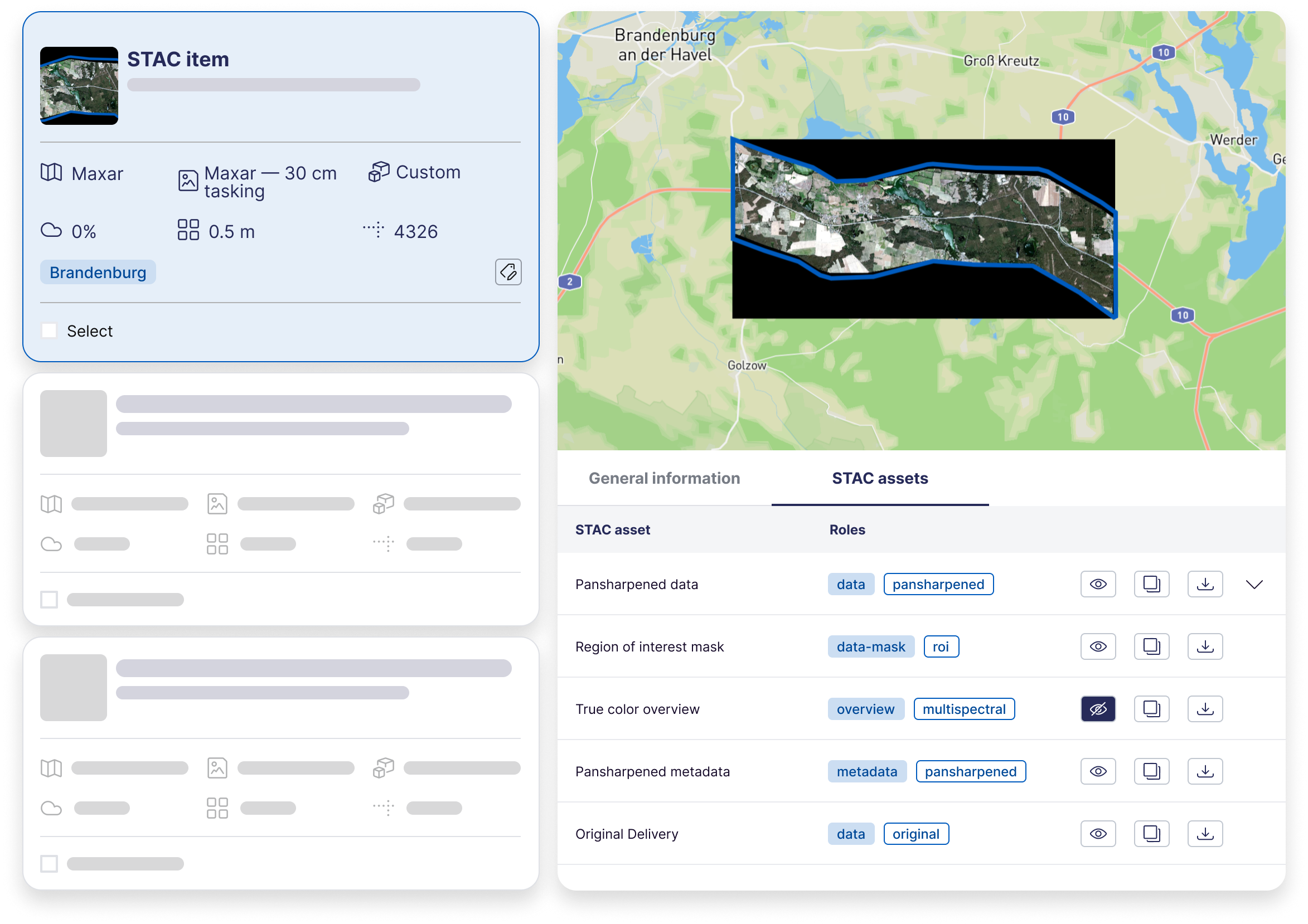
- Data visualization: You can visualize your data in our STAC-powered storage, where it's delivered in a standardized, cloud-native format with unified metadata and structure. Our platform offers advanced capabilities to search, filter, and sort your data, along with options to preview STAC items or specific features directly on the map (see the example of a true color STAC asset overview of Maxar’s data below). You can then stream or download either the entire asset or selected features.
One last thing before we wrap up: the features we’ve covered are available on the console, as well as through our API and SDK. If you have any questions or want to learn more, our documentation will guide you through every step of your tasking journey. Or, you can reach out to us directly via our contact form.

Subscribe to our newsletter
Stay up to date and learn about our fast-growing new features
