We're constantly shipping new updates that make ordering, managing, and processing geospatial data easier. From significant enhancements to subtle tweaks, here's a recap of the latest features that have gone live on our platform.
Revamped tasking flow with enhanced order status and delivery tracking
We released a new tasking flow last year that significantly improved the way our customers task satellites. Since then, we’ve continued to refine our tasking offering, enabling you to track tasking orders better.
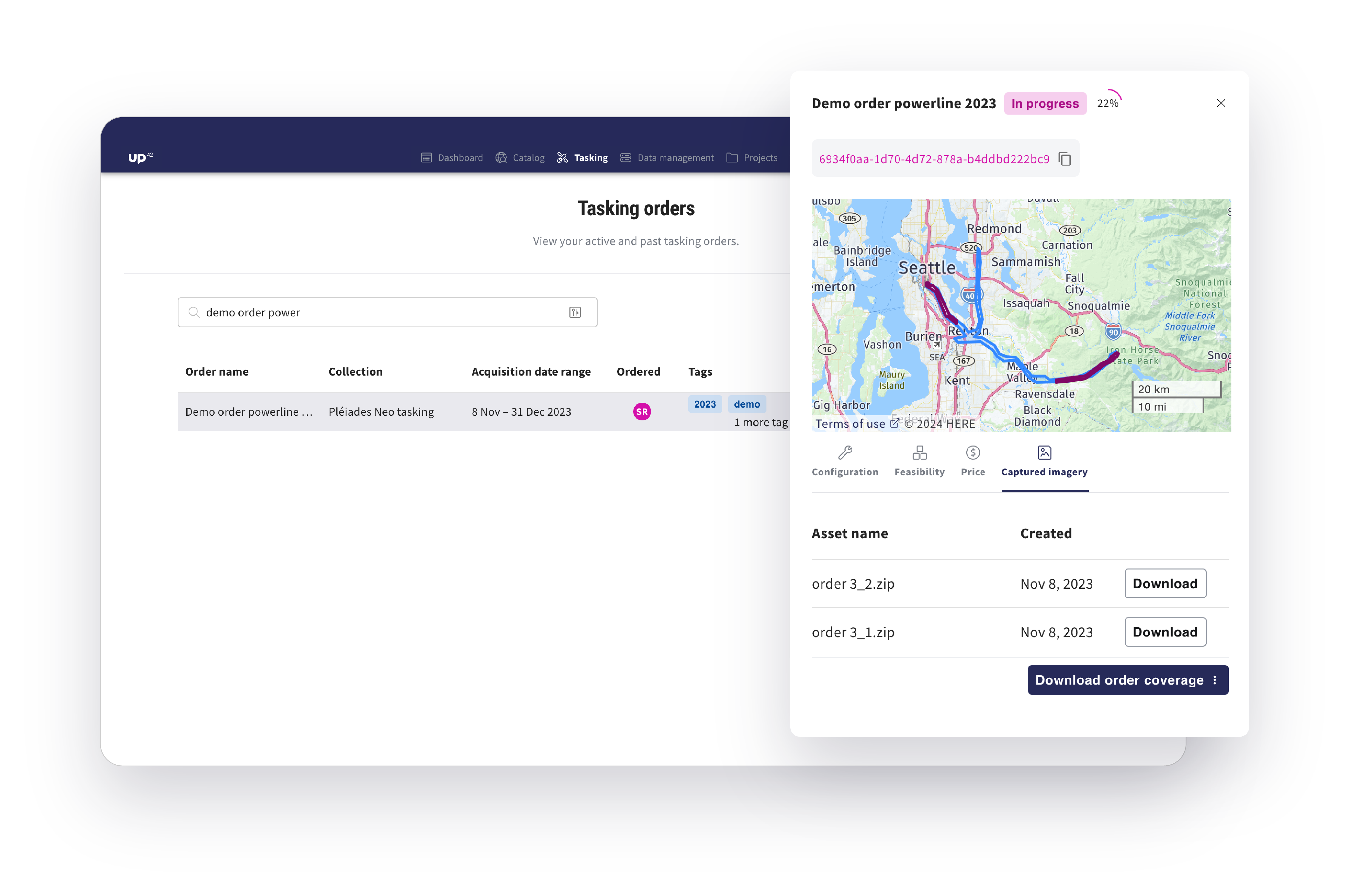
When you click on a tasking order, you could previously view the footprint of acquired scenes. Now you get a visual representation of the percentage of the already completed order and the option to download the remaining and covered AOI as KML files. This allows for better and faster internal decision-making while dealing with complex orders.
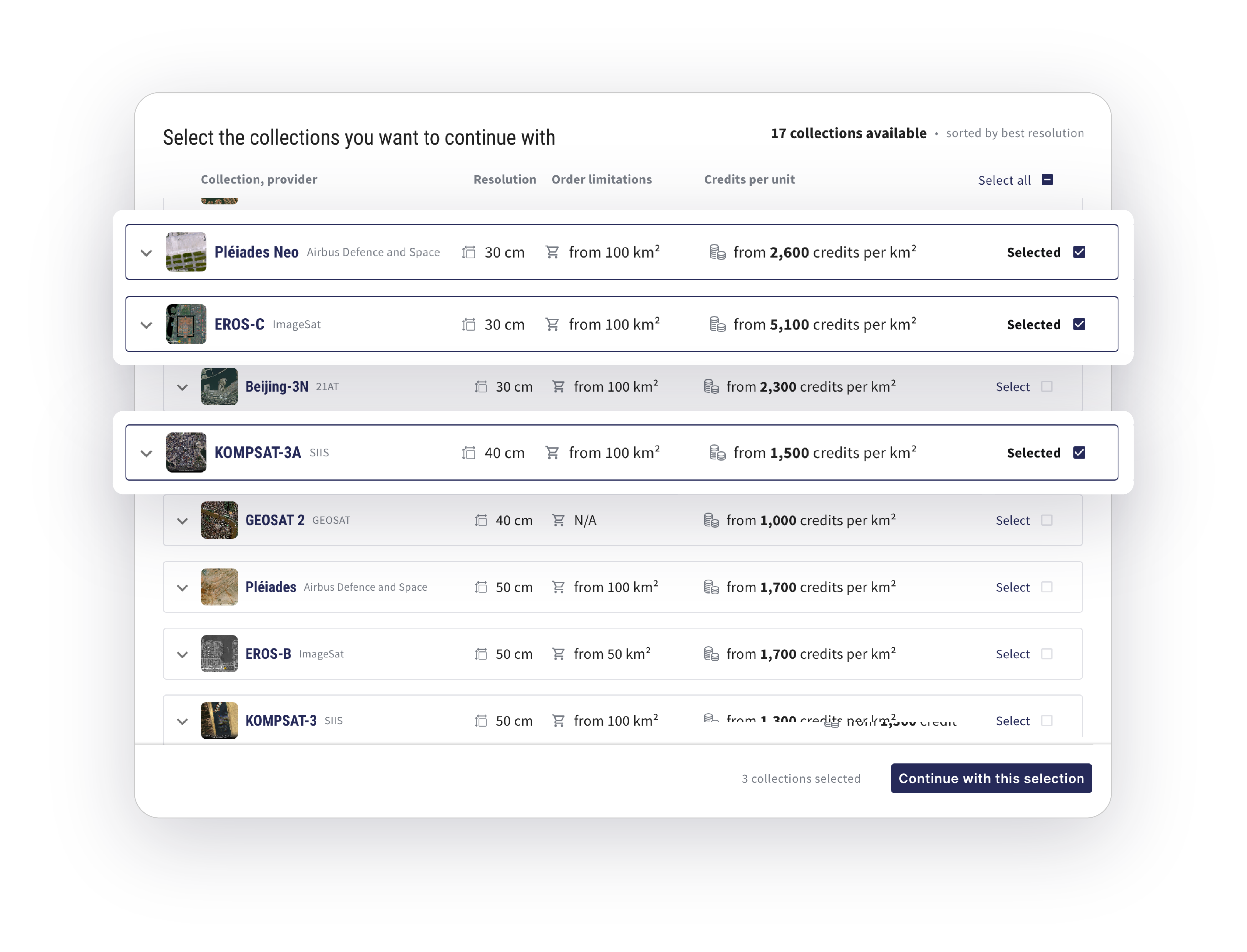
In addition to viewing the list of available collections and pricing upfront, you can filter this list by Data type and Resolution. Expect more filters with specific collection information, such as geometric and radiometric processing levels and stereo capabilities.
Check out UP42 tasking.
Processing capabilities from Nara Space, Spacept, and more
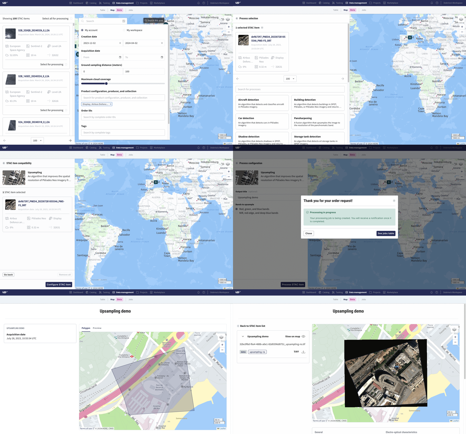
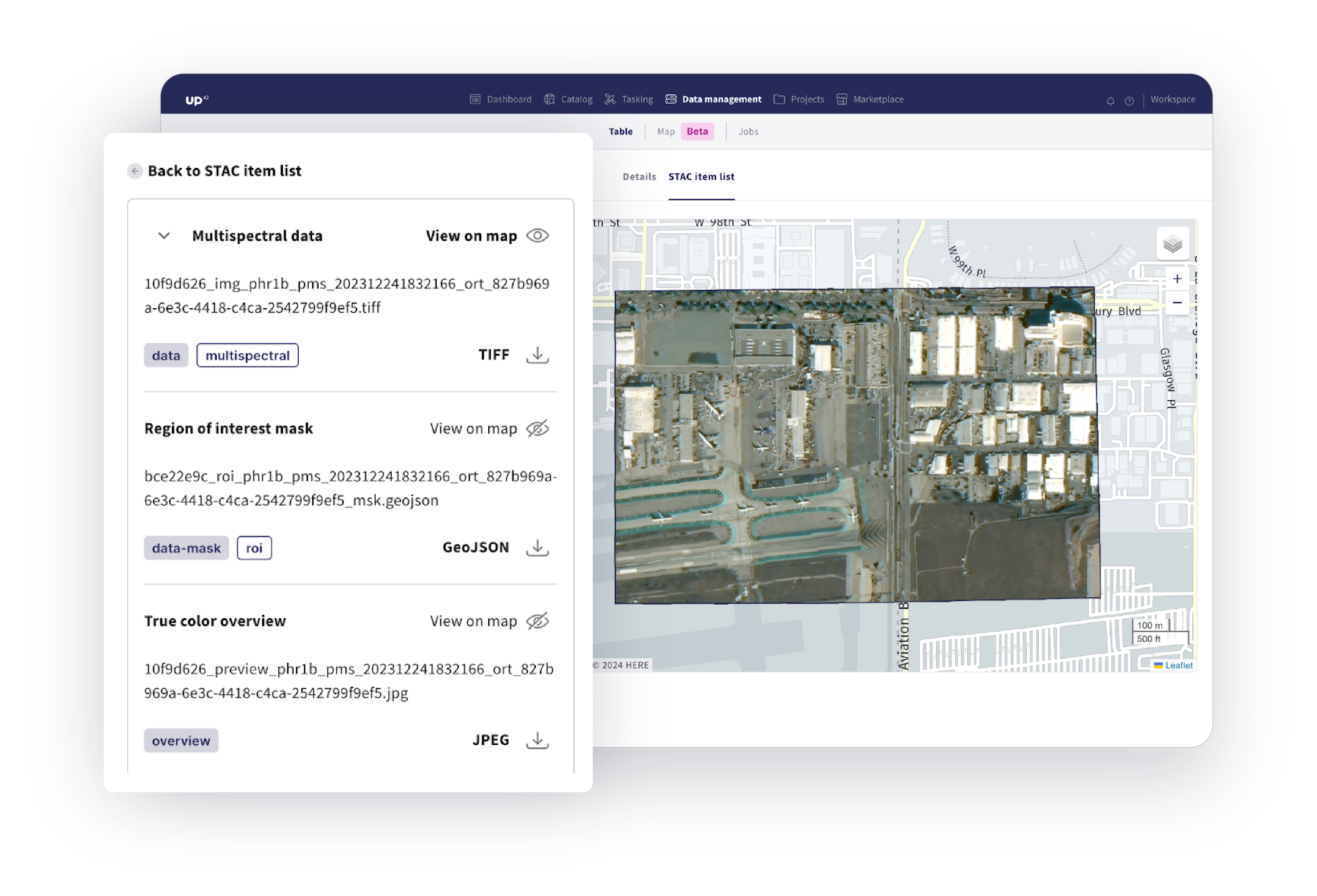
Processing on the UP42 platform is now easier and more scalable—we leverage STAC to improve validation, give you compatibility and price estimates early in the process, and let you process as many STAC items as you want. Go ahead and enhance your data with Upsampling from Nara Space, an algorithm that improves the spatial resolution of Pléiades Neo imagery from 30 cm to 10 cm. Or Pansharpening from Pixel Factory by Airbus, a fusion algorithm that upsamples the image to the resolution of the panchromatic band. Or get insights from your data with algorithms such as Building detection, Shadow detection, Tree detection from Spacept, and many more. How? If you’re a console user, go to data management, and in the map section, select the STAC items you want to process. Track the status in the Jobs table. Alternatively, create a new processing job using the UP42 API.
Effortless geometry management and new collections in the catalog
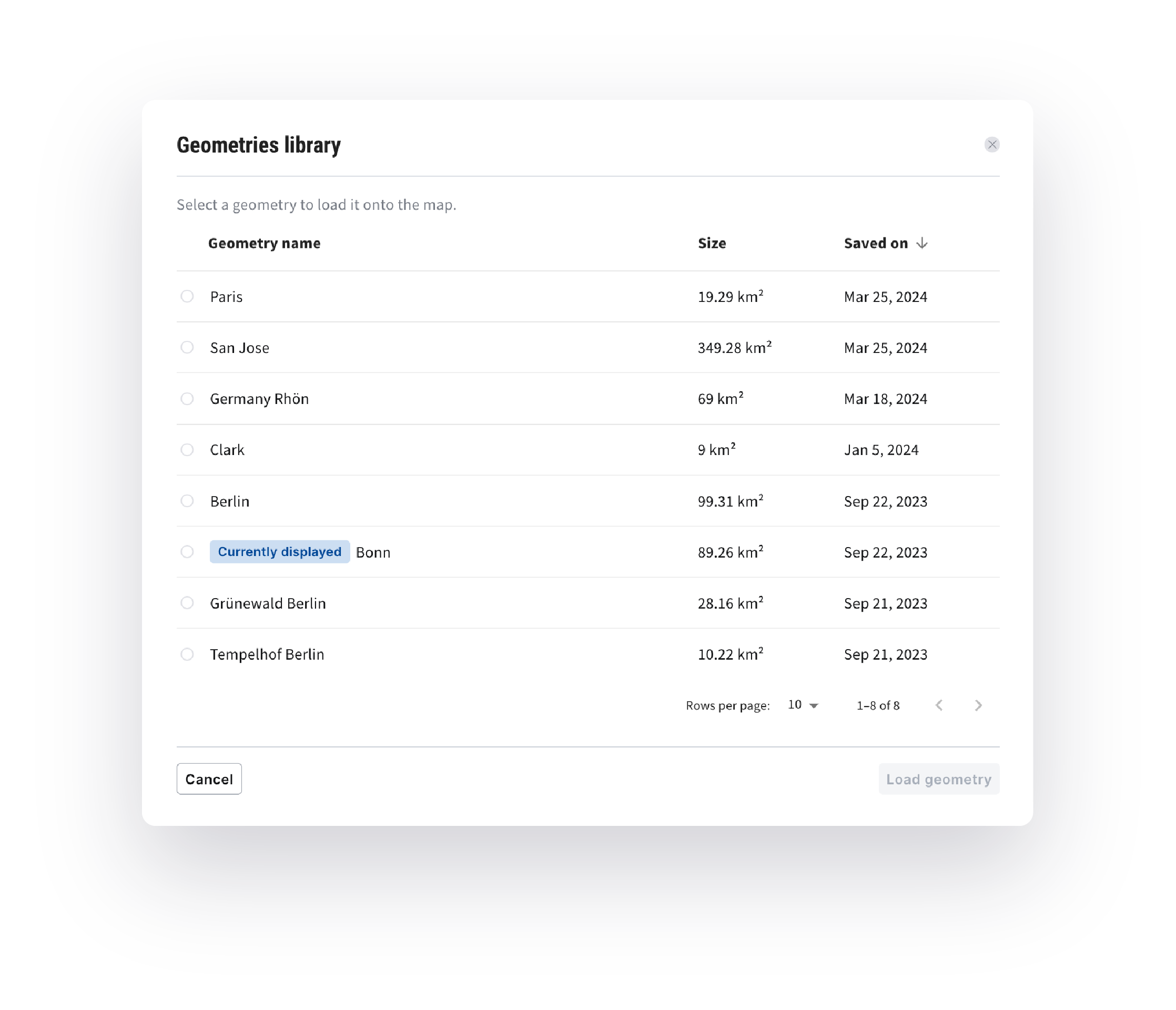
Save time and effort when managing your geometries in the catalog—store AOIs in your library, modify names or coordinates, and delete or generate new AOIs using existing ones.
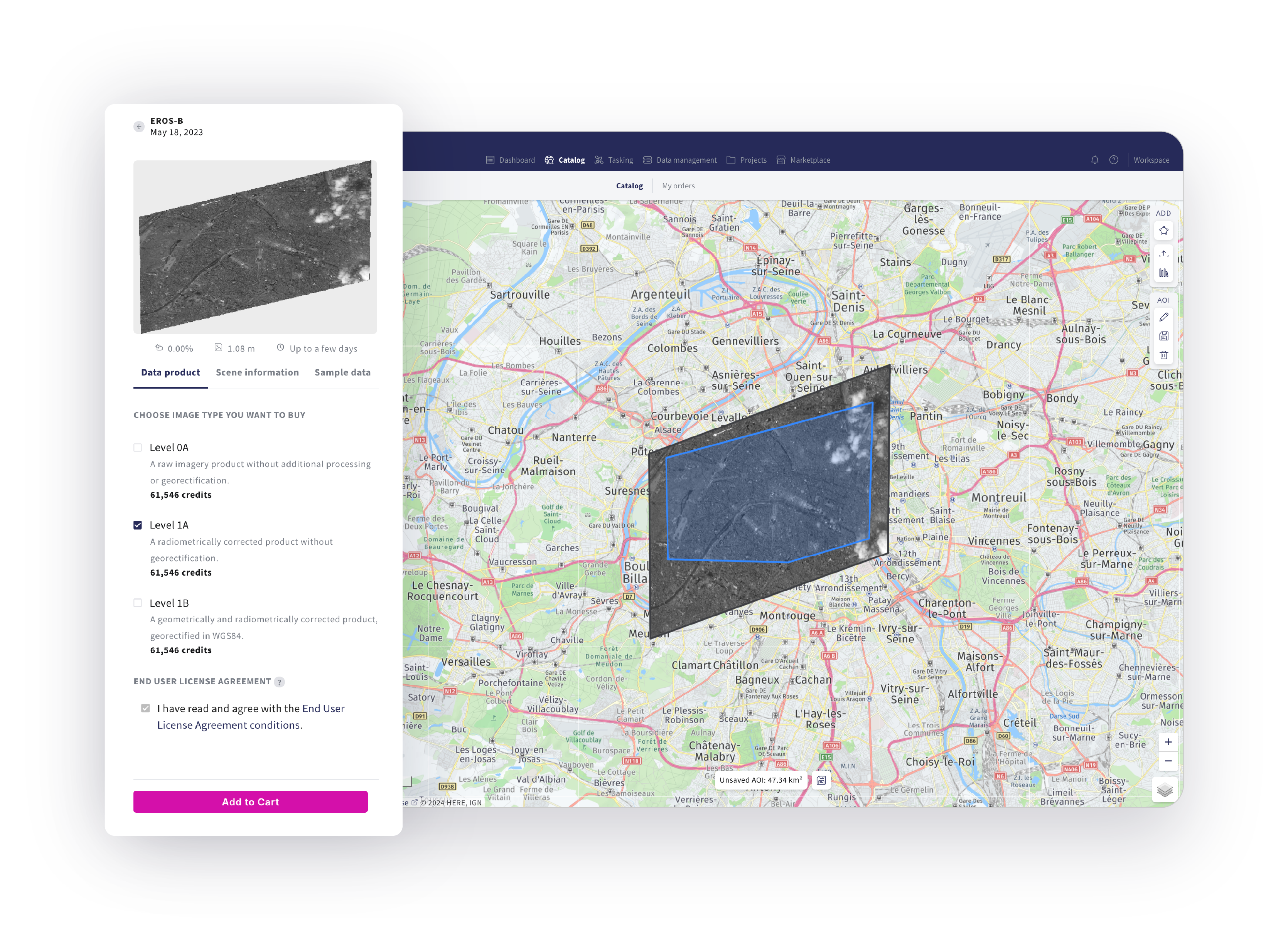
We also continue to enrich our platform with more diverse collections. Hexagon Elevation DSM (30 cm), as well as EROS-B (50 cm) and EROS-C (30 cm) optical satellite archive data from ISI, are now available on the platform. Place your order through the console or via our API.
Our sample data library is growing too: now with the additions from IMPRO (50 cm optical satellite imagery with mono, stereo, and tri-stereo capabilities), GEOSAT 1, and GEOSAT 2 (20 m and 40 cm optical satellite imagery, respectively).
Other platform updates
New notification subscription feature: When you work on tasking orders with multiple stakeholders, they must be able to receive and respond to order updates (like feasibility or price quotes). Toggle on notifications for specific workspaces that matter to you, and receive timely email alerts for relevant updates. Check out our documentation to learn more.
Improved visualizations: In your data management component, you can view, search, and filter all your STAC items on a map. We have also launched a new tiler service, making it easier to visualize and verify STAC assets—try it out with any band or delivery.
Last but not least, stay informed about the latest updates and improvements to our API and SDK, easily accessible through our documentation.
That’s all for now. We’ll be sure to reach out with more product updates soon.
