Unified geospatial operations across the mining lifecycle
Some mining organizations are just beginning their Earth observation (EO) journey with a successful pilot. Others are already heavy users, maintaining sophisticated in-house GIS departments. Regardless of maturity, the challenge today is rarely a lack of data. It’s much more likely to be the friction of turning that data into an integrated operational framework. While remote sensing is an effective way to monitor many different sites and remote assets, most organizations struggle to move toward a unified geospatial strategy. By shifting from ad-hoc data procurement to a unified operational model, mining companies can transform their EO data usage into a core driver of safety, efficiency, and sustainability across their entire portfolio.
Exploration and site selection
Traditional ground-based exploration is costly and time-consuming. Modern teams utilize a "Tip & Cue" strategy: leveraging free open-source data to identify geological anomalies before tasking high-resolution assets. Hyperspectral and SWIR (short-wave infrared) imagery, for example, from Vantor WorldView-3, can identify specific mineral signatures and alteration zones that are invisible to the naked eye.
Beyond mineral mapping, satellite data and elevation models provide a deeper understanding of terrain and hydrology. This helps identify potential mining pits, rock formations, and other critical structures while providing the necessary data to plan access routes, haul roads, and optimize site logistics.

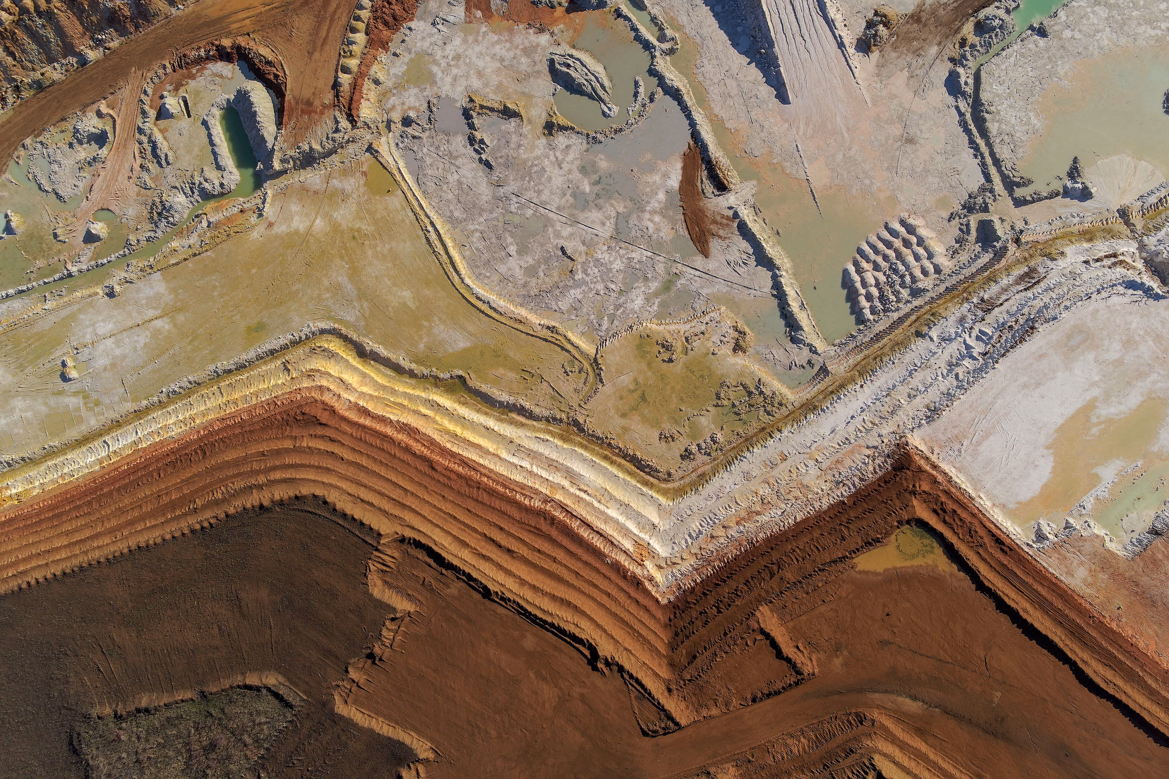
Monitoring site progress
Once a site is active, the challenge shifts to frequency and reliability of monitoring. High-frequency tasking from providers like Vantor, BlackSky, and Airbus allows for near real-time construction monitoring. Repetitive automated tasking helps track infrastructure development, audit stockpile inventory, and ensure open pits conform to mine plans. By digitizing the monitoring of field resources and road conditions, operators move away from manual site checks toward a proactive, data-driven management style that can be replicated at every site in the organization.
Asset integrity and multi-site risk management
Obviously, safety should be the top priority for mining sites, especially for tailings storage facilities (TSFs) and open-pit slopes. InSAR remains the gold standard for monitoring geotechnical stability, detecting millimetric surface movements over time. You can access SLC data from providers like Airbus, ICEYE, and Capella Space on the UP42 platform required to power these precise stability assessments.
In a unified geospatial environment, these insights aren't siloed in a single department. Instead, millimetric deformation data becomes part of a centralized risk management dashboard, helping teams maintain oversight of geotechnical stability across dozens of global sites simultaneously.
Environmental compliance
Modern mining requires transparent environmental reporting. Remote sensing data provides a permanent record of reforestation efforts, water quality, and land cover changes. Access to a vast historical archive is a strategic necessity for legal compliance. During site closures, fresh high resolution imagery documents successful reclamation, providing the definitive evidence needed to satisfy regulators and maintain corporate ESG commitments consistently across all regional operations.
Why scaling EO across mining operations is still difficult
Despite the clear benefits of EO intelligence, mining enterprises run into operational friction when trying to move from one site to fifty.
- Fragmented procurement: A single mine site might require SAR for stability, optical for construction, and hyperspectral for exploration. Managing dozens of disparate vendors, each with their own contracts, portals and pricing models, creates an administrative bottleneck.
- Operational silos: Every new area of interest often triggers a fresh round of legal and financial reviews. For global mining houses, decentralized sourcing across teams leads to a lack of transparency. This frequently results in expensive, duplicate data purchases over overlapping concessions and missed opportunities for group-wide volume discounts.
- Technical complexities: Converting raw pixels into actionable insights requires specialized engineering. When data arrives in inconsistent formats or through manual downloads, it prevents the creation of automated, repeatable workflows that can be deployed globally.
- The multi-site visibility gap: Without a unified platform, it’s nearly impossible to standardize monitoring protocols across sites to gain a true enterprise-wide view of risk and progress.
The UP42 approach: Building a unified infrastructure
UP42 solves these barriers by acting as the geospatial operating system for the mining lifecycle. Rather than managing dozens of individual relationships and custom integrations, the platform provides a unified infrastructure to access and manage the world’s largest geospatial repository.
- Standardized and centralized procurement: We unite optical, SAR, lidar, hyperspectral, and elevation data into a single environment. Whether you need all-weather reliability with SAR, stereo tasking for volume assessments, or hyperspectral / SWIR data for mineral identification, the complexity of the contract and the data format is handled for you. The platform offers the flexibility your projects require, from resolution levels and acquisition modes to processing levels.
- Automated integrations: Our API and Python SDK allow your engineering teams to build automated pipelines directly into existing GIS workflows. By delivering standardized, analysis-ready data, UP42 ensures your teams spend less time on manual downloads, inconsistent data formats, and pre-processing and more time on high-value analysis.
- Enterprise governance & security: A centralized platform approach ensures visibility into spending, maximizes volume discounts, and protects sensitive proprietary data under SOC 2 Type II and GDPR standards.
- Strategic advisory: Beyond simple troubleshooting, our dedicated experts act as an extension of your geospatial teams. We provide the specialized guidance required for complex, cross-sensing tasking and success planning tailored to the unique geospatial demands of the mining lifecycle. From optimizing data selection for remote exploration to custom development that ensures seamless pipeline integration, we focus on accelerating project delivery and maintaining operational continuity across your global assets.

Operationalizing stockpile volume assessments
Let’s look at an example: calculation of stockpile volumes. To do this accurately across multiple global sites, you need consistent, high-quality elevation data. By calculating the difference between a Digital Surface Model (DSM) and a Digital Terrain Model (DTM), teams can measure volume changes over time. UP42 simplifies this by offering immediate access to diverse high resolution elevation collections, from Vantor Vivid Terrain and Airbus Elevation to NEXTMap and Vexcel.
Furthermore, the UP42 platform enables the use of stereo/tri-stereo imagery (from providers like Airbus, BlackSky, GEOSAT, IMPRO, and Vantor) to generate fresh, site-specific elevation models. By providing a single point of access for these disparate sensors, the platform allows mining companies to standardize their volume reporting globally.
Unify your approach to geospatial data with the UP42 platform
The examples above represent a shift in how the mining industry perceives geospatial intelligence: as a foundational layer of their operations. UP42 is designed for the enterprise that needs to manage massive volumes of data and complex cross-team coordination. By unifying data, processing, and vendors into a single ecosystem, you eliminate the friction of fragmentation. This model saves money, and provides the visibility and agility required for long-term, sustainable growth in an increasingly complex global landscape.
Want to try out the UP42 platform? Sign up for a free account here.


Subscribe to our newsletter
Stay up to date and learn about our fast-growing new features
