Synspective and the potential of SAR for mining
Our last blog post on mining gave a fairly broad overview of using Earth observation data, from optical and elevation to hyperspectral. In this one, we're going to focus on SAR (Synthetic Aperture Radar), while highlighting one of our new partners: Synspective.
How SAR works
SAR is a remote sensing method that places a sensor on a moving airborne platform. This platform can be a satellite, a drone, or an aircraft, for example.
SAR sensors emit microwaves and collect the returned waves to create an image.
But why "synthetic"? Because with traditional radars, larger antennae create a larger aperture (the portion of the antenna that emits and/or collects information). By that logic, the bigger the antennae, the more information it can collect.
SAR creates an aperture by using the space that it passes through above its defined area as its antenna. Depending on the platform's height above ground, this can create a synthetic aperture that spans multiple kilometers. This is much more practical than building one. Imagine trying to launch a three kilometer antenna into space.
As with most Earth observation imagery, SAR data still needs to be processed after collection. In its raw form, it's just a mix of grey and black pixels, kind of like TV static. But luckily, there are lots of algorithms that will take care of this processing for us.
SAR also has one major advantage over optical sensors: it can see through clouds and smoke, which makes it extremely useful during cloudy weather or disasters that cause heavy smoke.
For a deeper dive into SAR, take a look at our dedicated article.
How to use SAR for mining
One of the most important ways in which SAR can be used by the mining industry is multi-temporal InSAR (short for interferometric SAR) techniques.
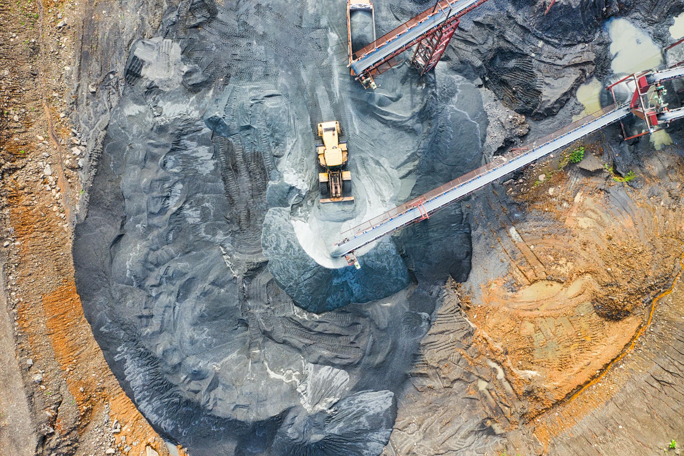
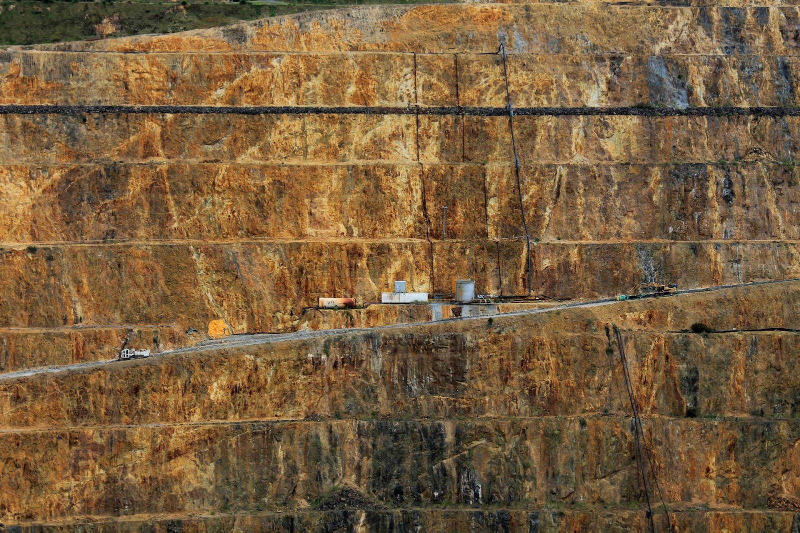
The process of digging into the earth to retrieve precious metals opens up a whole slew of potential problems. First off, open-pit mines like the one pictured below are in danger of slope failure, either from bad planning or unexpected heavy rainfall. Slope failure can lead to catastrophes, causing miniature landslides that hurt or bury workers.
Underground mines, meanwhile, can cause ground subsidence: the collapse of surfaces. This is extremely dangerous, especially when it impacts neighborhoods or roads. And on the other hand, underground mining can also cause uplift, where the ground's surface distorts or swells, damaging infrastructure and creating unsafe conditions.
Then there are tailings dams, which are built to contain the waste produced by mining operations. Tailings are mostly rock and mineral dust, and leftover chemicals, mixed with water to form a sludge. Tailings dams grow bigger over time, and need to be monitored extremely closely, as even a minor leak could cause serious environmental damage and health issues to anyone in the vicinity.
All of these examples present multi-temporal InSAR monitoring opportunities. InSAR compares captures of the same area, taken at different times. By comparing minor differences between images, you can create an image called an interferogram, which maps differences in the interference of the returned signals.
To get even more advanced, and to remove other sources of information that might be causing distortions, a method called Differential InSAR is used (and this is the last time we'll expand the SAR name, don't worry). Differential InSAR can either use another SAR image or a Digital Elevation Model to help account for atmospheric conditions or other interference, allowing for an extremely precise measurement of the ground's surface that wouldn't even be visible to the human eye.
Synspective recently took part in a digital event on mining with Geoawesome. In the below video, Synspective's Customer Engineering Manager Asuka Wachi gives a presentation on how SAR can be used for mining:
Want to learn more about using SAR for mining? Let us know! Our team would be happy to help.


Subscribe to our newsletter
Stay up to date and learn about our fast-growing new features
