UP42’s data management and streaming capabilities

In this post, we’ll take a more in-depth look at UP42’s data management capabilities. As your business scales, managing large volumes of geospatial data across projects becomes a major challenge. UP42 solves this with a centralized solution where you can easily store, access, and organize geospatial data.
UP42’s data management solution offers some distinct advantages
- Data harmonization: The data you order through UP42 is translated into a unified format, so you don’t have to worry and spend time on parsing and normalizing data.
- Flexible access: It doesn’t matter whether you have a preference for the UP42 web interface, API, Python SDK, ArcGIS add-in, or 3rd party tools like QGIS. We’ve got you covered.
- Analysis-ready data (ARD): UP42 provides tools that improve resolution and deliver ARD, allowing you to focus on your use case while leaving the heavy lifting to us.
- Reliability: We offer scalable, secure, high-availability architecture for hosting your data. UP42’s data management ensures robust data protection and 24/7 access across the globe, helping you save costs.
In a previous post, we looked at tracking for complex tasking orders, both on the UP42 console and the API. Once your order is placed and the sensor starts collecting imagery for your AOI, the image deliveries are stored as STAC items in your data management space.
Over the past few months, we’ve shipped a number of cool features around data management to make our customers’ work easier. Let's consider a practical example to see how you would find specific deliveries associated with a project, visualize it, and then stream the images on 3rd party tools like QGIS.
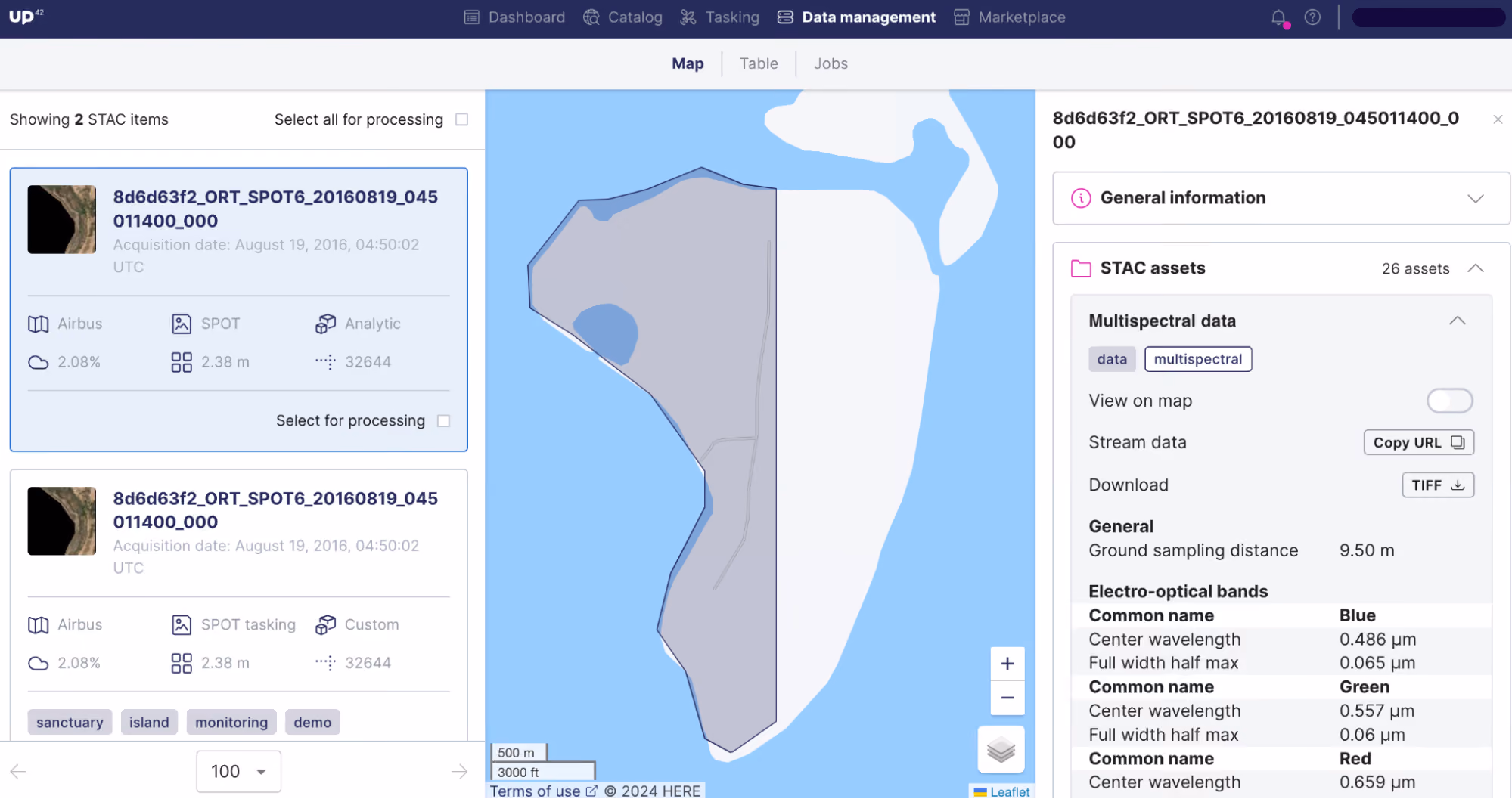
1. Place a search on data management

The search function within data management gives you a centralized location to find all of your ordered items. You can place a search just for your account or across your business workspace, and add filters to narrow down on specific project deliveries (listed as STAC items). In this example, we use the tags we created while placing our tasking order to initiate a search and find the specific images that we’re looking for. (Tags are a popular feature among our customers while placing larger orders. It allows you to group and identify image deliveries.)

2. Find your STAC items
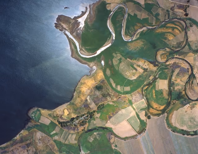
After you initiate the search, the relevant STAC items (with the associated tags) are loaded onto the basemap view. On the right side, all asset metadata is neatly arranged under different categories, giving you a clear view of the delivery file’s information.
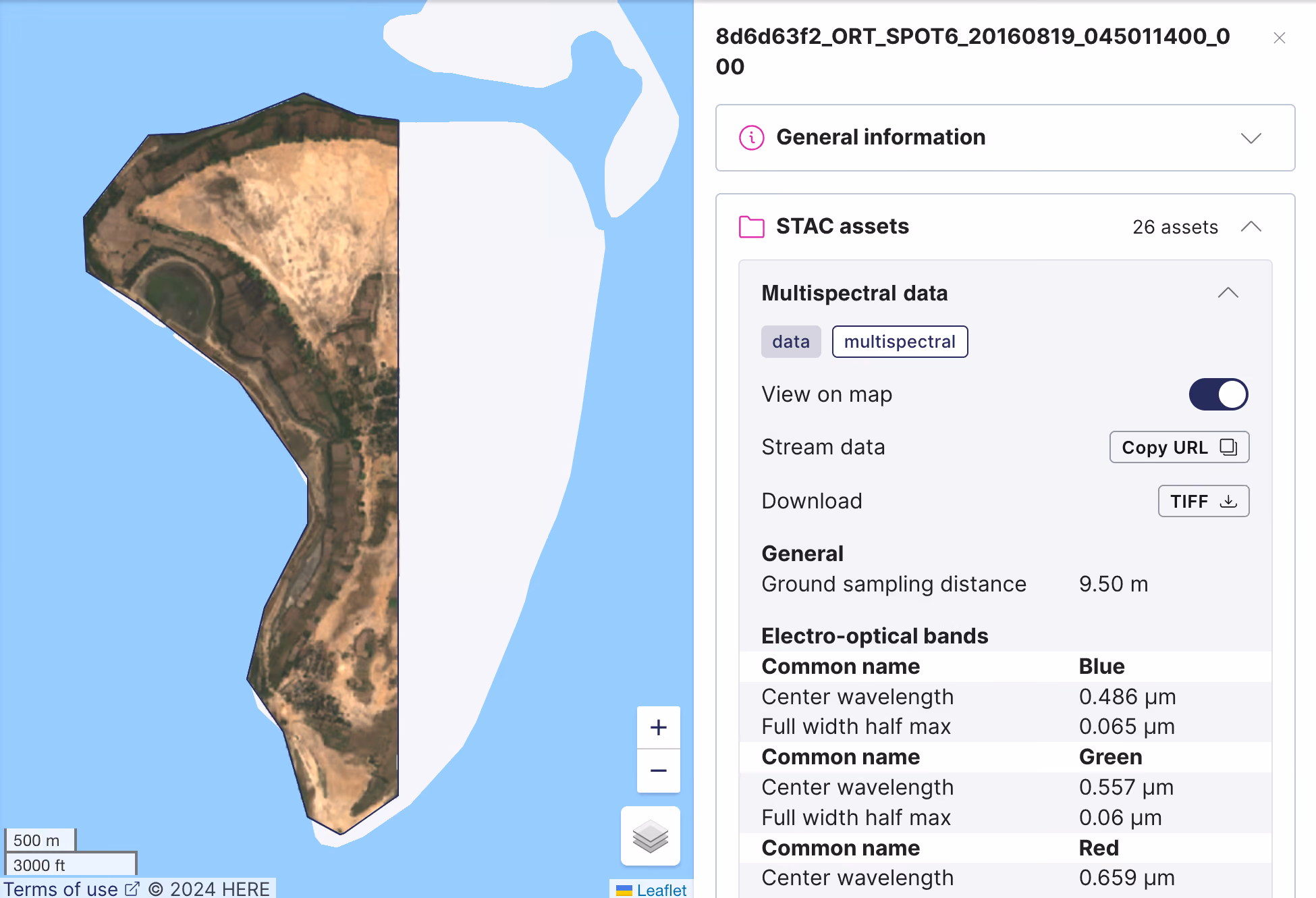
By toggling the ‘View on map’ option on the right, you can do a quick visual check of the delivered asset, without the need for downloading. When you have bigger projects with multiple AOIs, this feature gives you visual context into the status of delivery coverage, letting you make project decisions faster.
3. Process the imagery with UP42’s built-in algorithms
From this point, you get a lot of flexibility with your next steps. In case you’d like to process your imagery straight away, you can do so on the UP42 platform by clicking the ‘Select for processing’ option under each STAC item. You can choose any one of the built-in processing algorithms available on our platform, saving time and giving faster output.

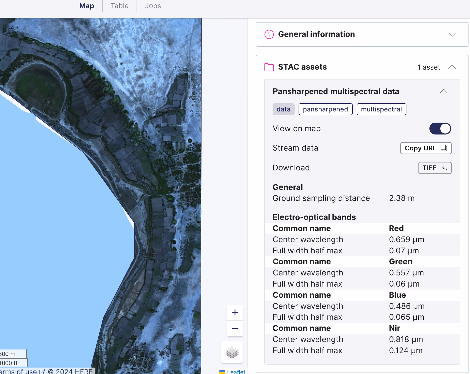
In this example, we choose the Pansharpening algorithm that upsamples the image to the resolution of the panchromatic band. You can find more information about this algorithm and the pricing on our marketplace. Once you confirm the credits and initiate the processing request, the results can be viewed under the Jobs tab within Data management.

Once the processing is complete, the final output can be viewed as a STAC item under the Map view. Again, we’ve made it very easy for you to visualize the results on the basemap, without the need for downloading and checking it separately.
4. Stream the imagery on 3rd party tools
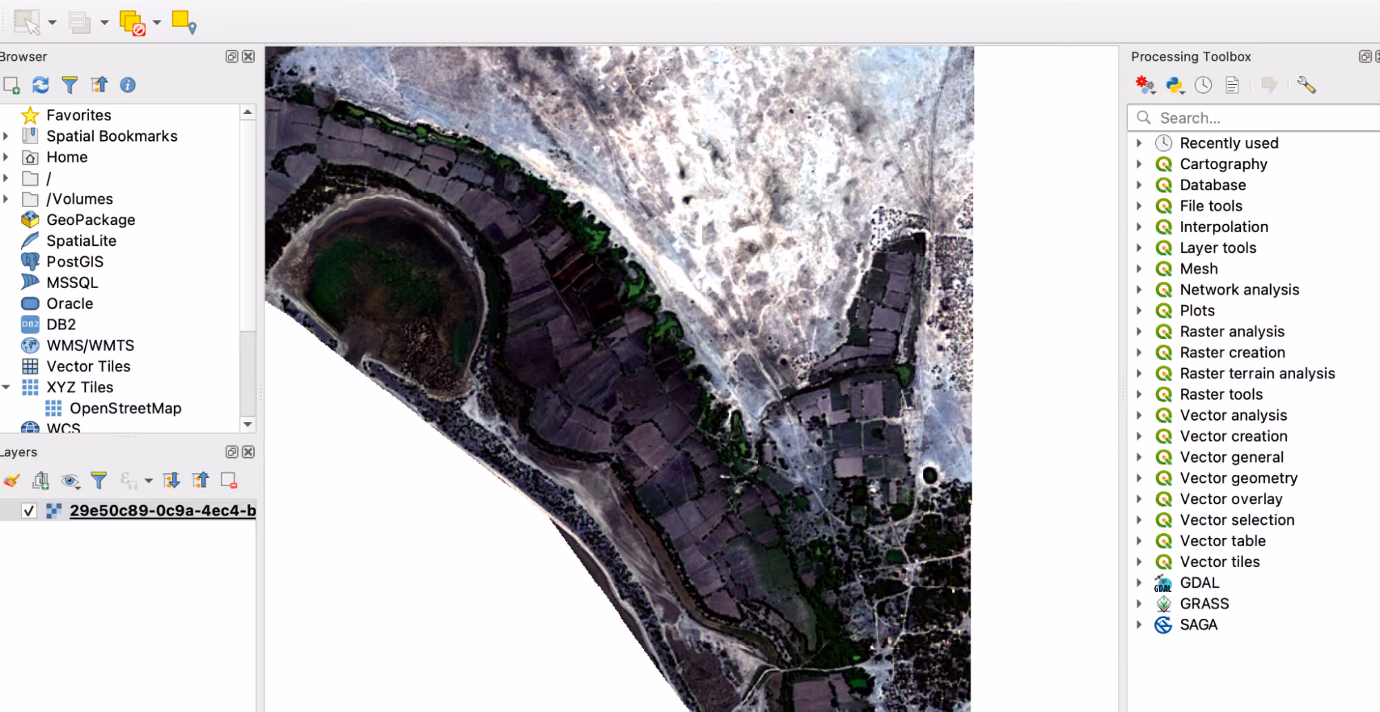
Remember what we said about flexibility? Assets in UP42 data management can be easily streamed thanks to the cloud-native asset model that we introduced last year. We automatically convert raster data into cloud optimized GeoTIFFs (COGs) and vector mask files into GeoJSONs. Instead of downloading multiple (massive) files to your system, you can view UP42 assets on QGIS by using the Copy URL option.
Our documentation walks you through the process of visualizing your orders and processing results on QGIS. The STAC asset will be added as a new layer, and you can do further analyses on this image based on your specific use case.
To summarize, we help you centralize your data management for geospatial projects, enabling easy downstream integrations. What we’ve covered is just one part of the vast functionality that data management now offers. Interested in trying out UP42? Try out data management here. In case you’d like to reach out directly with questions or feedback, please let us know here and we’d be happy to help.

Subscribe to our newsletter
Stay up to date and learn about our fast-growing new features
