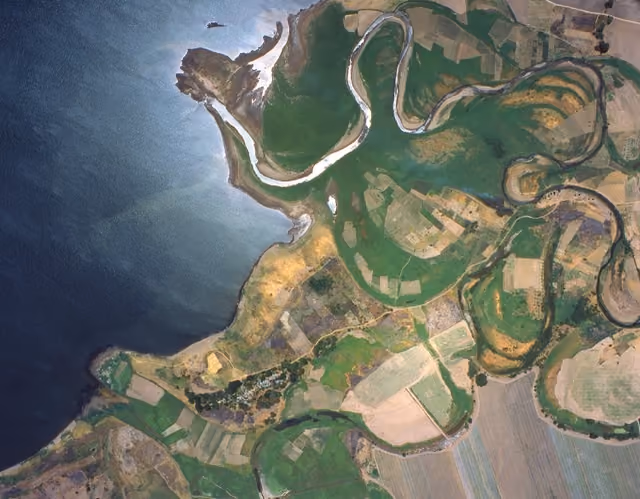
Bring more clarity to your projects with Maxar and 15 cm data
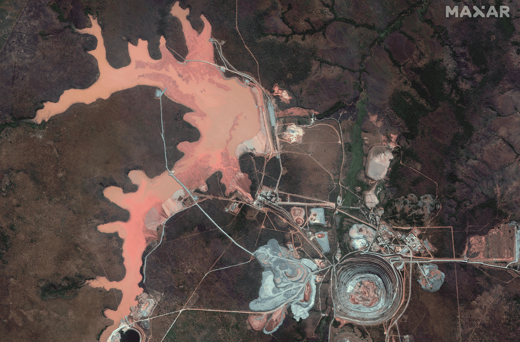
In case you hadn’t heard, we recently partnered with Maxar. You can now order archive data or task Maxar’s constellation, including GeoEye-1, WorldView-2, WorldView-3, and WorldView Legion, directly through the UP42 platform.
Not familiar with Maxar’s data? Here’s what to expect:
- 15 cm HD, 30 cm and 50 cm imagery
- Revisit rates of up to 15 times per day
- Mono and stereo formats (tasking only, archive coming soon)
- 9 spectral bands
- Exceptional positional accuracy (<5 m CE90)
- Extensive archive imagery dating back to 2007 for some collections
And soon to come, more dimensions to your analyses with Maxar Intelligence’s 3D and elevation models. Dive into our documentation or check out the latest blog post for more info.
Upsampled 15 cm satellite data is ideal for object detection: think solar panels or vehicles, infrastructure monitoring, detailed mapping, civil engineering, and urban planning. We’ve also enhanced our Pléiades Neo HD15 collection, now available for standard ordering through the platform with the same file structure as other Airbus collections, and delivery in under 48 hours.
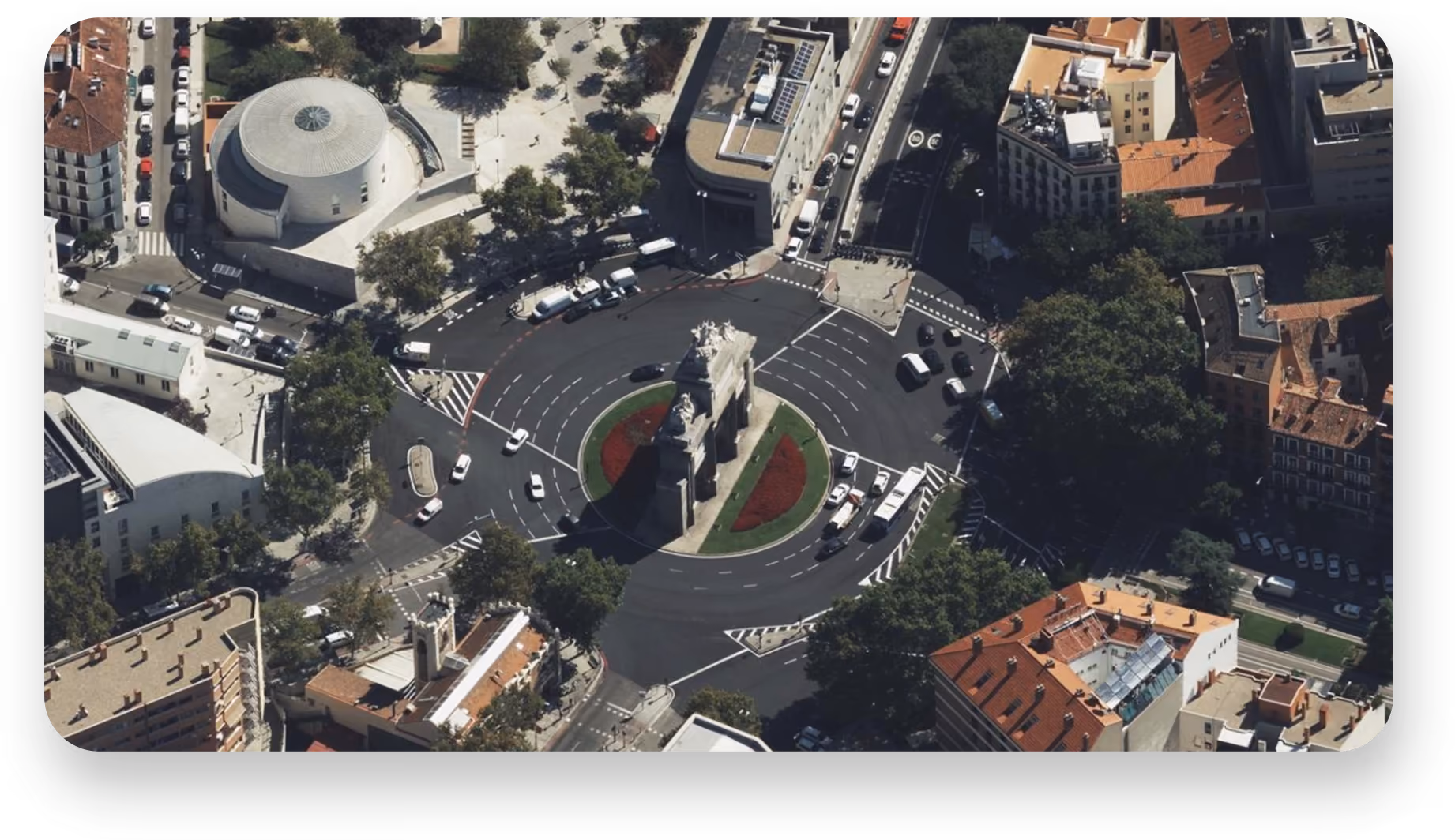
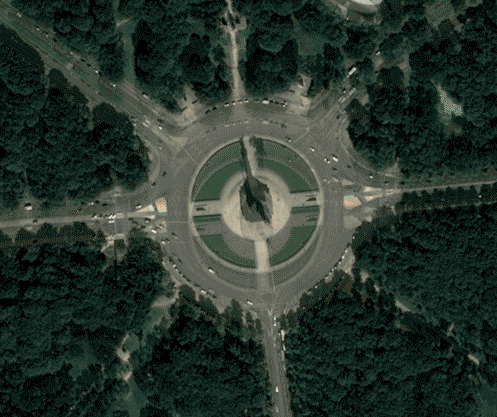
Aerial imagery from every angle
One of our most popular collections just got an upgrade. Vexcel Aerial Obliques and Nadir imagery is now available through the platform. Get full RGB scenes of oblique imagery at 5.5–7.5 cm resolution, captured from all four cardinal directions at a 45° angle—perfect for 3D visualization and site assessment. Order Vexcel data now.
Ensure optimal alignment across diverse datasets
Are you working with geospatial imagery taken from multiple acquisition angles, times, and sources? Differences between sensors and angles often result in misalignment. Our new coregistration algorithm from Simularity automatically aligns a source image to a reference image, detecting and correcting mismatches between features to ensure optimal alignment across multi-temporal and multi-sensor datasets. Learn about coregistration here.
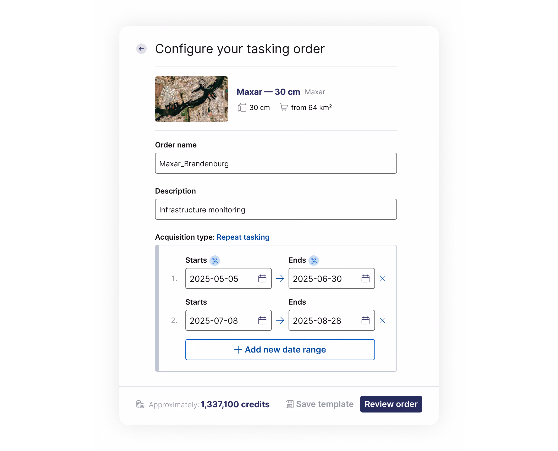
Set up recurring tasking orders with minimal effort
Need to monitor the same AOI over different periods? Repeat tasking orders give you a faster, more flexible way to do so. For example, if you want to monitor construction site progress, you can schedule recurring tasking orders to capture weekly site imagery, automating the process and guaranteeing consistent data.
Full control with less clicking around
We've replaced the table view with a map-first interface, allowing you to access, search, filter, and analyze all your geospatial assets directly on the map, with easier previews, tag management, and consistent metadata for smoother API/SDK integration.
You now also have the flexibility to delete your data at any time—and soon, you’ll also be able to upload your own. Full control, just as promised.
Navigate our growing number of collections with detailed documentation
We’ve always taken pride in the quality of our documentation, and now, in addition to our previously documented integrated collections, you can also explore manually orderable data collections. This update allows you to compare product specifications and ordering conditions at a glance.
Upgrade to our new SDK
Lastly, don’t forget our SDK. Version 2.2.0 is now live with new functionality and powerful features like improved asset management, enhanced order templates, and better processing. Support for versions below 2.0.1 has ended, so upgrade now to avoid service interruptions, maintain security (project credentials will stop working), and ensure compatibility. Full details in our changelog.

Subscribe to our newsletter
Stay up to date and learn about our fast-growing new features
