How aerial and elevation data helps with construction monitoring
Why use aerial imagery and elevation data in construction projects?
There is no single answer.
For some, aerial imagery represents a faster, cost-efficient, and more regular way to gather site data. For others, aerial imagery offers new data types that were previously unattainable, or fresh perspectives on project sites and their surroundings.
Aerial and elevation data both fill information gaps, enabling better decision-making and improved project outcomes. Their large area coverage and fast and timely data collection further justify their use.
This article explores the benefits of aerial imagery and elevation data in monitoring engineering and construction projects.
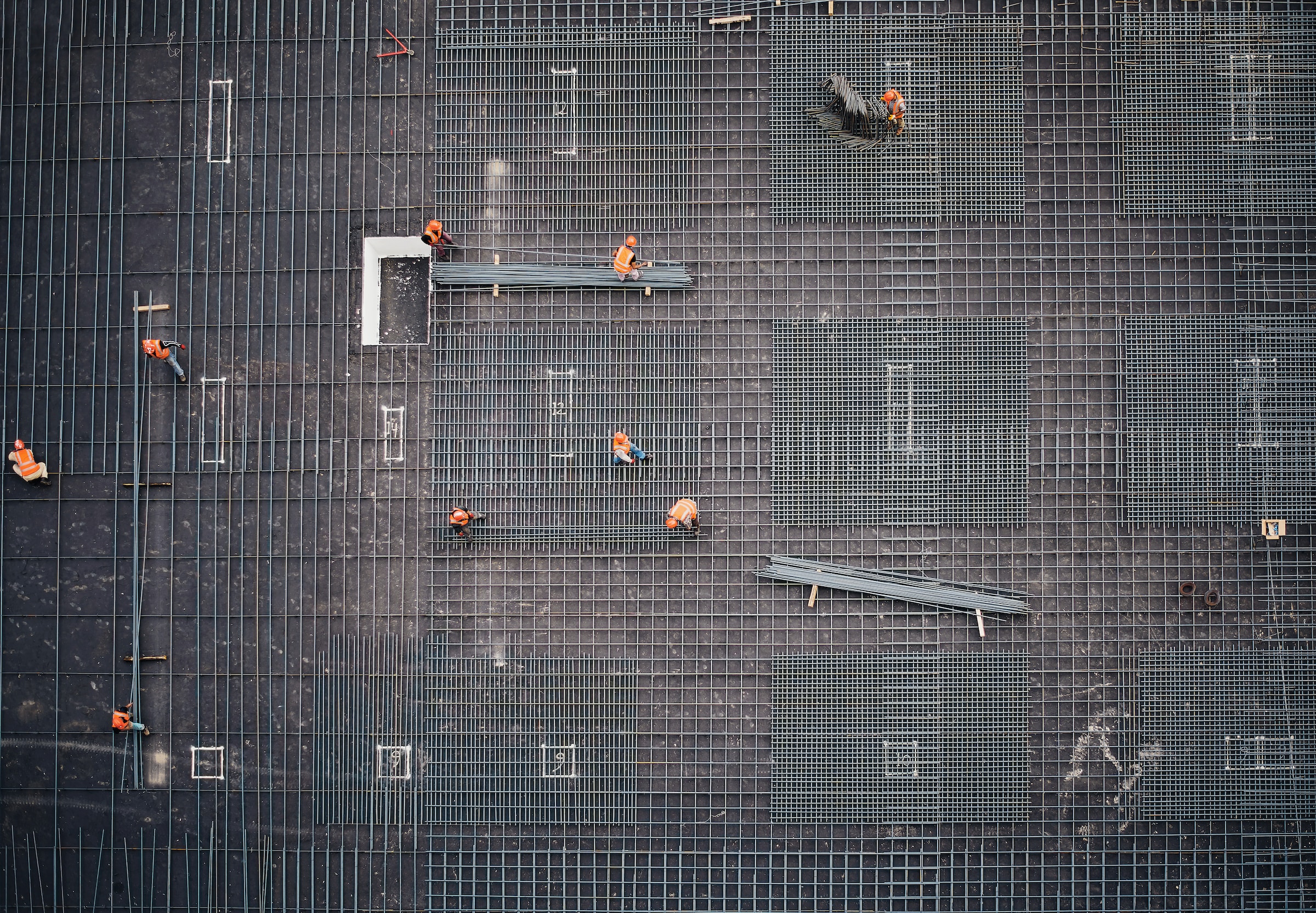
Aerial imagery is imagery captured from airborne platforms like aircraft, unmanned aerial systems (UAS)–more commonly, drones–or even balloons. Aerial images provide a bird's-eye view of surface objects.
Depending on the sensor type, aerial images are typically one of the following:
- Red, Green, and Blue (RGB) images: Similar to what we see with our eyes
- Multispectral images: Contain 3-5 spectral bands
- Hyperspectral images: Contain multiple spectral bands
Elevation models and 3-dimensional models can also be extracted from aerial images. These datasets are useful for extracting information like precise areas, volumes, and distances throughout the construction life cycle.
The key benefits of aerial imagery include:
- Very high spatial resolutions, enabling detailed detection of small site details like equipment
- A broader area perspective than ground surveys, for time-efficient monitoring over the construction site and surrounding area
- The ability to capture vertical or oblique imagery, enabling orthorectification and integration into GIS and CAD software, and helping to build a more complete picture of the project site
Next, we'll look at specific areas where aerial imagery is used in construction monitoring.
Monitor construction progress
Progress monitoring is important for timely project delivery within budget and quality standards. As such, there is a need for regular and timely information regarding the project's as-built status.
Some types of monitoring can be dangerous. Take, for example, having to document progress for roofs or bridges. In this case, it would be difficult and risky to manually take pictures from different vantage points to document progress.
Aerial imagery, on the other hand, enables data capture of tall infrastructure like roofs and bridges from different angles. It can provide different perspectives on construction progress, and help with site safety.
Another advantage is that compared to ground surveys, the more extensive area coverage of aerial imagery facilitates viewing of the surrounding areas and helps to identify potential influences on the site.
In addition, because aerial imagery depicts the as-built structures–from curbs and walls to slabs or buildings–one can overlay the design linework on orthorectified aerial imagery, to verify whether infrastructure has been built according to plan.
What's more, aerial imagery helps to document project progress. As a result, it provides a single source of truth regarding project progress to all stakeholders, potentially reducing disputes.
Monitor safety and reduce risks
Construction sites are high-risk areas. According to the U.S. Bureau of Labor Statistics, nearly 1 in 5 workplace deaths occurred in the construction industry.
Conventionally, safety monitoring is undertaken by visually inspecting the construction site for potential hazards and taking prompt actions to eliminate them. Thorough safety inspections, therefore, call for site visits which are time-consuming, labor-intensive, and prone to errors. Sometimes, it is difficult to detect unsafe conditions until they have led to accidents or near misses.
Thus, proactive site inspections are needed to identify safety hazards and take preventive measures. In this regard, aerial imagery provides a bird's-eye view of the entire site, and can be a huge help in supporting safety. The images will show placement of materials, equipment, and worker stations, supporting the timely detection of potential safety hazards.
Aerial imagery also enhances construction safety by enabling inspections in hazardous areas or hard-to-reach areas like busy highways or the roofs of tall buildings–without placing workers at risk.
Leveraging elevation data in construction monitoring
How does the current topography compare to the pre-construction topography? How much soil has been excavated? How much material has already been used, and how much remains? These are important questions that can be answered with the help of elevation data during construction monitoring.
Elevation data can be represented in different forms. A digital terrain model (DTM) depicts the bare earth surface, while a digital surface model (DSM) includes vegetation and human-made features such as buildings. In some cases, an elevation model only captures the height of aboveground features, making it a normalized digital surface model (nDSM).
If you're interested in delving deeper into the various methods of modeling elevation data, you can refer to our previous article here.
Now, let us focus on the specific applications of elevation data in construction monitoring. It is important to note that while there are various sources of elevation data, our primary focus is on aerial and satellite imagery-derived elevation.
Topographic mapping and site planning
Satellite and aerial imagery-derived topographic data play a crucial role at different stages of construction.
Prior to the commencement of construction, capturing the initial site topography provides a baseline against which subsequent construction progress can be measured and monitored. This baseline topography is a reference for assessing land surface changes and ensuring adherence to the design specifications.
Additionally, satellite and aerial imagery-derived topography captures the entire site and supports the evaluation of different site layouts to optimize equipment, materials, and access route placement.
During the construction phase, satellite and aerial elevation data provide vital topographic information for uses like earthworks/stockpile volume computations and drainage analysis. We look at these applications next.
Earthwork and volume calculations
Construction work usually involves excavation, filling, and movement of large quantities of soil, sand, or rock to prepare the site for construction. In a word: earthworks.
Earthwork calculations are vital for the effective planning of equipment and labor resource allocation. They also help to show the progress made towards meeting design requirements and estimating the excavated quantities for billing purposes.
High-resolution DTMs extracted from aerial or satellite imagery can help to model site topography for cut-and-fill calculations. This approach saves valuable time that would otherwise be spent on extensive ground surveys, improving project efficiency.
Furthermore, remotely sensed DTMs can also serve as verification tools for ground surveys, by detecting areas with significant discrepancies. Satellite elevation data offer an advantage in this regard, as they enable remote data collection in areas where deploying a ground team may be challenging.
In construction projects, fill materials such as soil and sand are often stored for future use. Such materials are known as stockpiles. It is usually necessary to assess the quantity of this material available on-site to reduce the risk of shortages during construction, as well as identify waste. Therefore, stockpiles need to monitored throughout the project.
The traditional method of estimating stockpile volumes involves traversing the piles–including climbing them–to collect multiple measurement points. This approach is not only labor intensive, physically demanding, and time-consuming, but it can also be hazardous.
Fortunately, the integration of aerial imagery and satellite-derived elevation data offers a solution. By utilizing remotely sensed elevation data, construction projects can benefit from regular large-area coverage enabling efficient stockpile management. Further, unlike ground measurements which rely on a limited number of measurement points, remotely sensed elevation data provides more comprehensive coverage.
Drainage and slope analysis
Elevation data help to model water flow and identify areas prone to water pooling. This enables the early detection and mitigation of potential drainage issues and the risk of flooding during construction.
In addition, elevation data helps to assess slope steepness to determine those that pose a risk. These analyses facilitate the implementation of mitigation measures like slope stabilization using retaining walls.
In this regard, satellite and aerial imagery-derived elevation facilitate comprehensive drainage and slope analysis of large sites–including unstable or inaccessible terrain. The remotely-sensed elevation datasets reduce the cost, effort, and potential risks associated with surveying challenging or hazardous terrain manually.
Specifically, satellite elevation is available for the entire planet, supporting projects even in the most remote and inaccessible areas.
Integrating aerial imagery and elevation data in construction monitoring
Looking at the individual applications of aerial imagery and elevation data, it might seem like their uses are as distinct as heads and tails. The reality is that they are connected, like two sides of the same coin. Let us demonstrate this in three applications.
Progress monitoring: Aerial imagery reveals changes in existing land features and infrastructure. Integrating elevation data facilitates the detection of elevation changes and adds a third dimension to progress tracking, which is key for monitoring earthworks.
Safety and risk assessment: Aerial imagery allows for comprehensive analysis of existing and potential hazards such as equipment or material placement. Integrating elevation data reveals steep slopes, or areas prone to erosion thus enhancing risk assessment.
Environmental impact assessment: Aerial imagery captures the surrounding vegetation, waterbodies, and other habitats enabling the visualization of construction impacts like vegetation health. Integrating elevation data enables an assessment of the impact of terrain changes on the drainage patterns further supporting impact assessment.
Aerial vs. satellite imagery in construction monitoring
Having previously looked at how satellite imagery helps in construction monitoring, you might be wondering, "Which is better, aerial or satellite imagery?" The table below compares aerial and satellite imagery.
Which is better? Well, it depends on your application.
Aerial images offer higher spatial resolutions over smaller geographic areas. On the other hand, satellite images have automated revisit times and global coverage. Aerial images are thus suited for detailed site monitoring while satellite images are better suited for large-scale monitoring without additional site staff.
Try it yourself
So, why use aerial imagery and elevation data in construction monitoring? As it turns out, there are compelling reasons to do so.
- Aerial imagery provides a comprehensive and up-to-date picture of the site, facilitating timely decision-making
- Aerial imagery and elevation data allow for accurate measurement of elevations, distances, areas, and volumes, reducing errors and minimizing disputes
- Aerial imagery and elevation data capture large areas in a single survey, reducing data collection time and saving on costs
- Aerial imagery and elevation data can help document activities throughout the project's life cycle, facilitating dispute resolution
- Aerial imagery enables monitoring in hard-to-reach areas like rooftops or remote locations, saving on time and costs and enhancing safety
To realize the benefits of aerial imagery and elevation data, you first have to use them. You can get started by going through a real-world example of how to undertake site investigation and monitoring using the UP42 platform.
Sign up today to try it for yourself and see the difference aerial imagery and elevation brings to your construction projects.


Subscribe to our newsletter
Stay up to date and learn about our fast-growing new features
