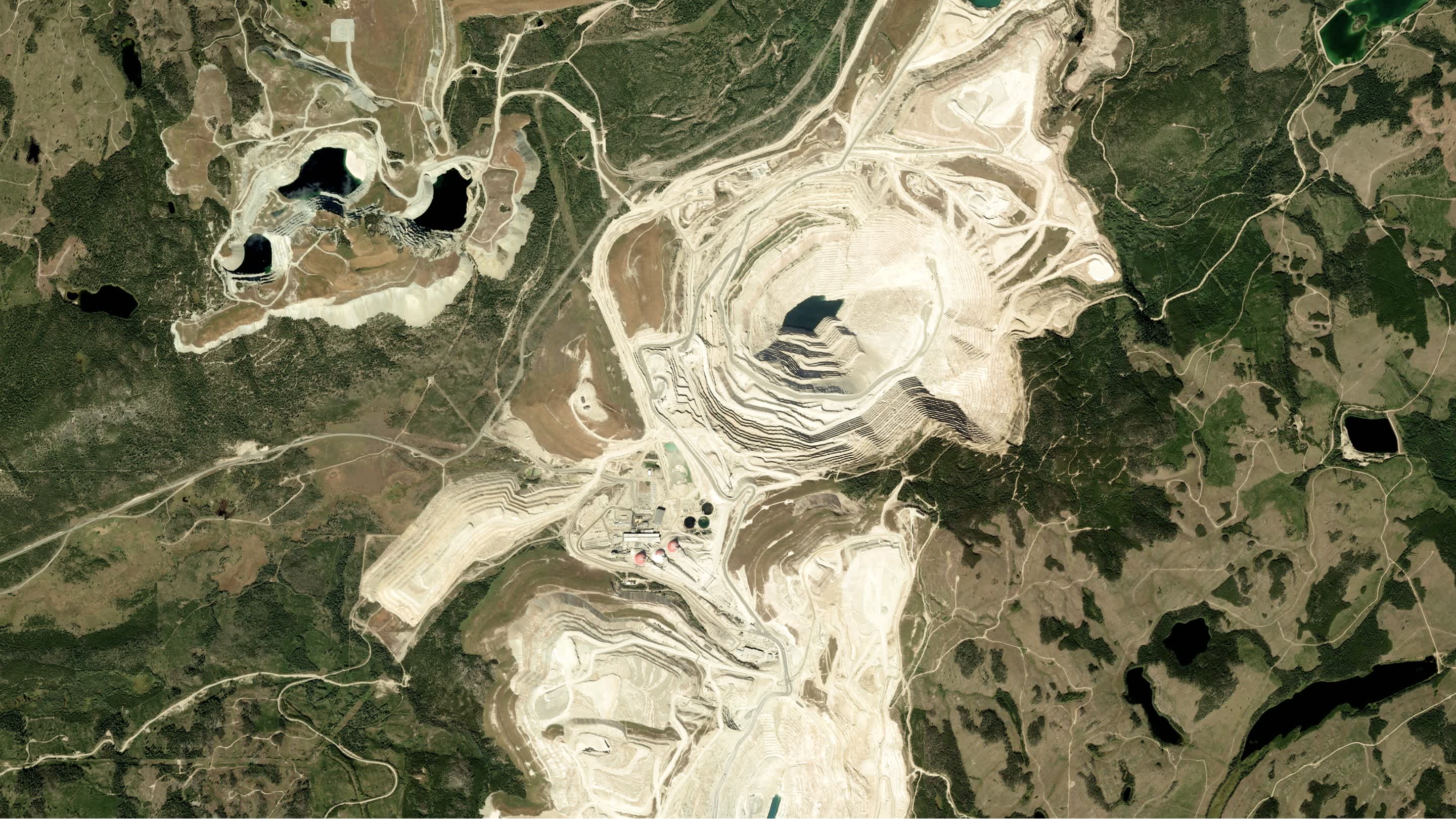
To monitor a mine’s natural evolution, you need accurate and timely information. But plenty of mines are located in fairly inaccessible places around the world, making Earth observation (EO) data the best tool for the job. Unlike ground monitoring initiatives, remote sensing offers the possibility to monitor mines at scale. From exploration and site selection to monitoring and reclamation, we’ll show you how geospatial data can be leveraged to make every stage of your mining operations safer, more efficient, and sustainable.
Site exploration
With Earth observation data, you can easily survey sites remotely to analyze geological features, identify mineral deposits and favorable geological formations, and understand subsurface geology.
- Assess geology, topology, and hydrology: satellite data and derived elevation models can facilitate a better terrain understanding, help identify potential mining pits, rock formations, and other structures, as well as obtain information about roads to plan assess routes, and optimize logistics
- Map mineral deposits: hyperspectral satellite imagery can enable more efficient exploration of minerals and materials, reducing waste and energy consumption
Site planning and monitoring
Once your site is selected, EO data can assist with site planning and monitoring:
- Probe a site’s infrastructure before operations begin, or track landscape changes such as slope stability resulting from mining operations
- Ensure worker safety by detecting potential hazards such as landslides or damages to infrastructure before accidents occur
- Monitor assets and field resources remotely
- Measure environmental impact such as expansion and waste, analyze vegetation health, or monitor water quality, pollution, sedimentation, and scarcity
- Spot and prevent illegal mining activities

Site reclamation
Site reclamation refers to the ecological restoration following the disturbance of mining operations. Once a mining project comes to an end, EO data can support environmental and compliance monitoring.
- Analyze changes in topography using elevation models to design more effective reclamation plans
- Detect changes in deforestation, soil composition, land subsidence, and erosion
- Analyze vegetation mass and health to optimize reforestation and re-vegetation efforts: for example, the Normalized Difference Vegetation Index (NDVI) can help understand vegetation development post-mining
- Classify land covers such as barren land, water, and high and low vegetation to then evaluate the success in restoring original land cover
- Oversee reforestation projects to offset previous emissions
Benefits of using EO data
- Remote access: Regardless of how inaccessible and remote the mine is, satellite data provides global coverage and reduces the need for human resources
- Reliability: Many satellites today have high revisit rates, providing you with fresh and accurate information weekly, daily, or even multiple times a day
- Cost: Remote sensing data allows you to monitor sites while reducing the need for labor-intensive inspections
- Speed: By making more precise and timely predictions, you can make your operations safer and more efficient, preventing unplanned interruptions and emergencies
How can UP42 help?
It can be quite daunting to procure the imagery you need from different providers. This is where UP42 comes in. UP42 offers a one-stop shop for geospatial data. You can find more than 70+ providers of optical (satellite and aerial), SAR, elevation, and weather data, as well as processing algorithms in one place. We make it easier to search for and purchase an image, without worrying about contracts, minimum annual purchase, volume restrictions, or data license agreements.
Archive data from the world’s leading providers
With our catalog, you can discover large imagery archives and overcome the challenge of ordering archive data from multiple providers. Define your AOI, specify your requirements, see availability in real time, and get image previews. Place and monitor your order, download your assets, and process them: on our platform, or externally. Integrating new data into your workflow is quick and easy, so you can scale your operations by placing hundreds of orders a day.

Unified tasking across multiple providers
You can also order fresh imagery by tasking a satellite for your area of interest. UP42 enables automated cross-sensor tasking - we give you flexibility when it comes to pricing, data type, and revisit frequency. Search for the specific collection you want, review and accept feasibility options, place orders, and benefit from automated asset delivery—all from within the console. Upload complex AOIs with multiple features: our built-in geometry compatibility check will instantly analyze the properties of your AOI to ensure that it works with your chosen collection. You can find out more about tasking with UP42 in our dedicated blog post.

A data management solution to work with large volumes of data
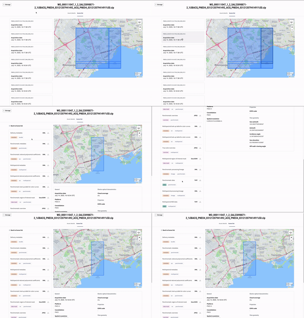
With UP42 storage you can access, organize, and seamlessly integrate data into your workflows. UP42 storage is STAC-compatible, which allows searching across multiple providers which share a common structure and set of metadata. Improve the way you manage your data by giving assets in storage custom titles and tags, searching for a specific asset properly, or running filter operations. In addition, our cloud-native asset model (CNAM) also standardizes all assets in storage, converting raster data into cloud-optimized GeoTIFFs (COGs), and vector mask files into GeoJSONs to enable easier integrations. This means that you can easily search for and work with the data without having to understand different formats and naming conventions, and most importantly: without having to download a compressed file first. Just stream or download the part of the file you need.

Multiple ways to access the UP42 platform
Automate geospatial data search, retrieval, and analysis using the API, or use our Python SDK or easy-to-use console. If you’re already an Esri user, you can search for, order, and analyze imagery directly from your ArcGIS Pro account.
A real-life example: monitoring stockpiles
Imagine you need to monitor changes in your stockpiles and calculate volumes. To get a better understanding of the earth’s surface, you will need elevation data. Digital Surface Models (DSMs) represent elevations of natural (like mountains and trees) and human-made structures (such as buildings and infrastructure). They illustrate the earth's surface and all objects on it. Digital Terrain Models (DTMs) are bare-earth models devoid of human-made and natural structures. You can then calculate the volume of the stockpile by calculating the difference between a DSM and DTM, and measure changes over time. With UP42, you can access elevation data from a variety of providers: Intermap’s NEXTMap® elevation data suite, Vexcel Elevate, HxGN Content Program, Airbus elevation data, and more.
You can also use stereo/ tri-stereo images to generate fresh elevation models. Stereo imagery refers to the capture of two or more images of the same area from different positions so that the same scene is visible in different photographs. Satellites can capture image pairs either in one pass, along the same orbit (along-track stereo), or from different orbits (across-track stereo). You can use stereo imagery to extract stereo DEMs and DSMs. UP42 works with several providers that offer stereo/ tri-stereo capabilities: Pléiades Neo, Pléiades, and SPOT from Airbus, BlackSky, Eros-B and Eros-C from ImageSat International, Kompsat-3 and Kompsat-3A from SIIS, and Beijing-3A from 21AT. You can order data directly from our catalog, or find more guidance on ordering stereo imagery on the UP42 platform in this article.
These are just a few examples of the types of data you can find on the UP42 platform. Whatever you need, our experienced teams will help you to define requirements, recommend the best data, and monitor your ongoing technical and data acquisition progress from start to finish. UP42 has the infrastructure to process urgent requests so you can obtain your data as soon as possible and stay on budget. We continue to roll out new partners and exciting new features to our platform to give you even more options and flexibility when working with geospatial data.


